Natural place
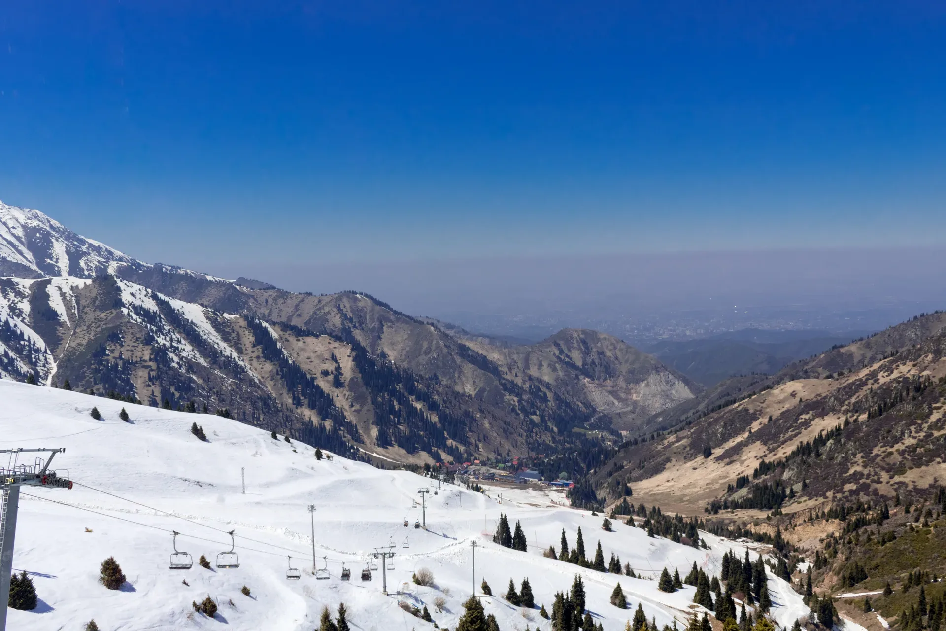
Above Treeline Pasture Viewpoint 3 000 M
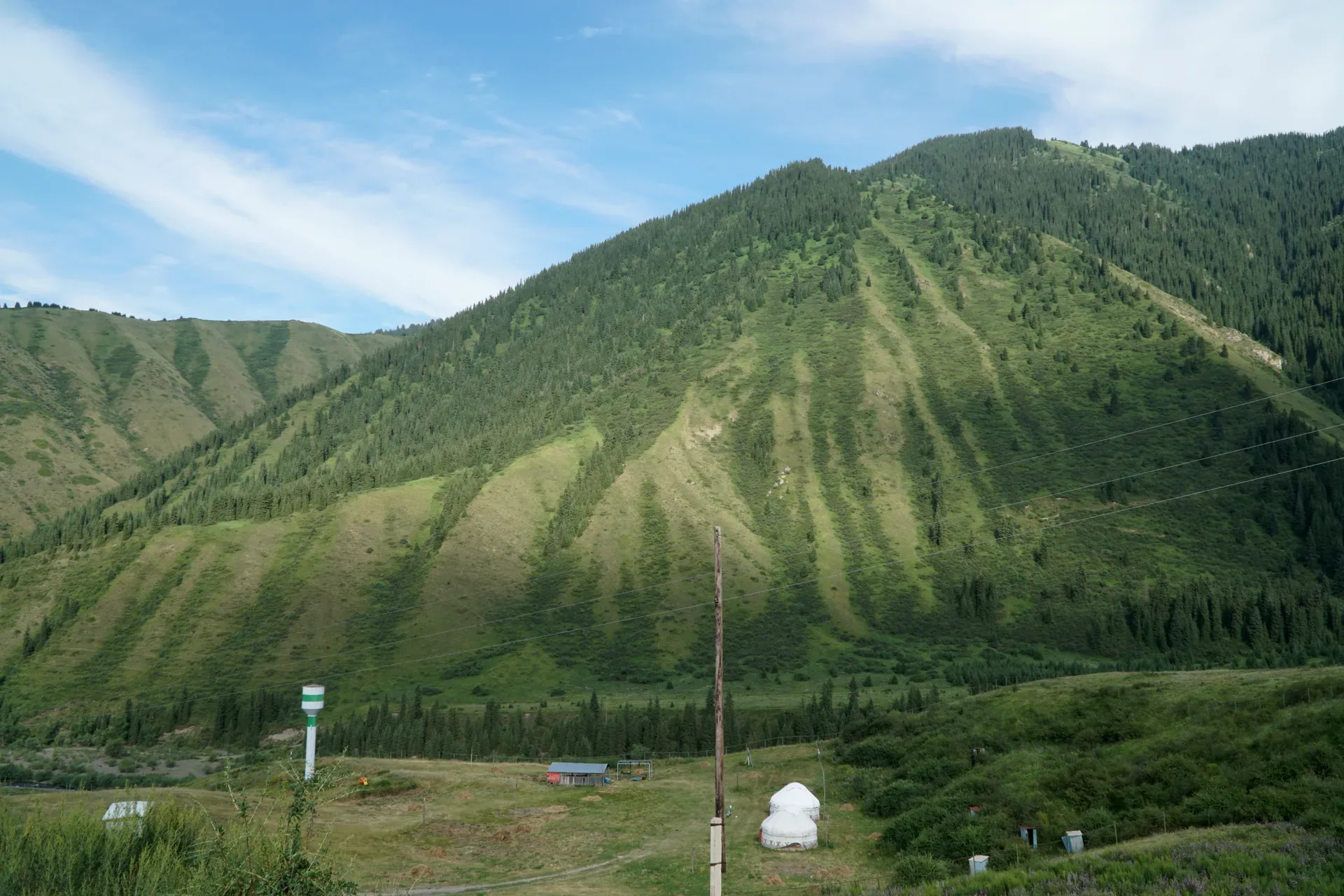
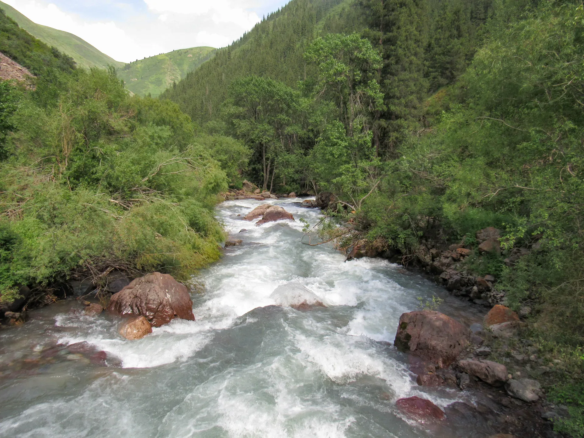
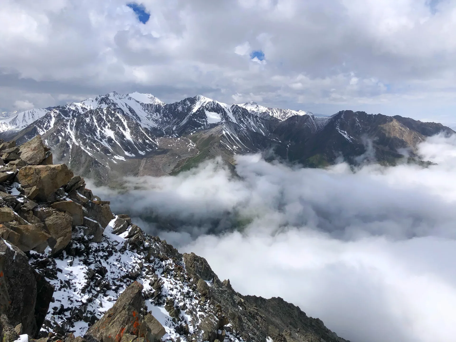
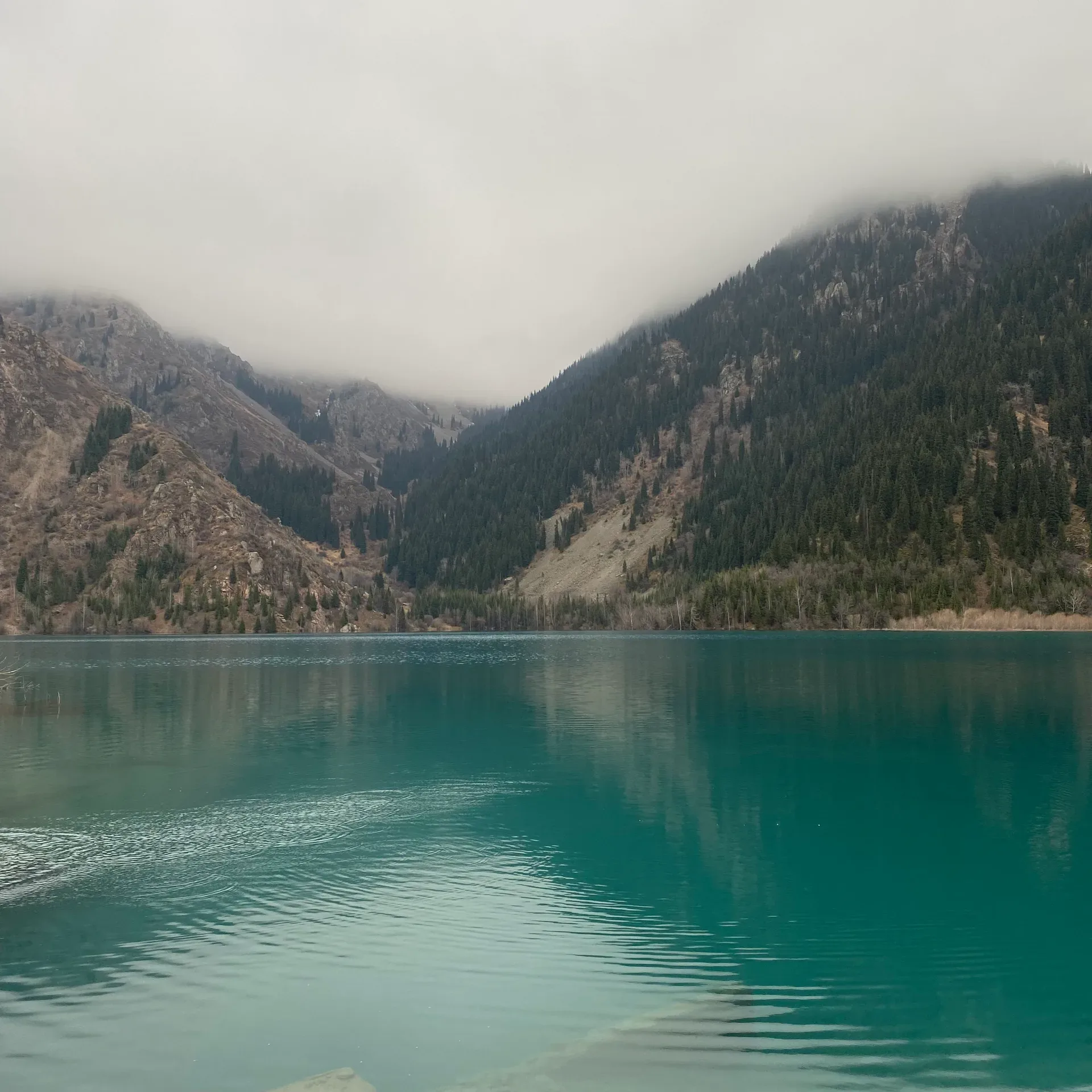
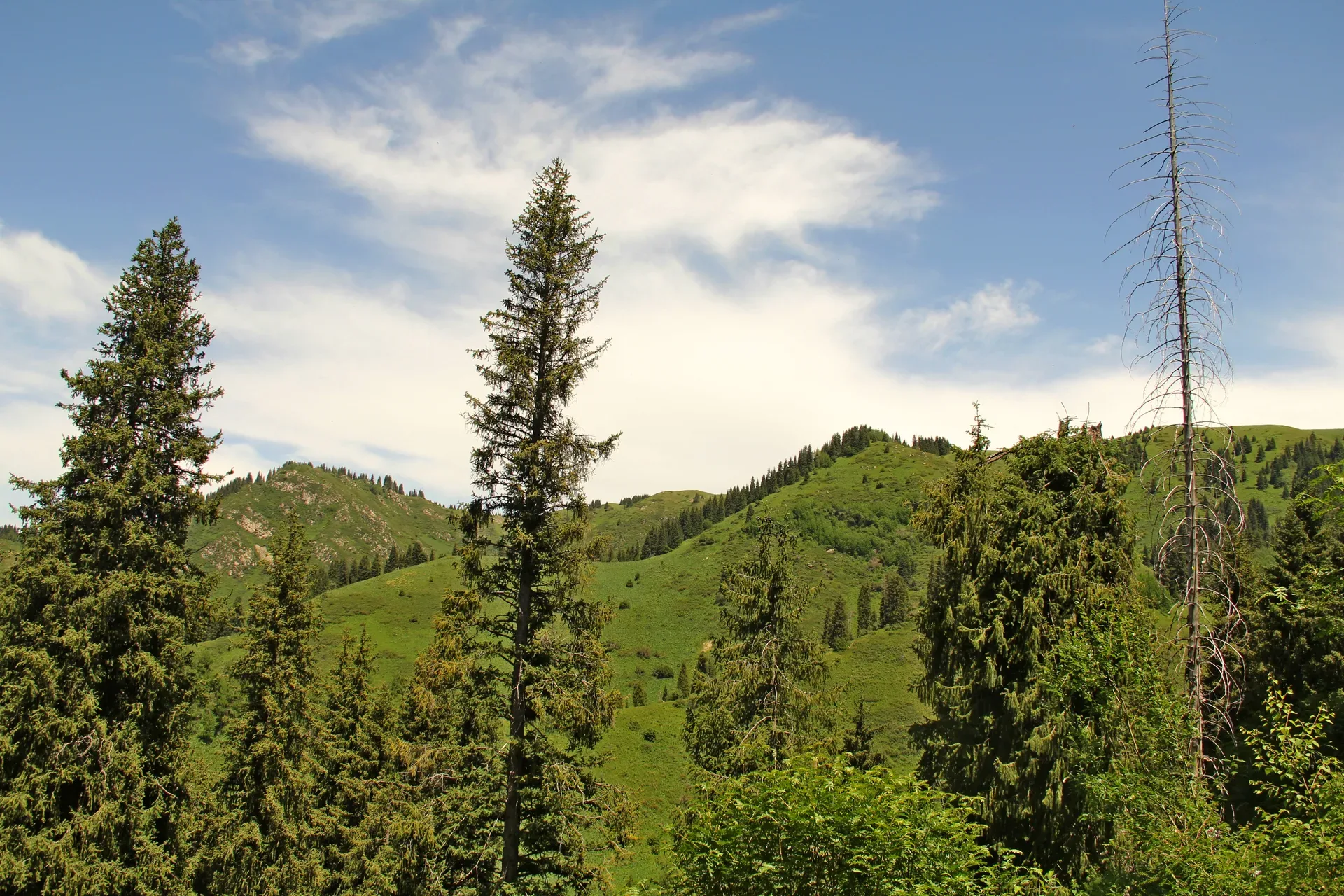
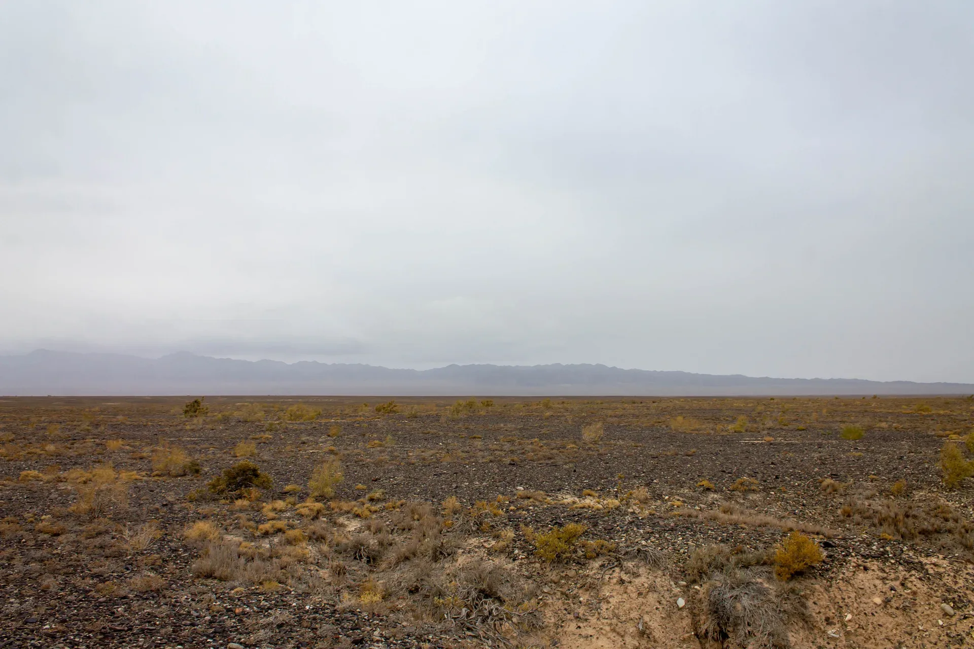
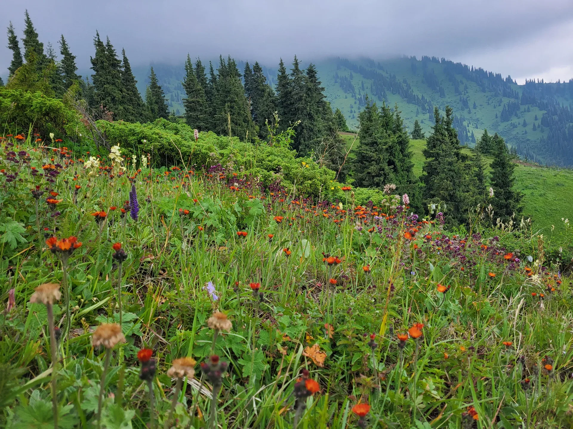
From the jailau camp, a 1.5–2 km walk or short drive uphill reaches a viewpoint above 3,000 m where the full scale of the Kungey Alatau ridge becomes visible.
Used in 1 trip
Points of interest
These pages keep the big-picture background in one place. Trip pages still carry the route, pacing, and stop-by-stop advice.
Use the map to preview every place and practical stop featured below. All points are also listed below.
Showing 106 of 106 places.
Landscapes, villages, trailheads, and cultural sites worth browsing before you pick a route.
91 entries
Natural place
From the jailau camp, a 1.5–2 km walk or short drive uphill reaches a viewpoint above 3,000 m where the full scale of the Kungey Alatau ridge becomes visible.
Used in 1 trip
Natural place
The 72 km track from Basshi to the Aktau Mountains takes 90–120 minutes in dry conditions.
Used in 1 trip
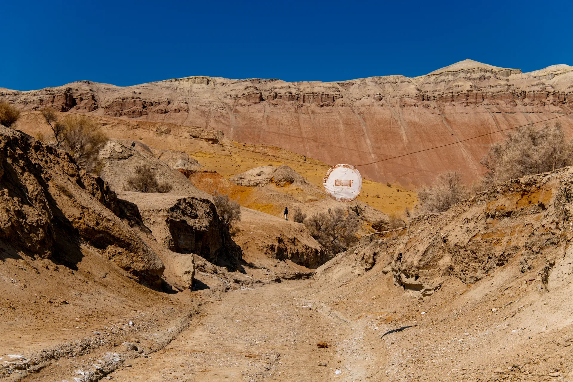
Natural place
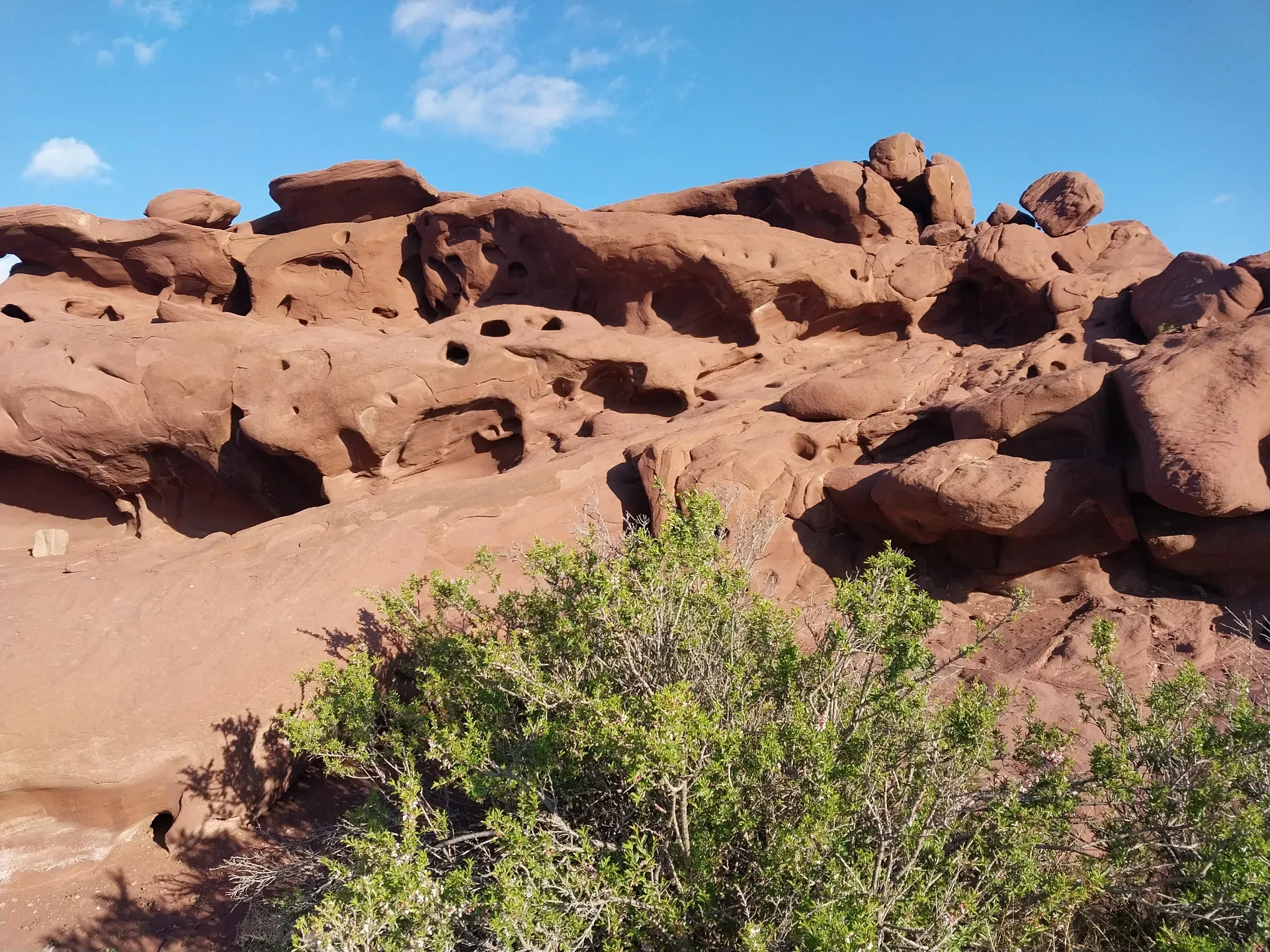
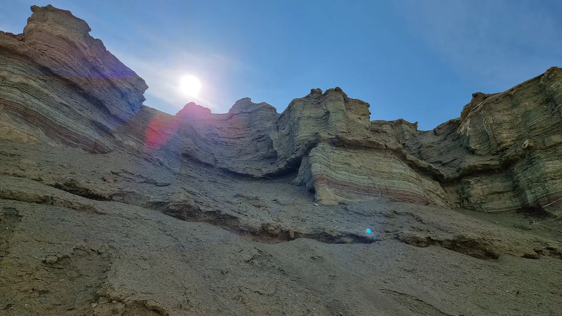
A 2–3 km walking loop enters the gully system known locally as the labyrinth — a maze of eroded clay channels that cut 5–15 m deep into the sediment.
Used in 1 trip
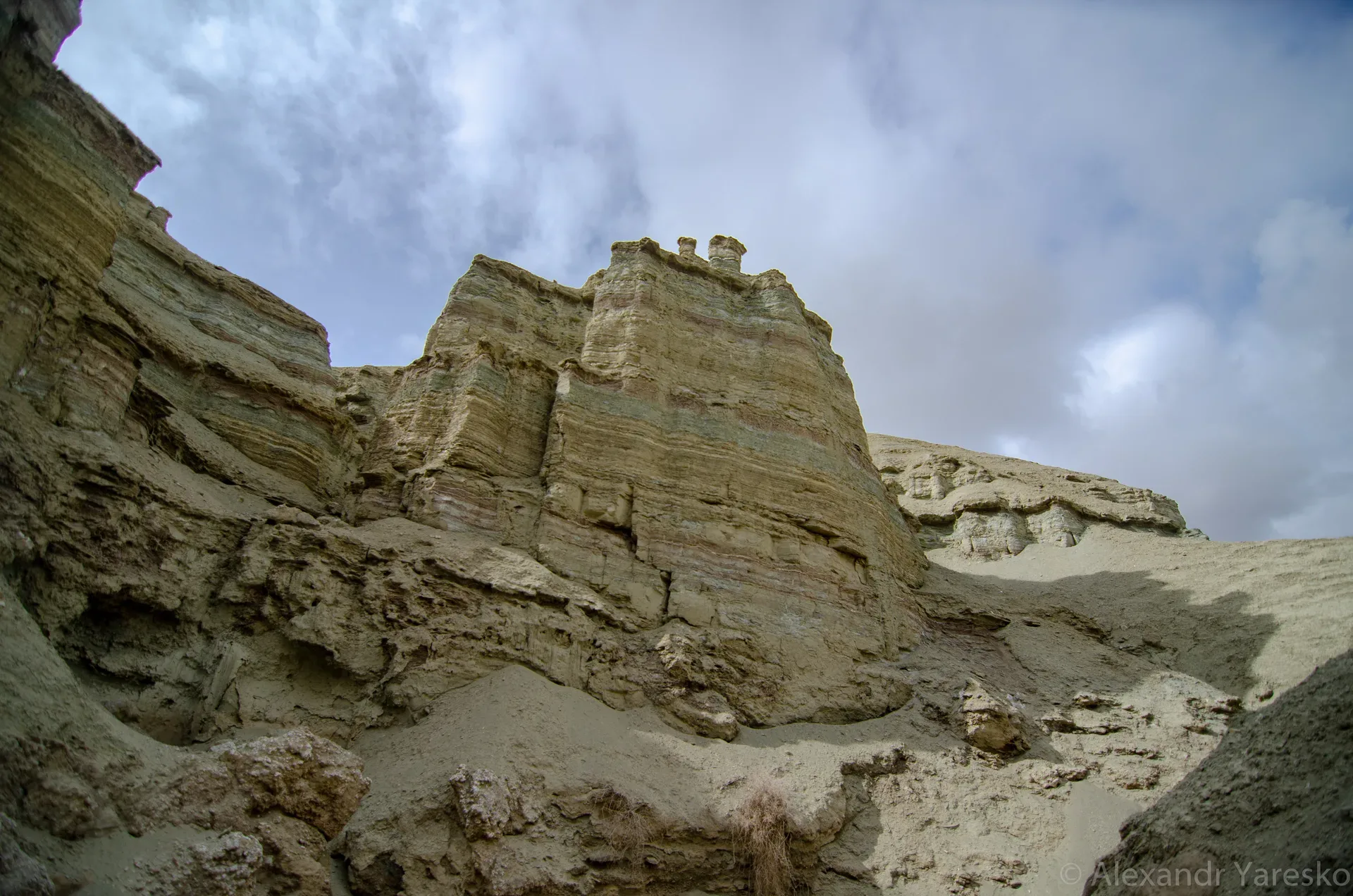
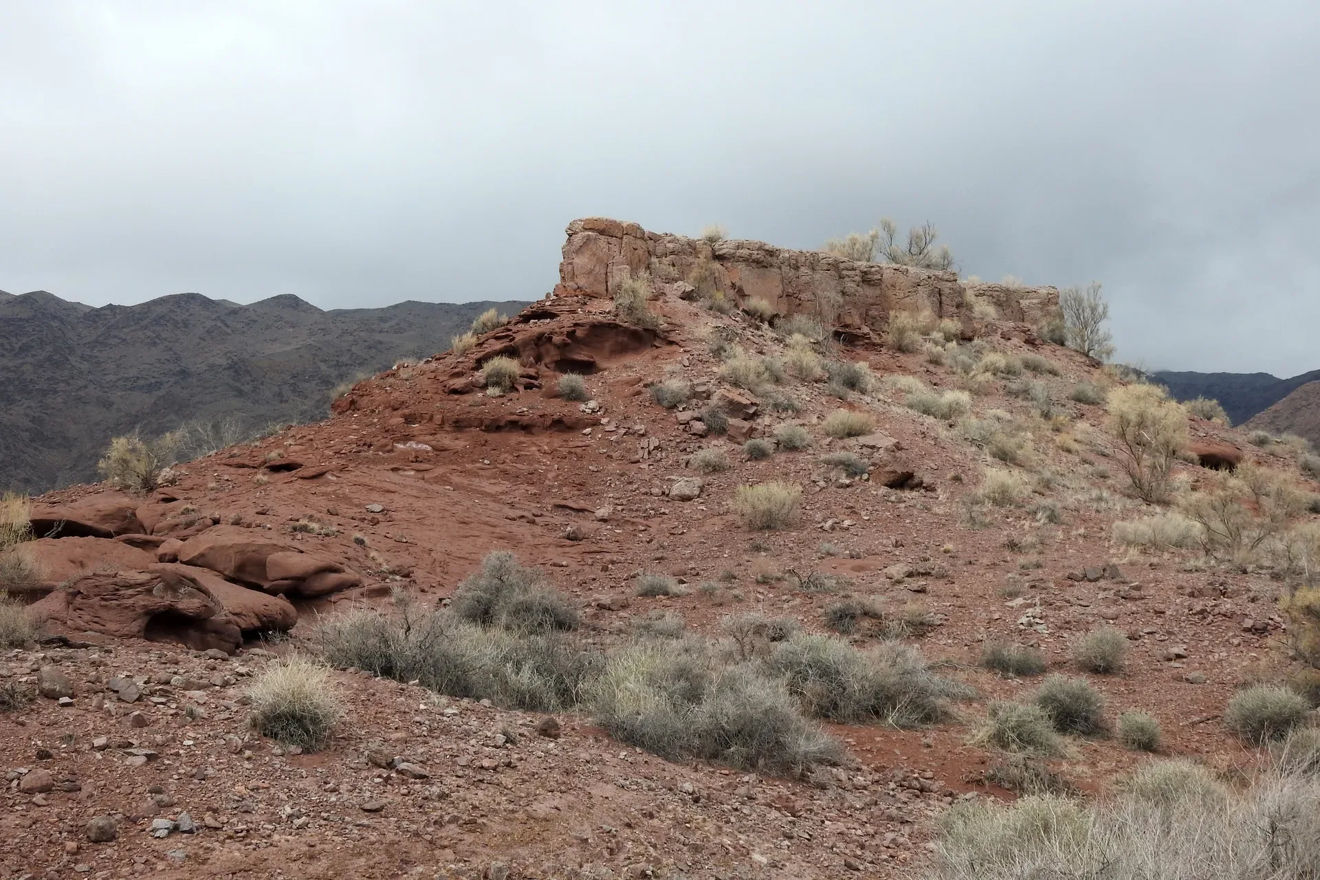
Natural place
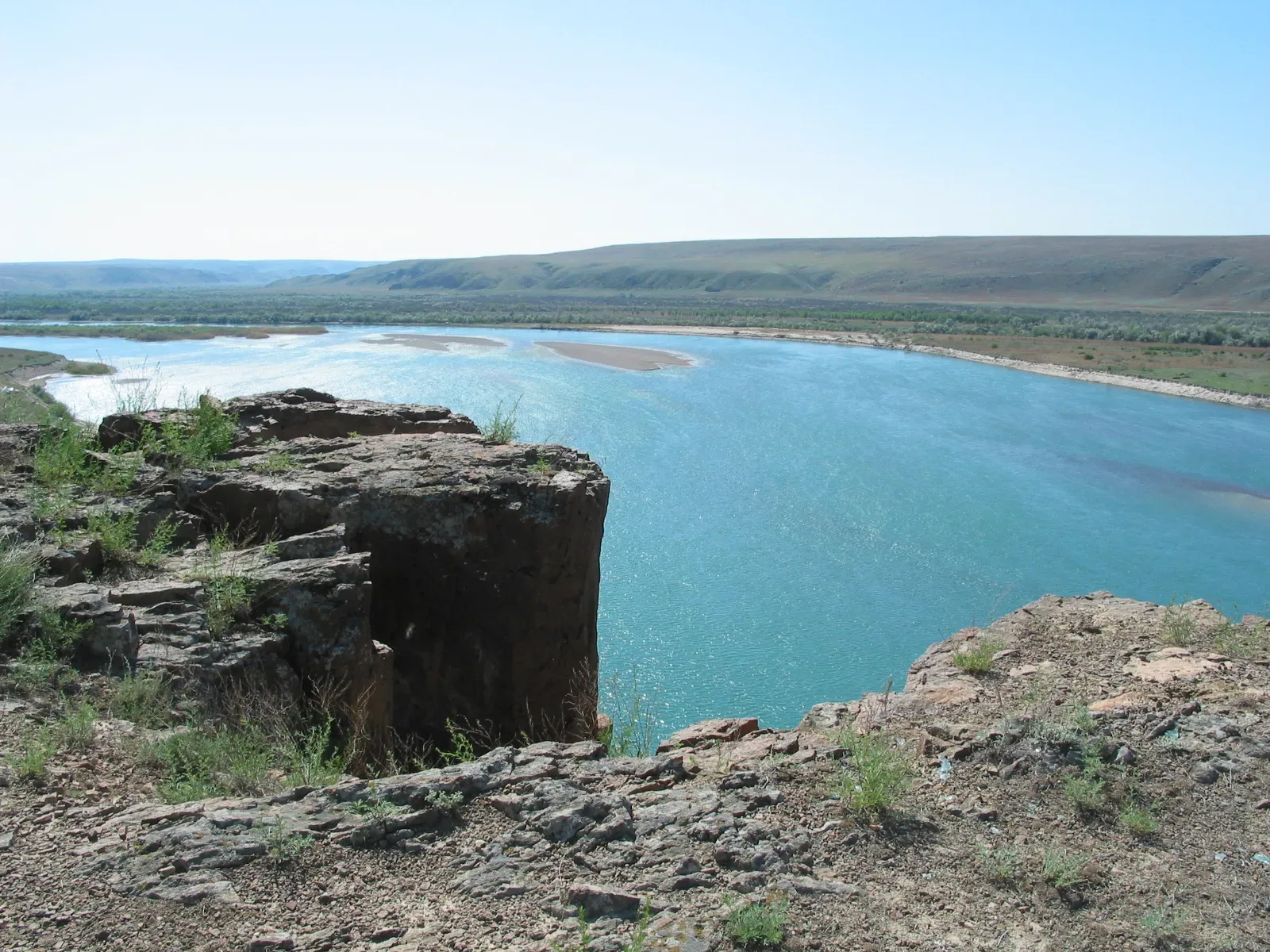
The Aktau range — the name means 'White Mountains' in Kazakh — is a 30-km-long escarpment of Paleogene and Neogene sedimentary rock along the right bank of the Ili River.
Used in 1 trip
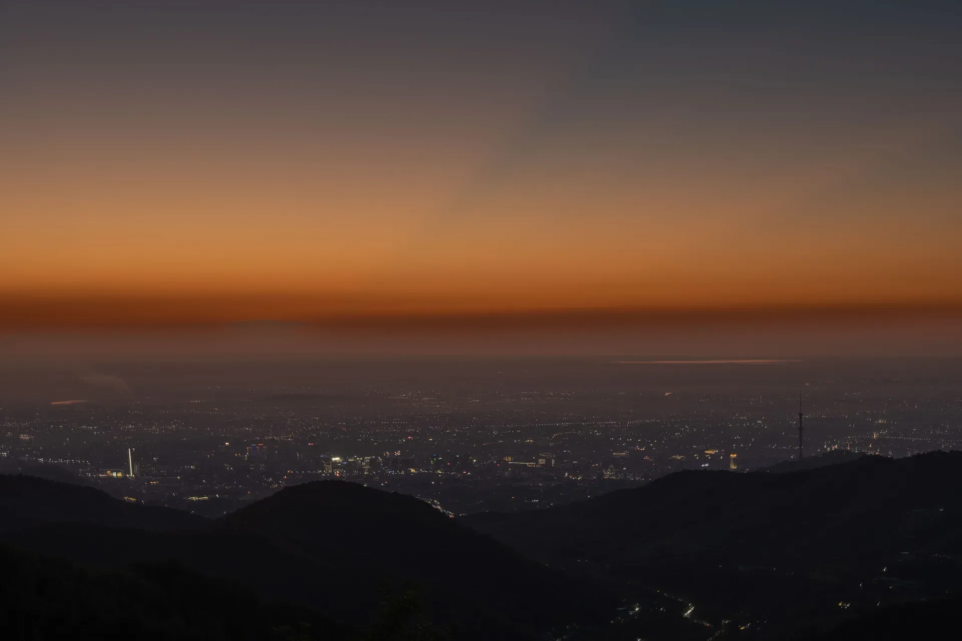
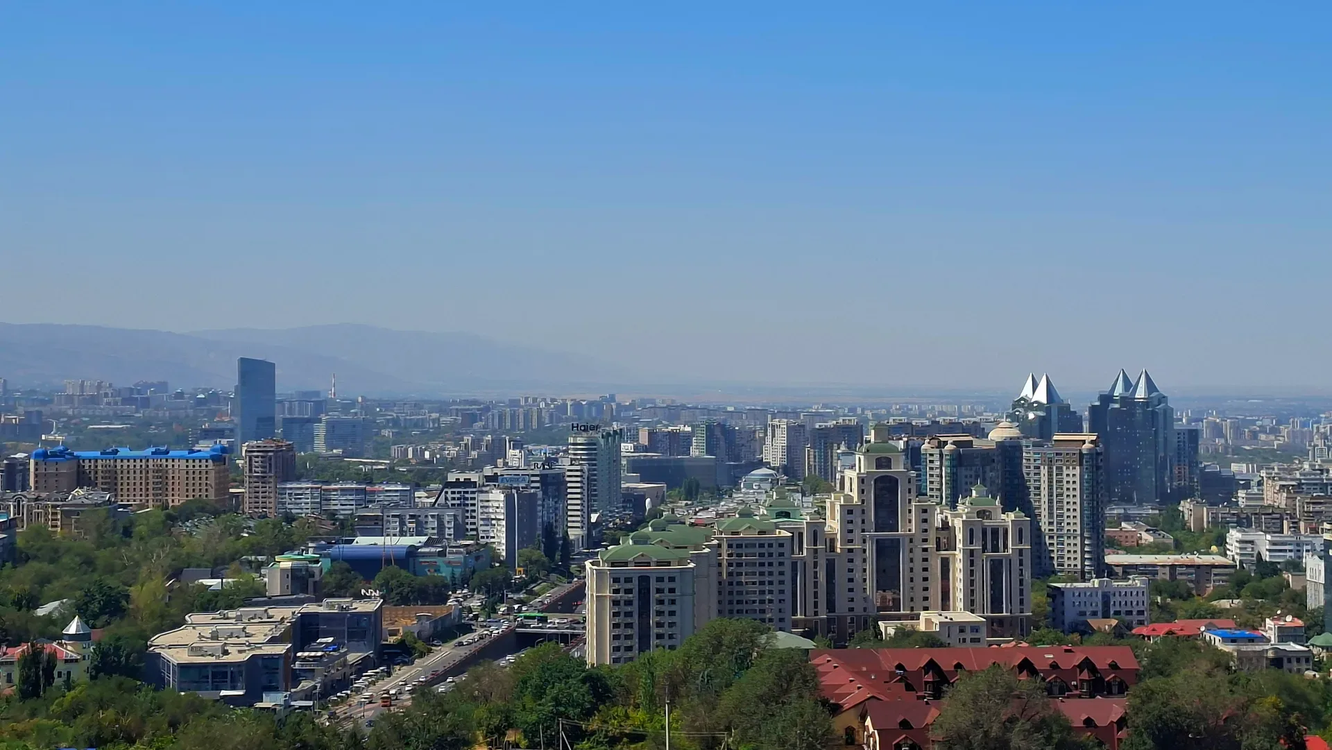
City
Leave Almaty by 05:30 to reach Basshi by 10:00, allowing time to complete permit registration before the lunch-break closure at 13:00.
Used in 25 trips

Natural place
The route leaves Almaty on the A3 northeast toward Kapchagai (Qonaev).
Used in 1 trip
Natural place
Leave central Almaty by 07:00 to reach Sorbulak in early morning light, when birds are most active and heat haze has not yet built up over the open water.
Used in 1 trip
Natural place
The return drive retraces the A-351 westbound for 350 km back to Almaty, taking 4–4.5 hours without stops.
Used in 1 trip

Natural place
The return from the Ile delta to Almaty follows the M-36 southbound through Kapchagai city — a 90 km, 60-minute drive.
Used in 1 trip
Natural place
Cresting the Asy Pass at 2600 m, the plateau opens to the south and east — roughly 40 km long and 7 km wide, at elevations between 2100 and 2800 m.
Used in 1 trip
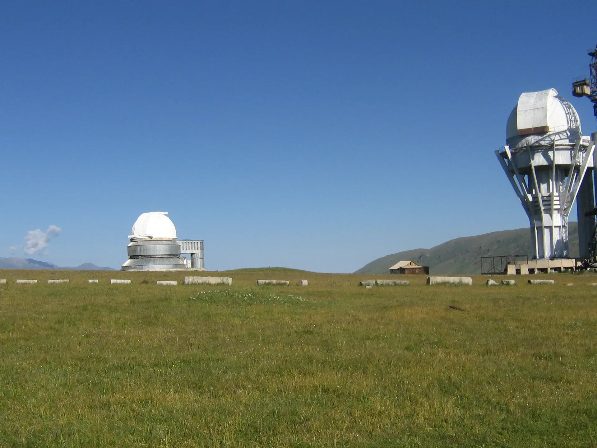
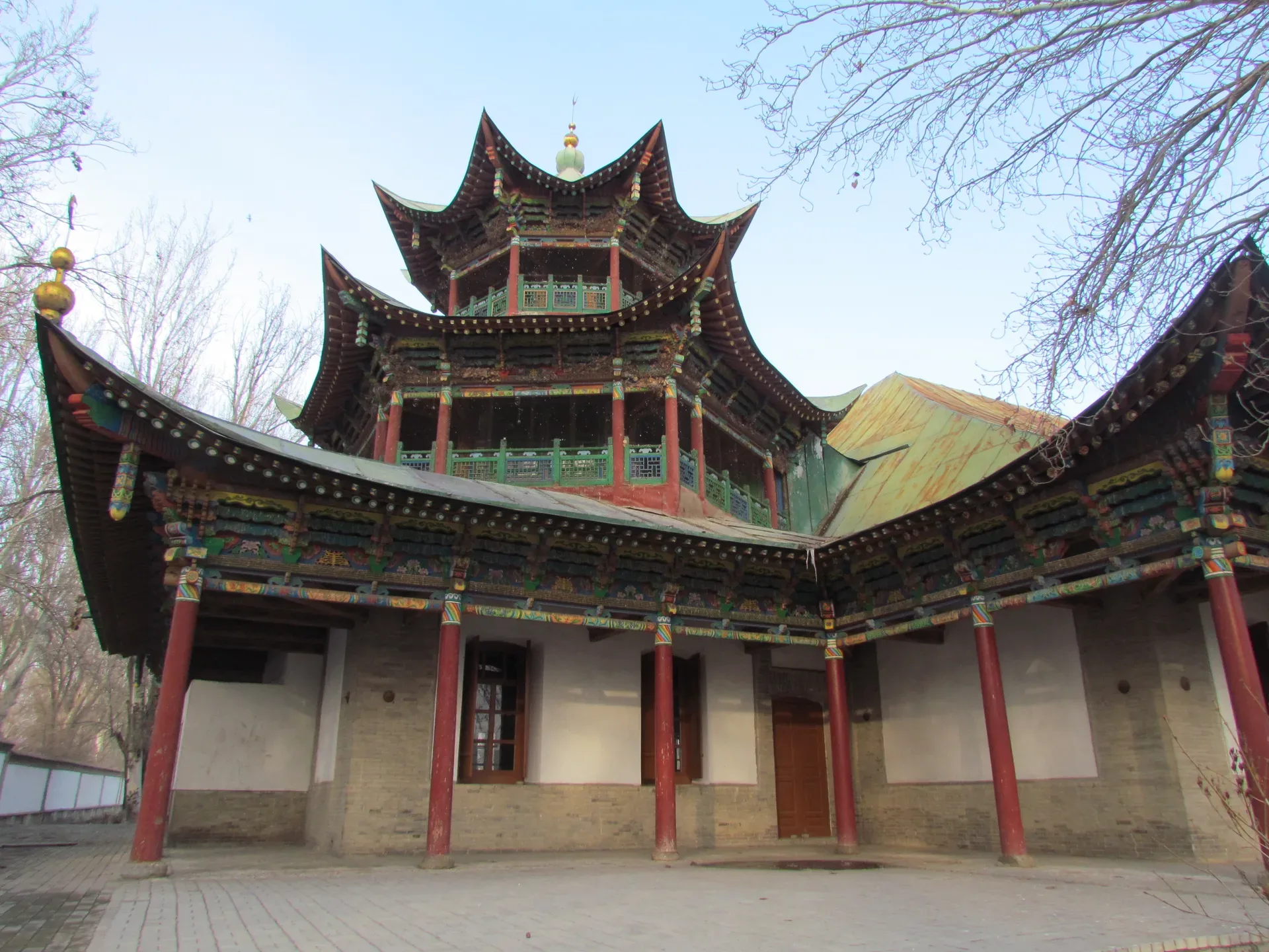
Cultural site
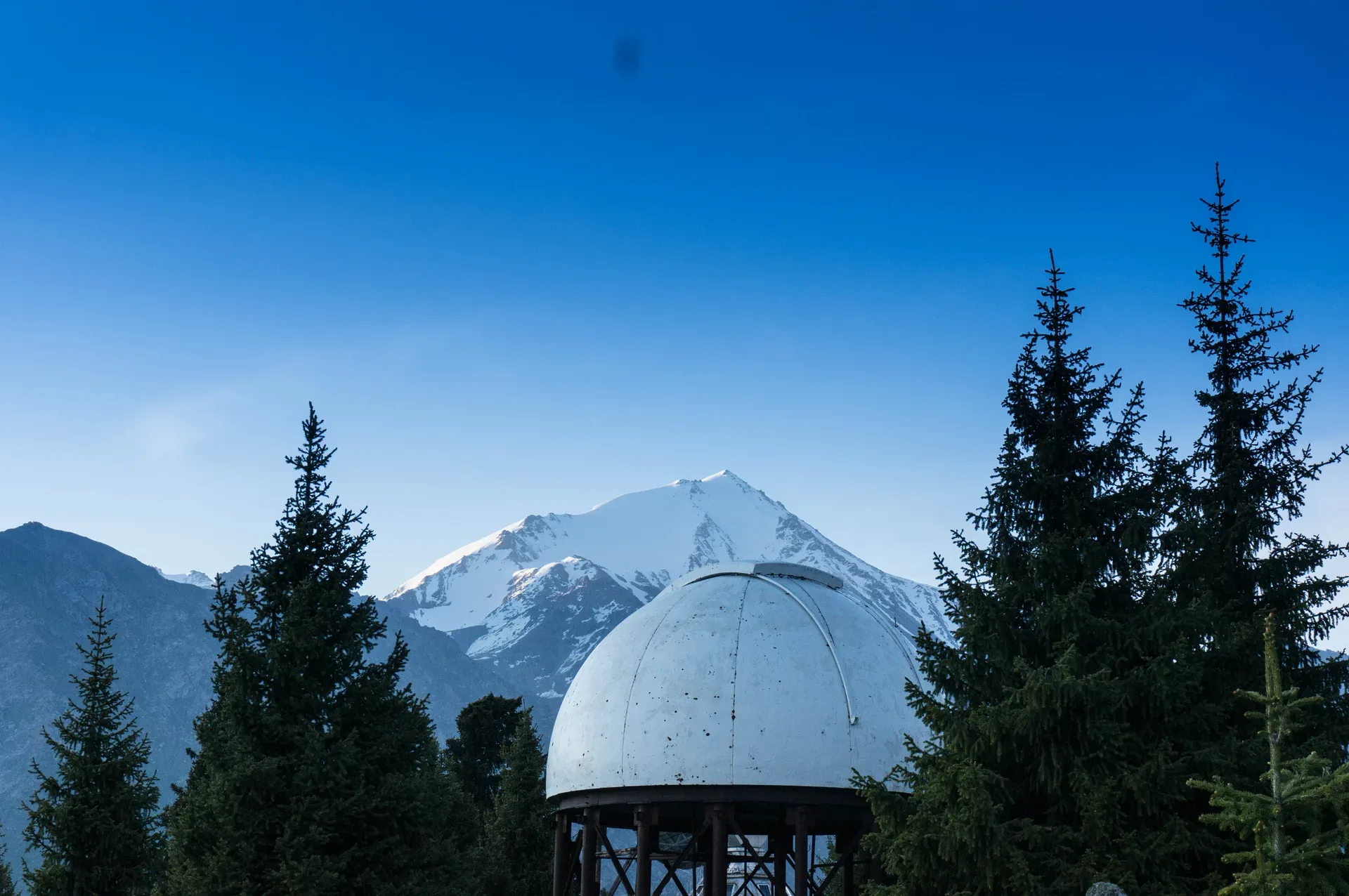
The Assy-Turgen Observatory sits at 2750 m at the eastern edge of the plateau, its white dome visible from several kilometres away.
Used in 1 trip
Trailhead
The Ayusay Visitor Centre (marked by a Three Bears sculpture) sits at the gorge entrance and serves as the trailhead for those arriving by public bus (line 28).
Used in 1 trip
Natural place
The Bartogay dam appears after the road bends south from Kokpek village.
Used in 1 trip

Village
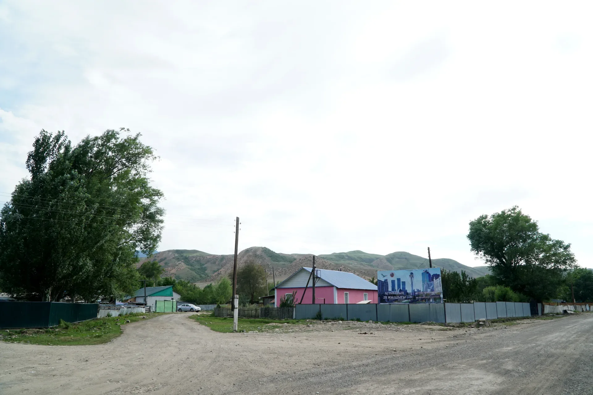
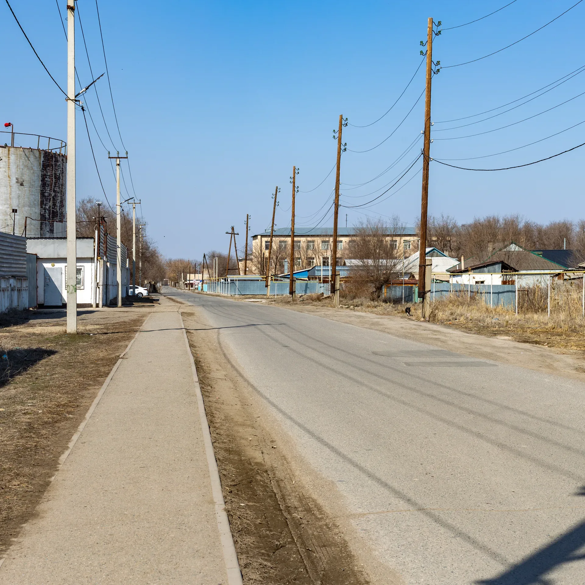
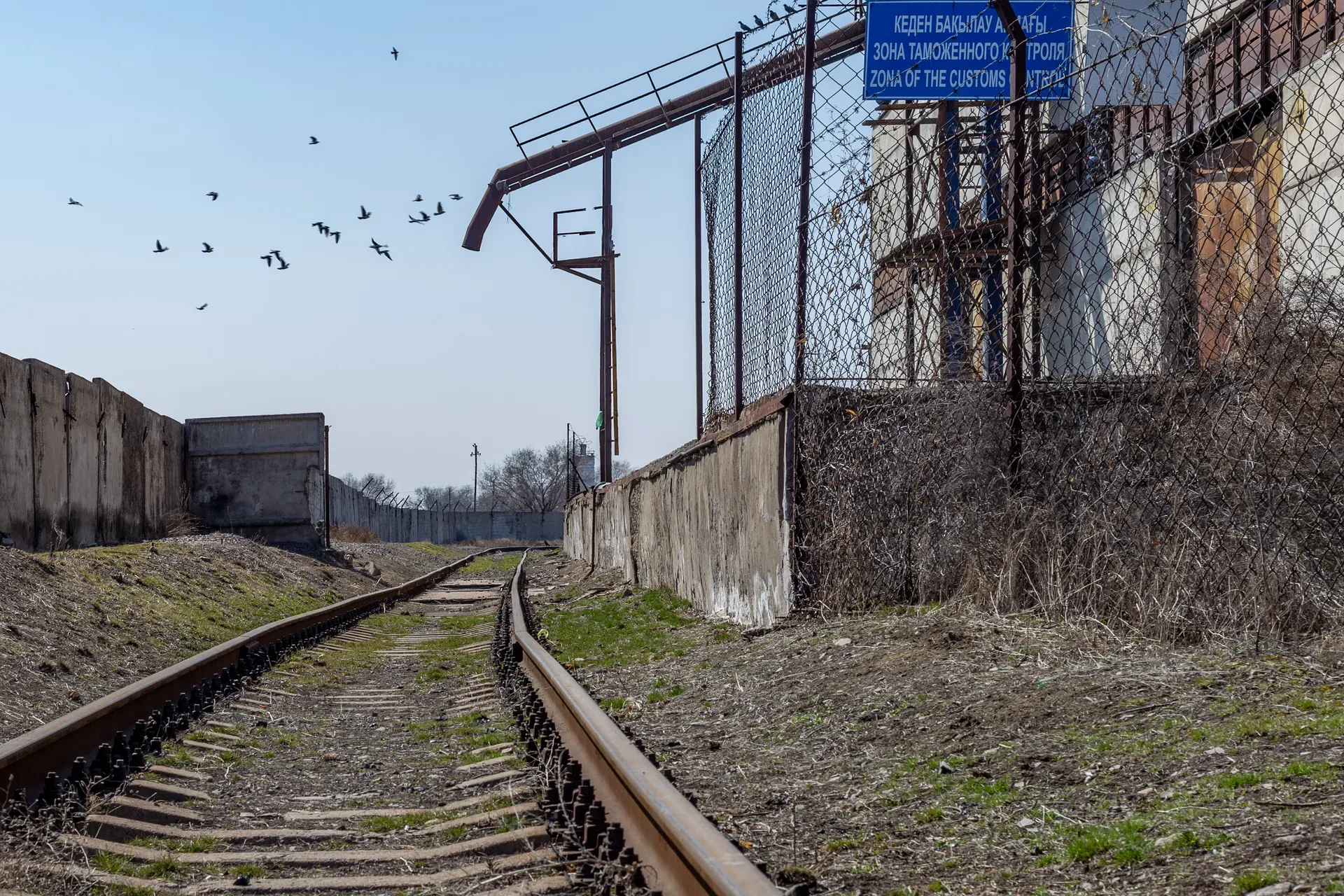
Basshi is the administrative entry point for Altyn-Emel National Park and the only place to register for the Aktau-Katutau sector permits.
Used in 2 trips
Natural place
Bastobe Hill rises a modest 30 m above the surrounding steppe on the northern edge of Ushtobe.
Used in 1 trip
Trailhead
Batan is a small settlement at the confluence of the Turgen and Batan rivers, approximately 83 km from Almaty.
Used in 1 trip
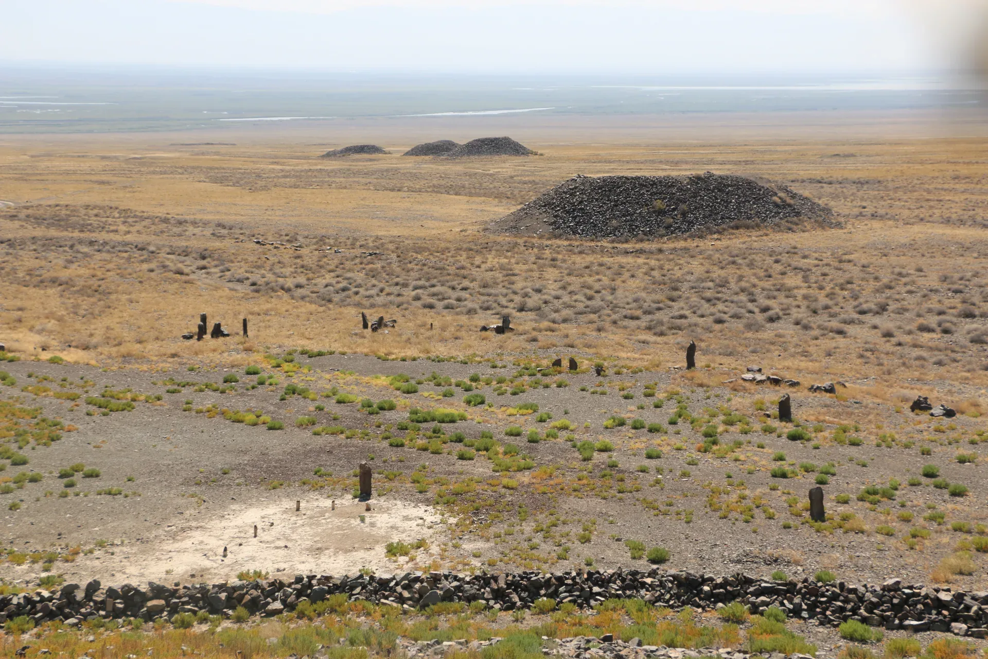
Cultural site
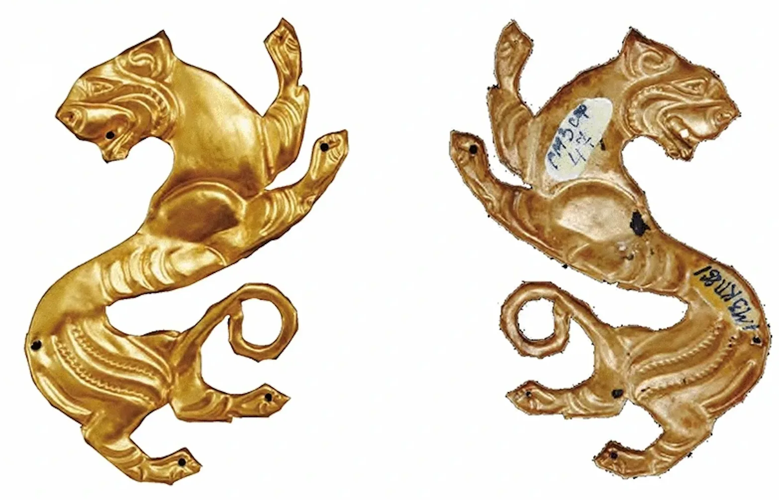
On the right bank of the Ili River, a plain scattered with 31 earthen mounds marks the necropolis of the Semirechye-Saka, nomadic pastoralists who dominated these steppes from the 6th to the 4th century BC.
Used in 1 trip
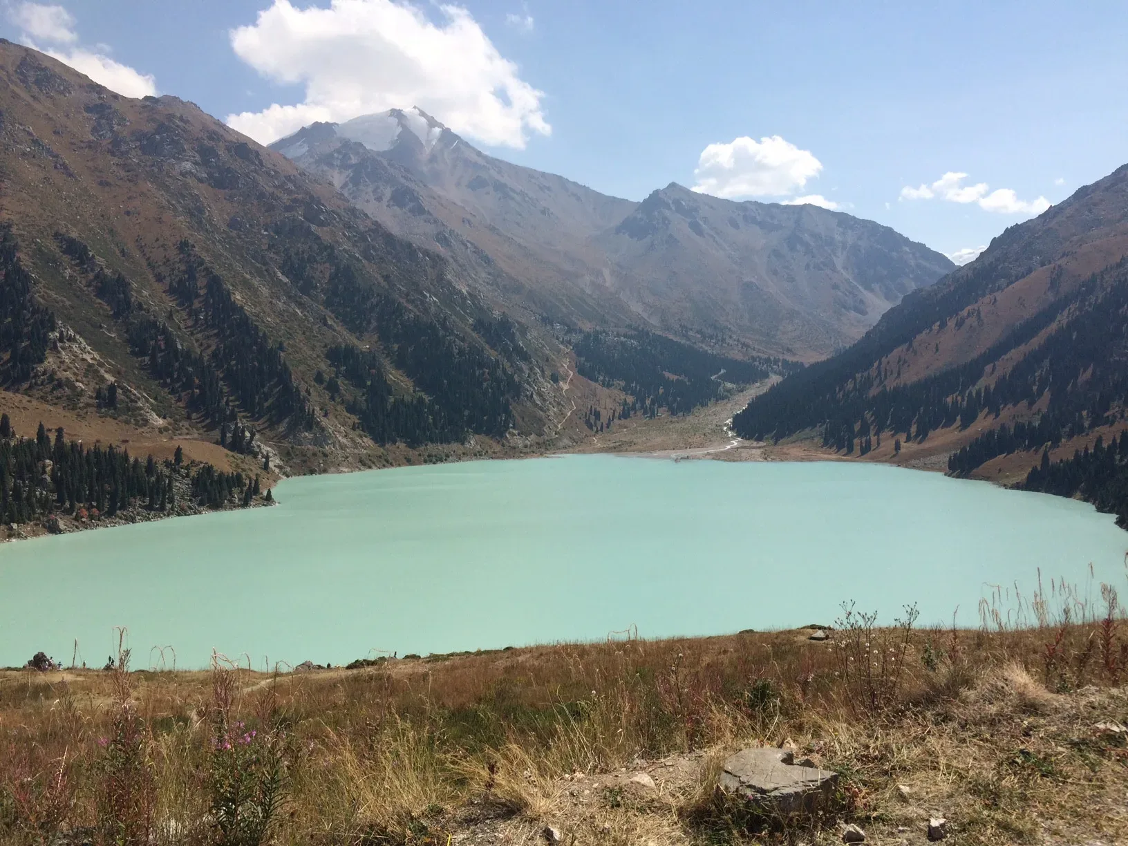
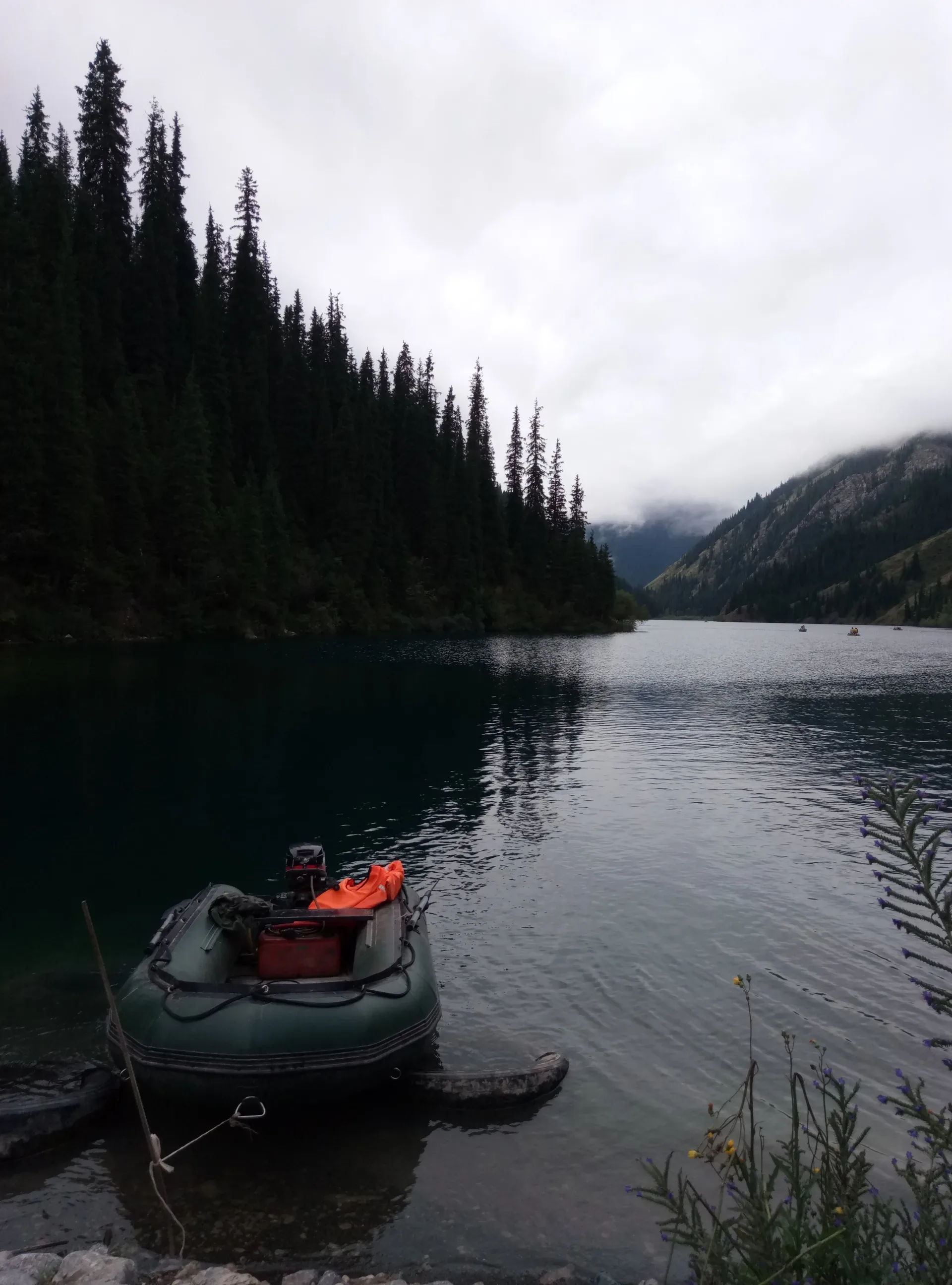
Natural place
The lake occupies a tectonic basin at 2,511 m and is surrounded on three sides by peaks that hold snow through much of the year.
Used in 1 trip

Natural place
South of the main reservoir, a series of smaller brackish impoundments and damp hollows attract wading birds that prefer muddier, more exposed shorelines than the reed-fringed main lake.
Used in 1 trip
Cultural site
The Kegen basin and surrounding plateau contain numerous kurgan fields — earth mounds of the Saka and Wusun (Usun) periods, roughly 7th century BCE through 4th century CE.
Used in 1 trip

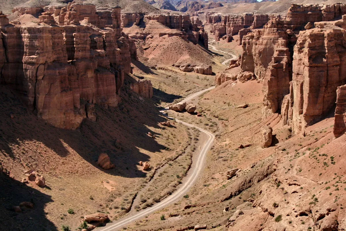
Natural place
Charyn Canyon cuts through compressed red and ochre sediments laid down over millions of years.
Used in 1 trip
Natural place
Returning north on the Kokpek road and continuing 45 km east on the A-351 brings you to the Charyn Canyon junction.
Used in 1 trip
Natural place
A signed spur road leaves the A-351 roughly 187 km from Almaty and runs 10 km to the park eco-post, where you pay the entrance fee and show your passport.
Used in 3 trips
Town
Chundzha (also spelled Zhungar or Dzhungar) is a small town roughly 150 km from Almaty along the A-351, reachable in about 90 minutes.
Used in 3 trips
Natural place
The descent from T-1 back to the Shymbulak gondola station reverses the morning route: moraine to Mynzhylki dam (45 min), through the Bastions and Tuyuksu Gate (1 hour), to the Shymbulak base (30 min).
Used in 1 trip
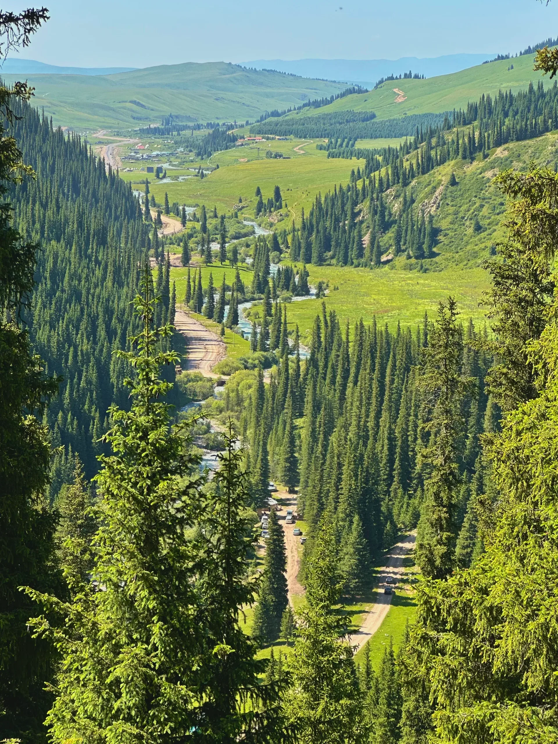
Natural place
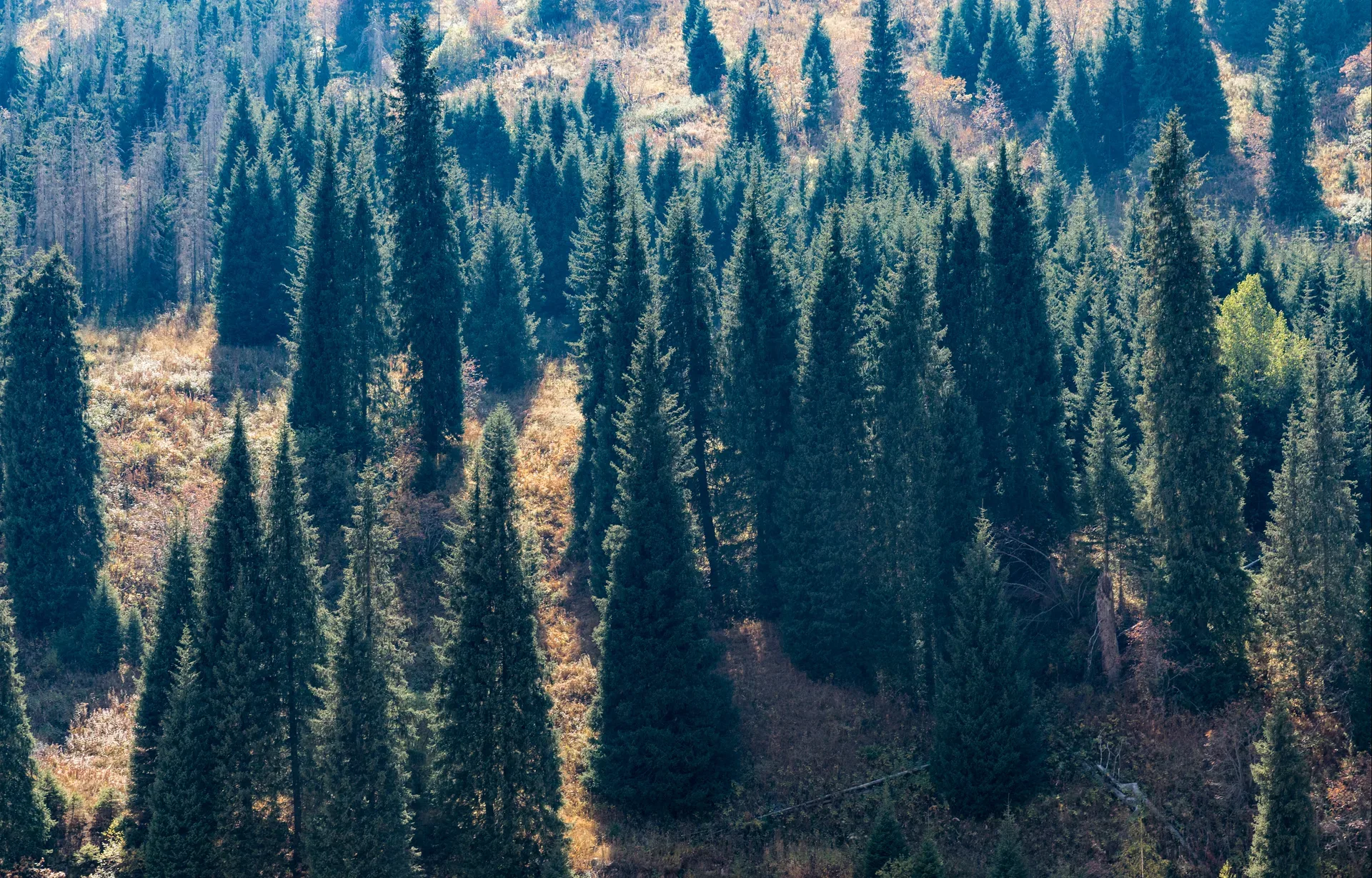
The jailau track begins at the southern edge of Saty and climbs through dense Tian Shan spruce forest on an unpaved switchback road.
Used in 1 trip
Natural place
From Talgar, rejoin the A-2 heading east and continue approximately 15 km to the town of Issyk (officially Yesik).
Used in 1 trip
Natural place
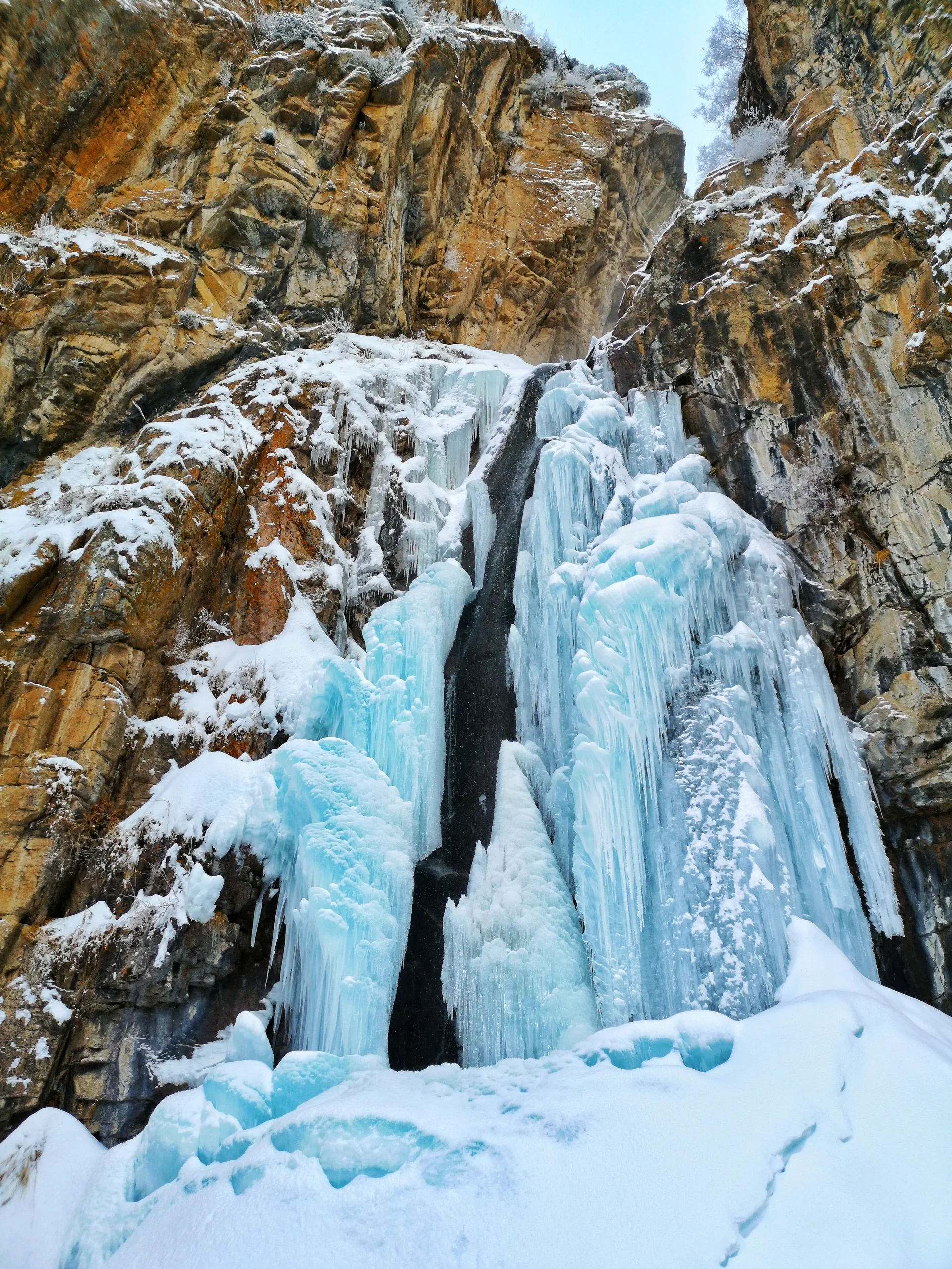
A seasonal waterfall drops over a limestone ledge at around 1,750 m.
Used in 1 trip
Trailhead
From the eco-post parking area, a dirt road follows the Butakovka River upstream through spruce and birch forest.
Used in 1 trip
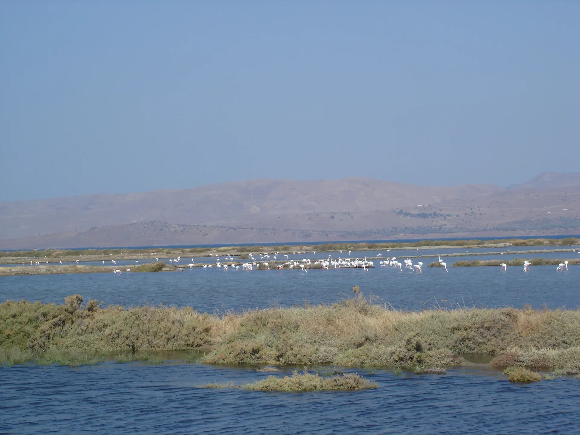
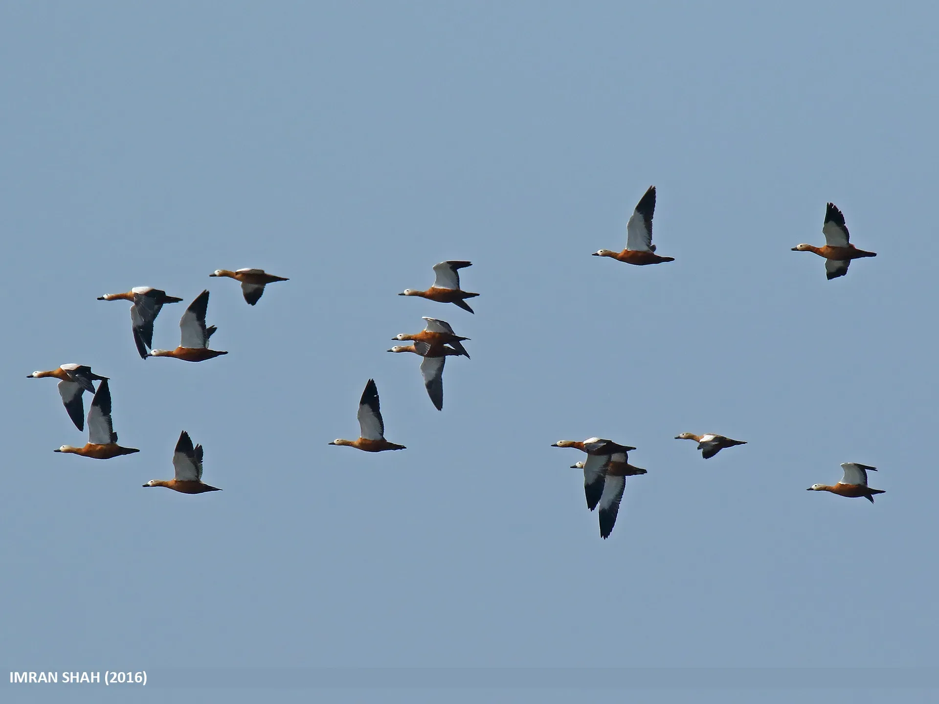
Natural place
Drive 1.5 km northwest along the south shore track to a slightly elevated bank where greater flamingos (Phoenicopterus roseus) are typically staged during April–May northward migration and again in August–September on the return south.
Used in 1 trip
Natural place
The summit of Furmanov Peak is marked by a small cairn and occasional flagging at 3,053 m.
Used in 1 trip
Natural place
The T-1 glaciological station sits on the moraine at 3,445 m, approximately 1.5 km from the current glacier terminus.
Used in 1 trip
Trailhead
The gorge narrows noticeably about 3 km past the valley turn-off, where a barrier marks the Ile-Alatau National Park boundary.
Used in 1 trip
Trailhead
About 62 km from Almaty the road passes through the ecological post at the edge of Ile-Alatau National Park.
Used in 1 trip
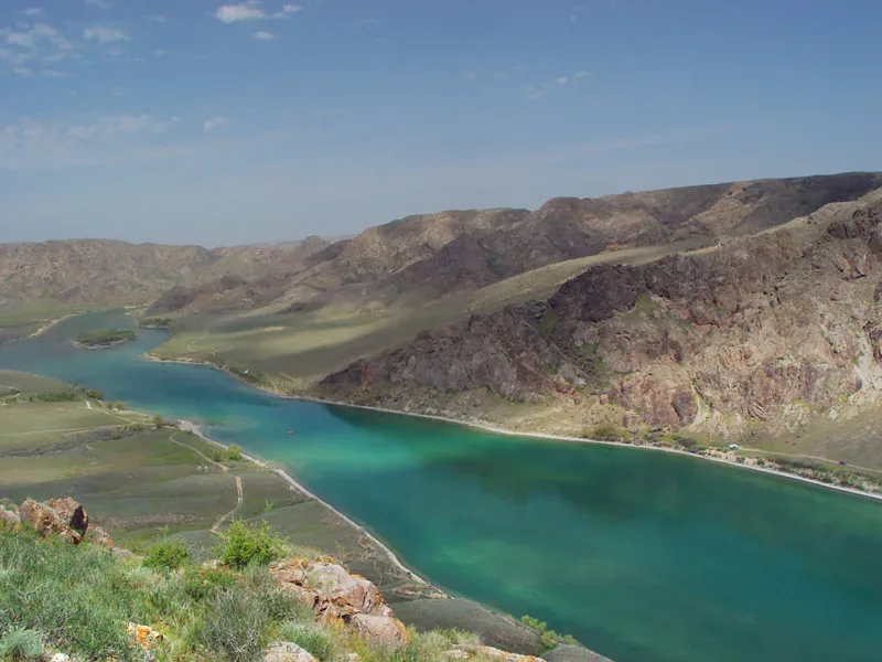
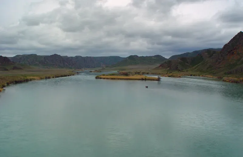
Natural place
The Ile (Ili) River enters the Kapchagai reservoir 40 km northeast of Sorbulak, forming a delta complex of reed channels, flooded scrub, and open water bays covering roughly 168,000 hectares — the largest wetland in Kazakhstan.
Used in 1 trip
Natural place
The road south of Zharkent toward the Ile River runs through a microclimate zone unlike the surrounding steppe.
Used in 1 trip
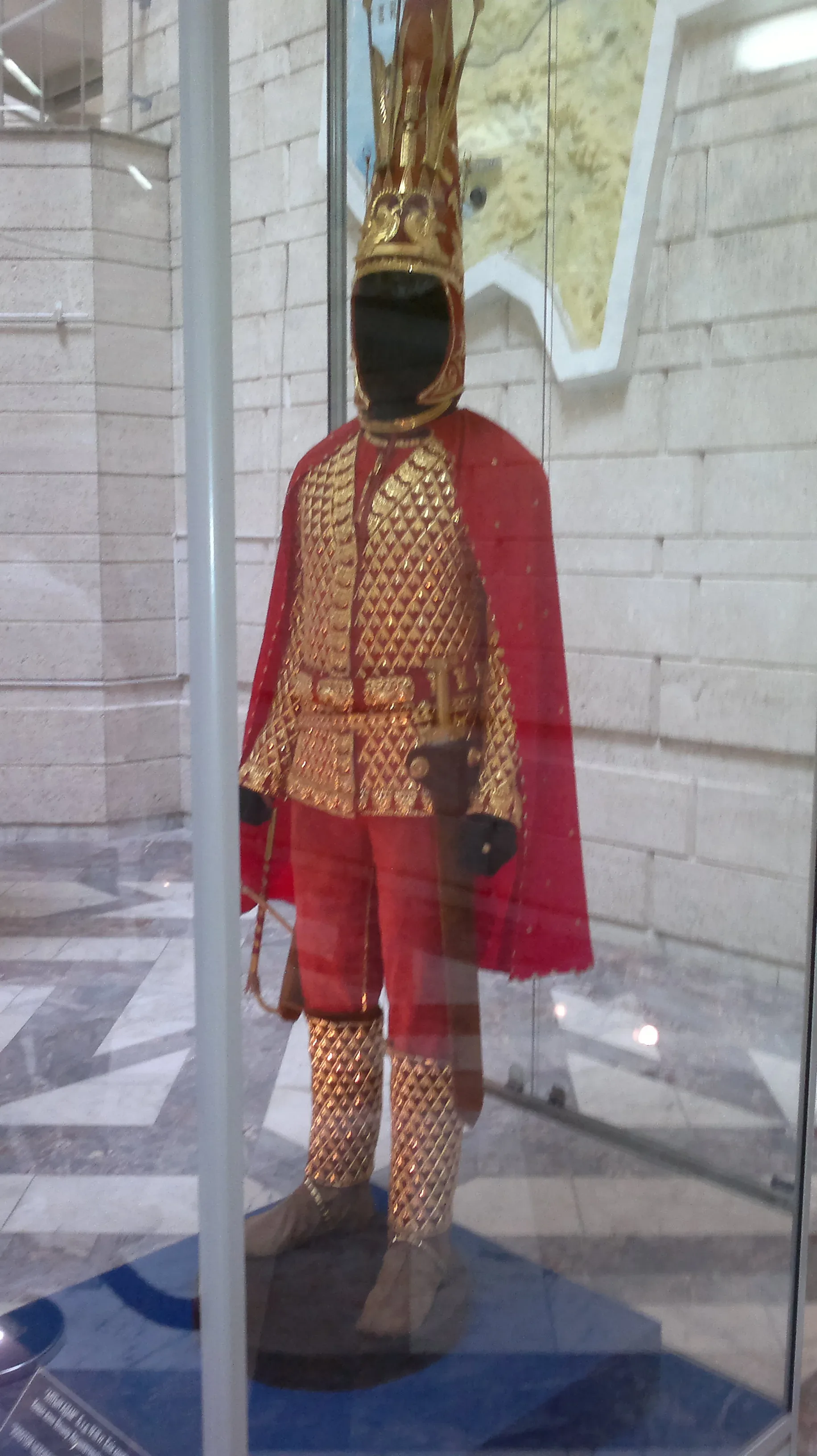
Cultural site
The Issyk State Historical and Cultural Reserve-Museum, in the town of Yesik, centres on the Altyn Adam — the Golden Man.
Used in 1 trip

Cultural site
About 2 km west of the museum, on the northern side of the A-2 highway, the kurgan field is visible from the road: a series of low grass-covered mounds ranging from 4 to 15 metres in height and 30 to 90 metres in diameter, forming the royal necropolis of a Saka tribal elite.
Used in 1 trip

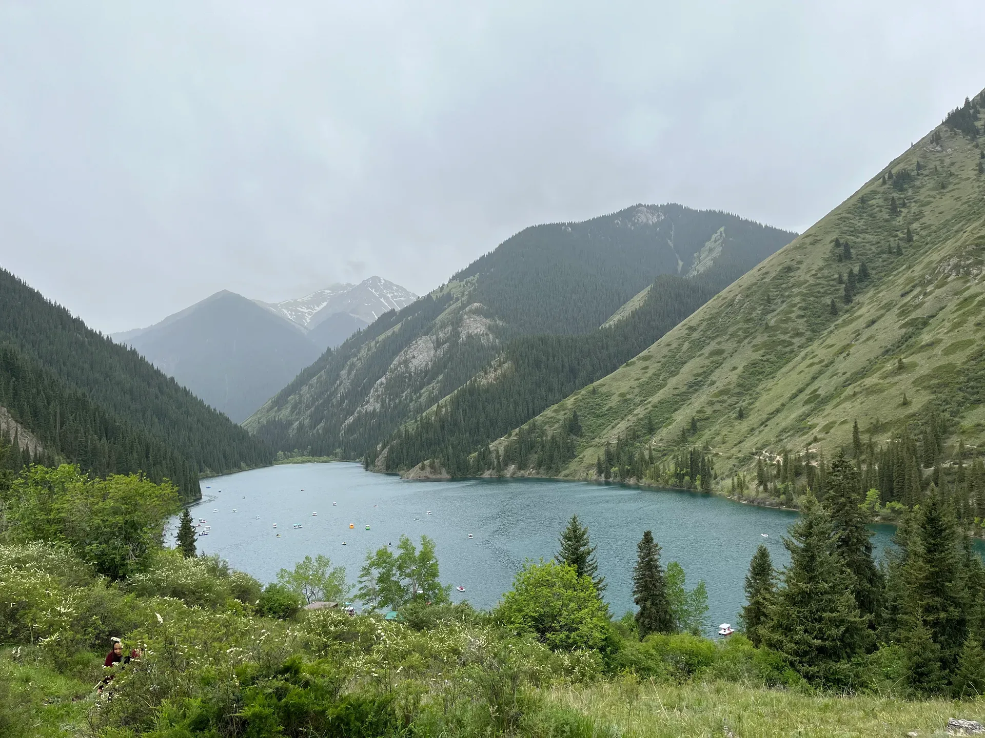
Natural place
The lake occupies a glacially scoured basin at 1,756–1,780 m, roughly 1,850 m long and 500 m wide.
Used in 1 trip

Cultural site
The town of Yesik sits about 48 km east of Almaty and is worth a short stop for the Issyk State Historical and Cultural Reserve-Museum.
Used in 1 trip
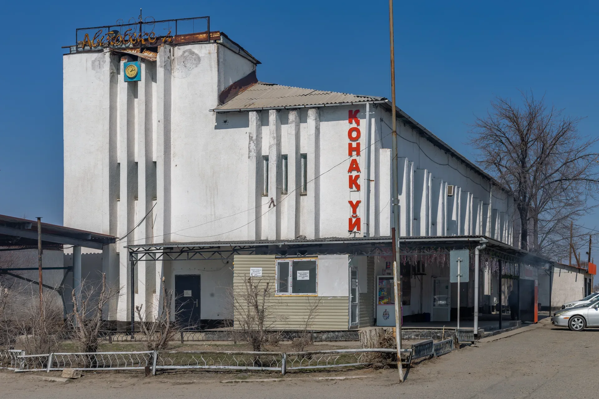
Natural place
The kiyiz üy (felt house) erected on the jailau is a fully functional working shelter, not an exhibit.
Used in 1 trip
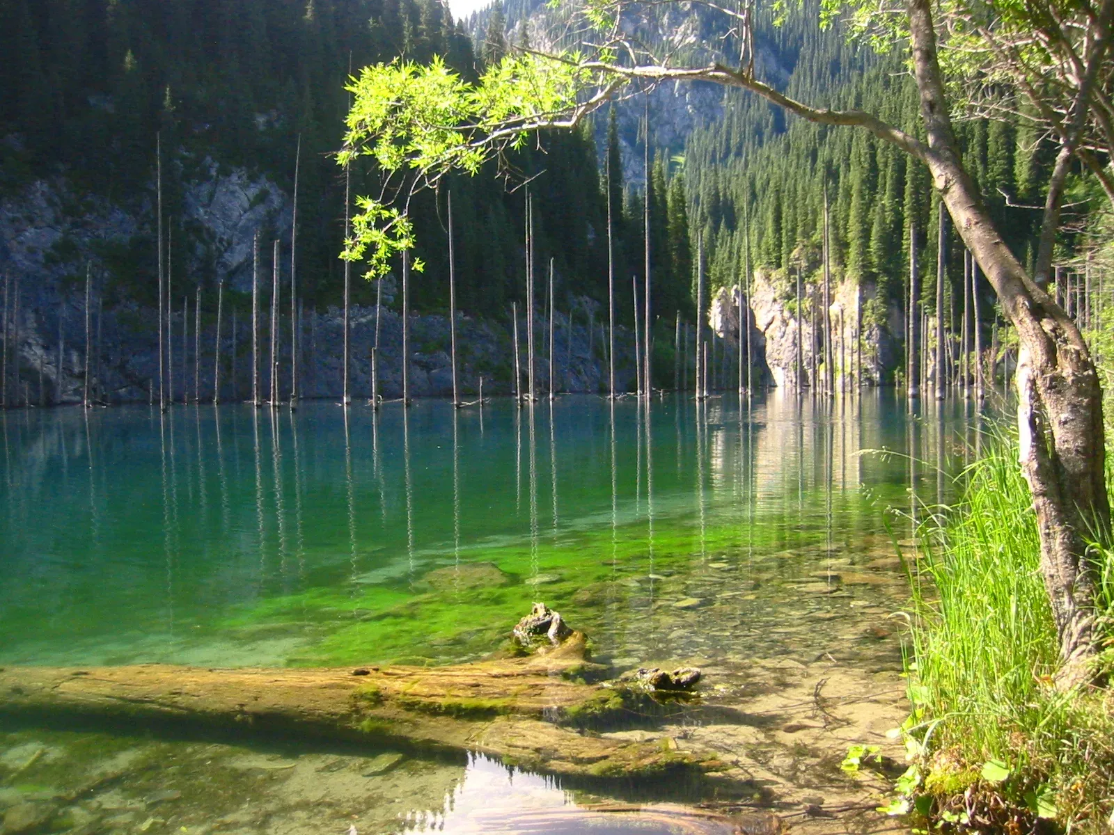
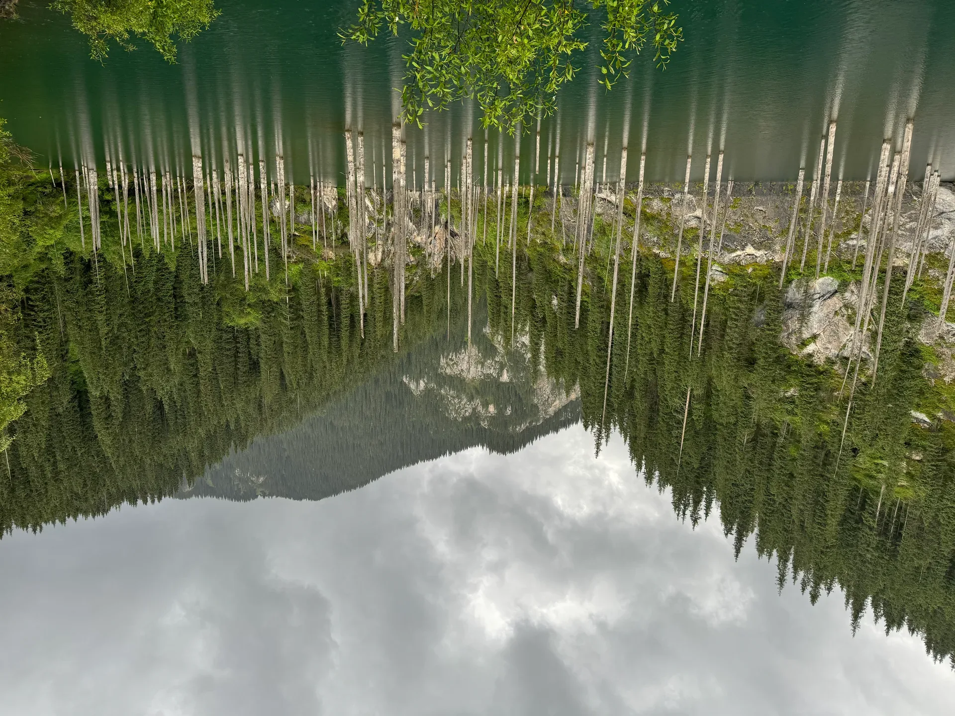
Natural place
Kaindy Lake sits at 2,000 m and measures roughly 400 m long.
Used in 3 trips
Trailhead
The 12 km track from the Saty turnoff to the parking area is the crux of the trip.
Used in 1 trip

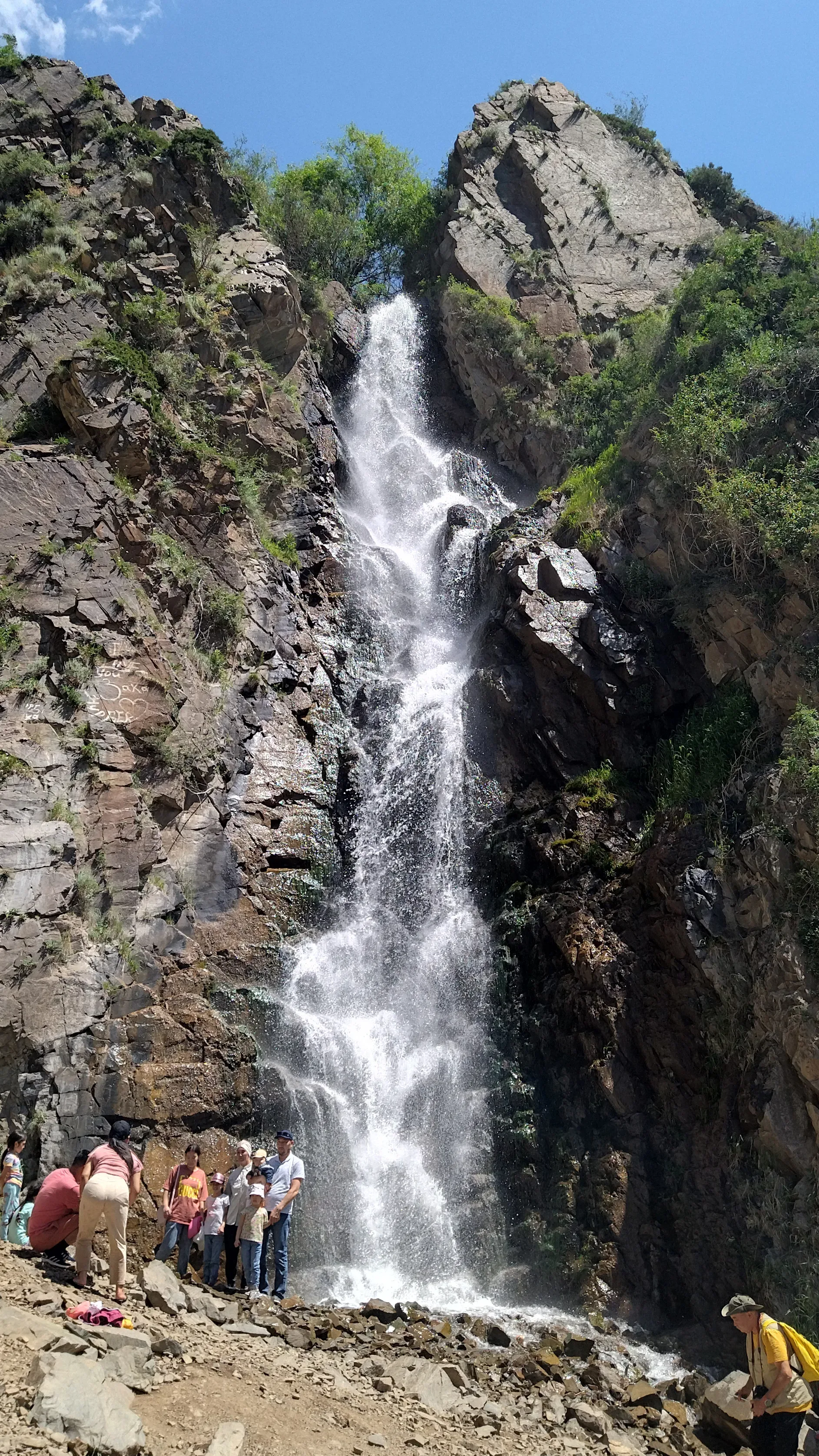
Natural place
Kairak Waterfall is the tallest in the gorge at 55 m, situated on a tributary of the Bozgul River at 2,210 m elevation.
Used in 1 trip

Natural place
The reservoir appears on the left about 75 km from Almaty.
Used in 1 trip
Village
After passing through Kaskelen and continuing west on the A2, watch for the signed right turn toward Karabastau village at roughly the 88 km mark from Almaty.
Used in 1 trip
Natural place
The Karatal Korean History Center in Ushtobe was established by Korean-American missionary Helen Park, who relocated to Kazakhstan after working in Russia.
Used in 1 trip
Town
Kaskelen is a district-centre town of about 70,000 people, 19 km west of Almaty's city boundary and the last place before the gorge with reliable fuel, an ATM, and shops.
Used in 1 trip
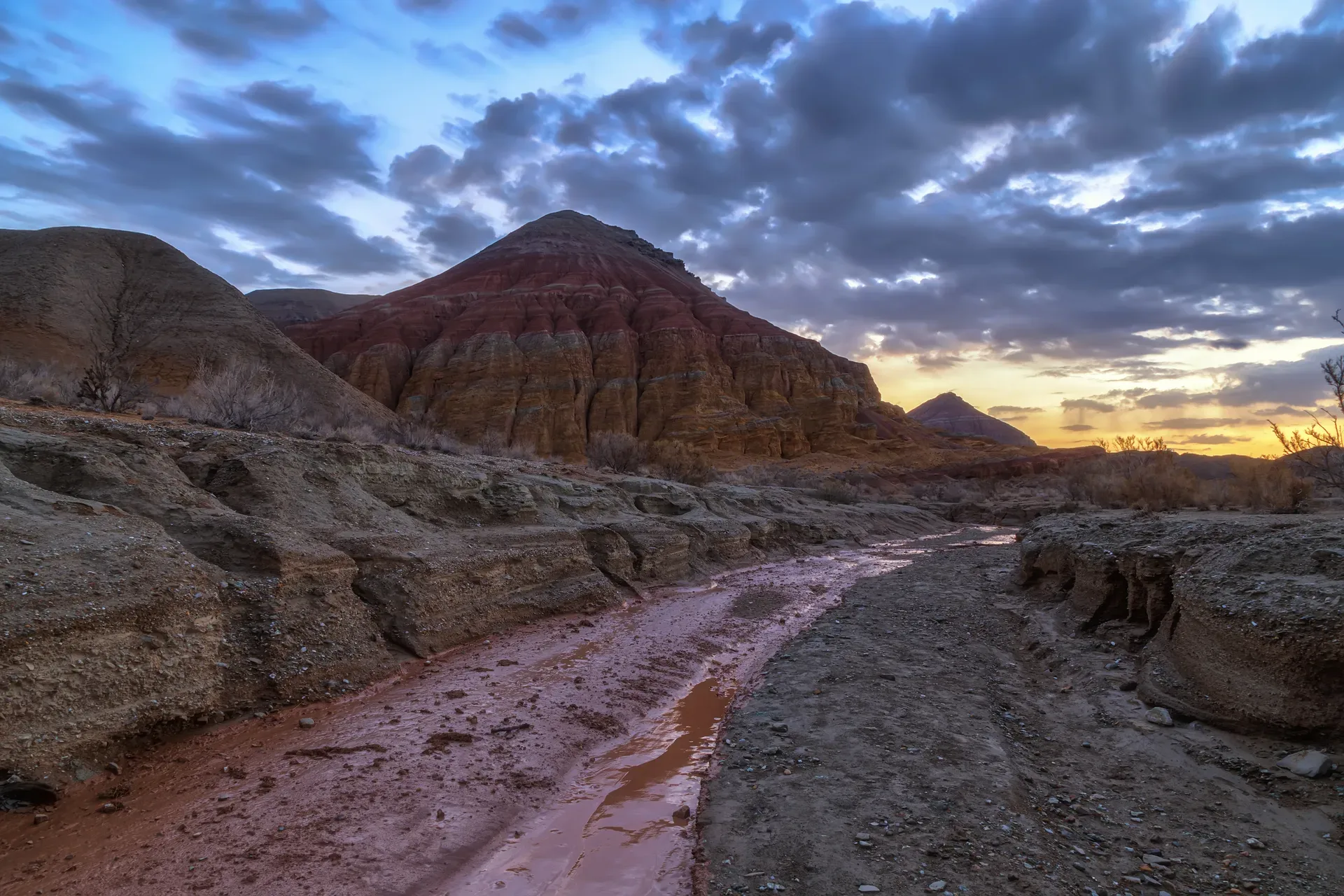
Natural place
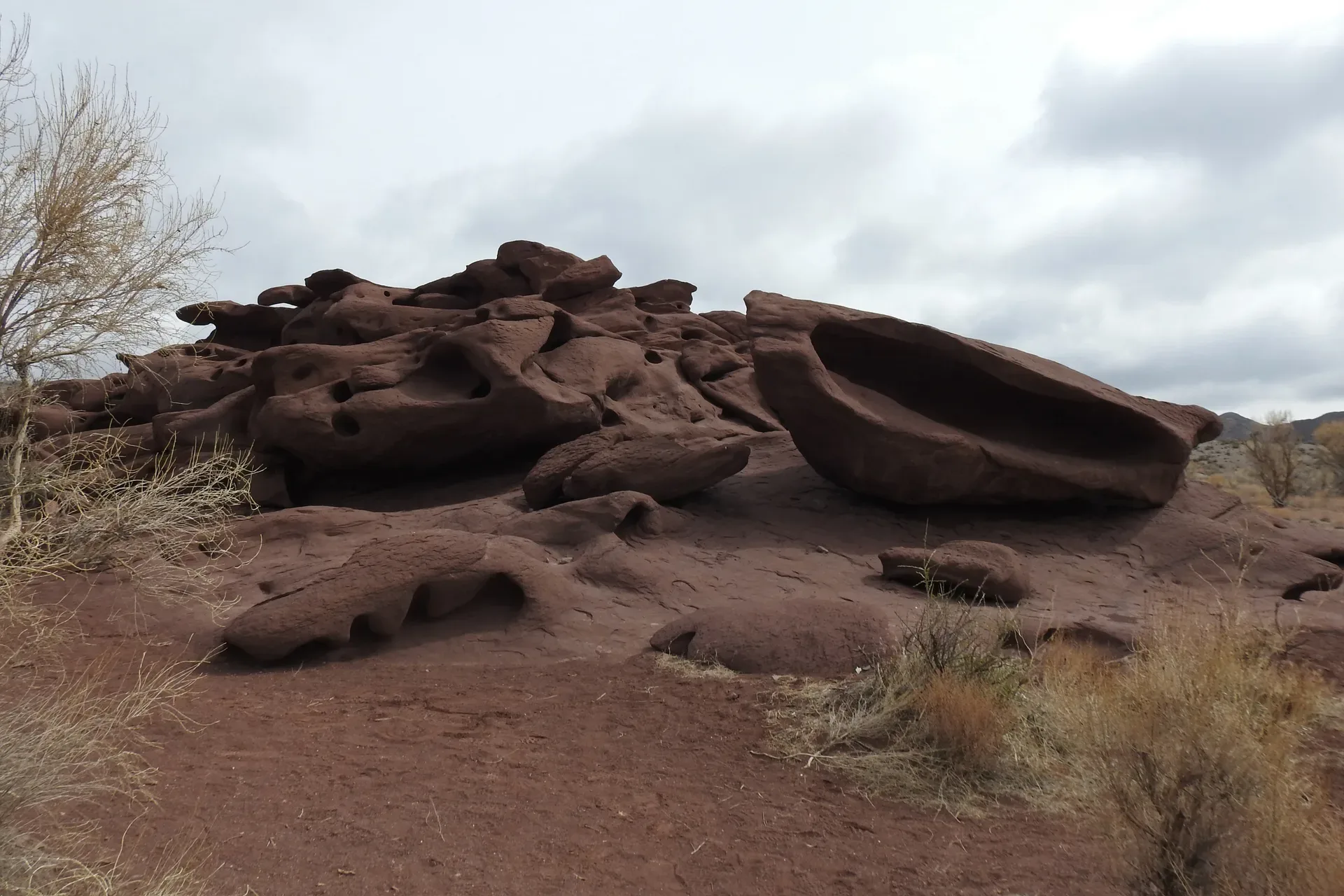
Katutau ('Bitter Mountains') is the volcanic counterpart to Aktau's sedimentary world.
Used in 1 trip
Natural place
Katutau ('Bitter Mountains' or 'Hard Mountains' in Kazakh) lies 25 km west-northwest of Aktau.
Used in 1 trip
Natural place
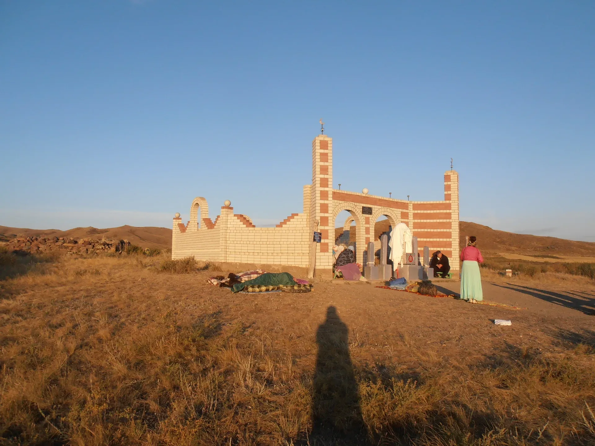
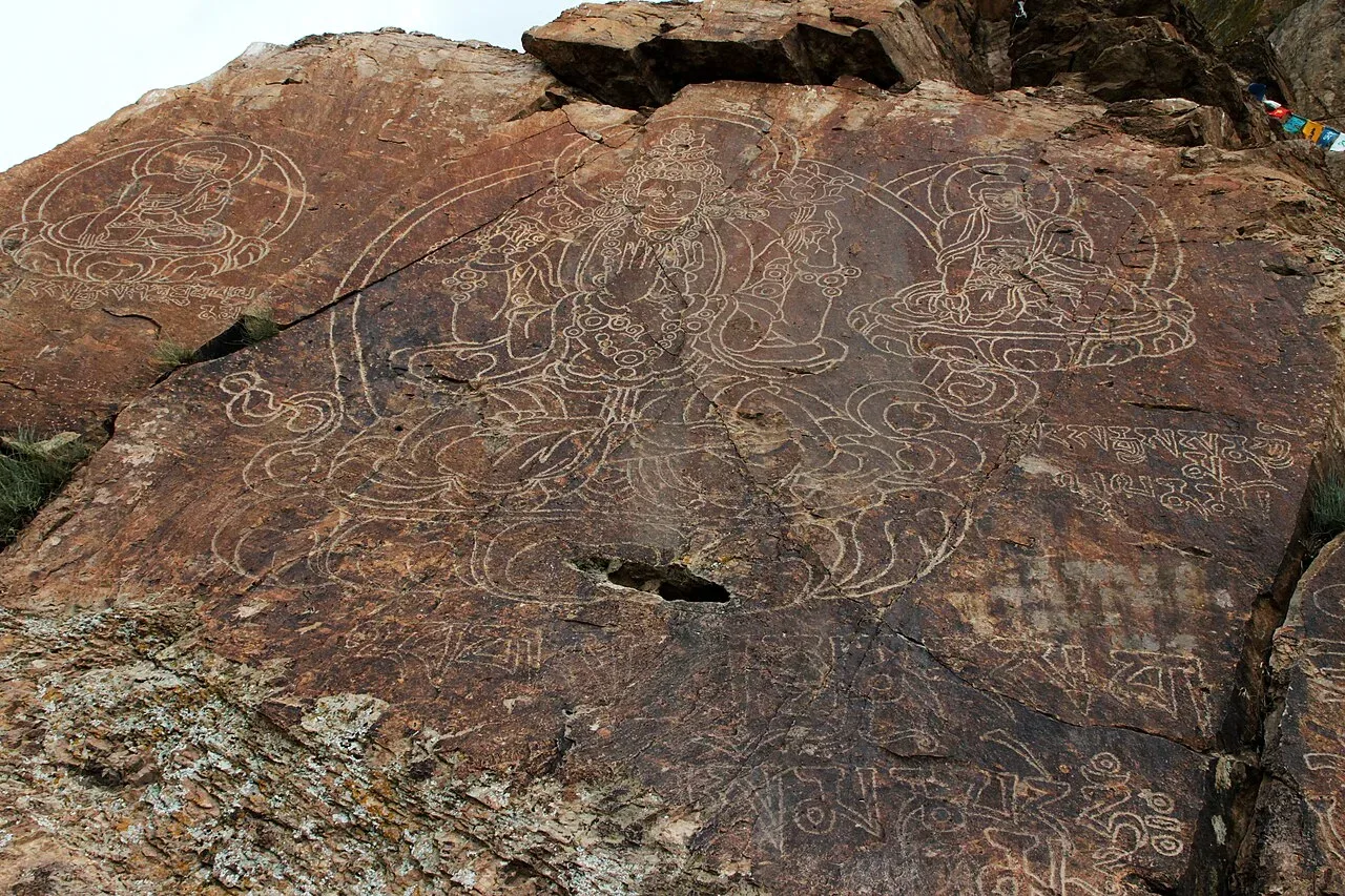
Small vernacular mausoleums known as kesene (кесене) dot the steppe of the Kegen and Tekes districts — mudbrick dome-on-drum structures built during the 14th–17th century as the Kazakh Khanate consolidated across these high-plateau territories after the dissolution of the Mongol Empire.
Used in 1 trip
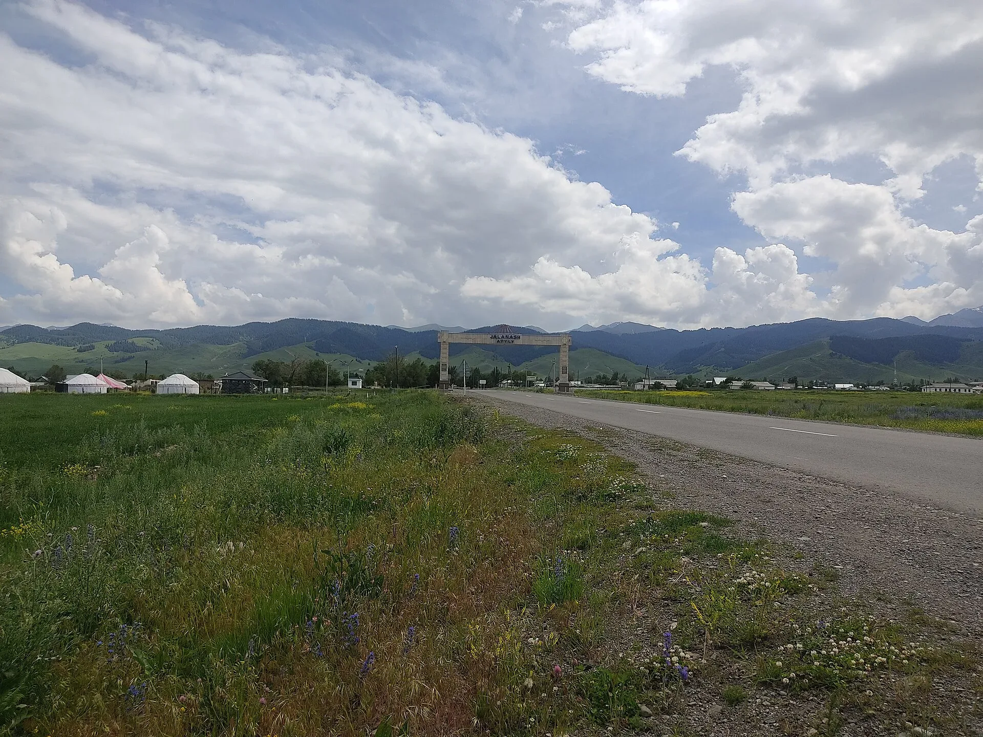
Village
Kegen village (pop.
Used in 2 trips
Natural place
After the fork the trail climbs steeply through Tian Shan spruce, crossing the remains of a Soviet-era ski lift — the rusted pylons are still visible in the forest.
Used in 1 trip
Natural place
From Saty a paved road climbs 15 km to the Lower Kolsai Lake at 1,818 m.
Used in 1 trip
Natural place
Kurmety gorge cuts north from the Kungey Alatau range in the Kegen district, draining into the Kolsay Lakes National Park territory.
Used in 1 trip
Natural place
The Lower Butakovka Waterfall spills about 30 m down a wall of dark granite, landing in a shallow pool at roughly 2,100 m altitude.
Used in 1 trip
Natural place
The lower lake sits at 1,818 m, about 1 km long, with a small beach area and a basic restaurant near the entrance.
Used in 2 trips

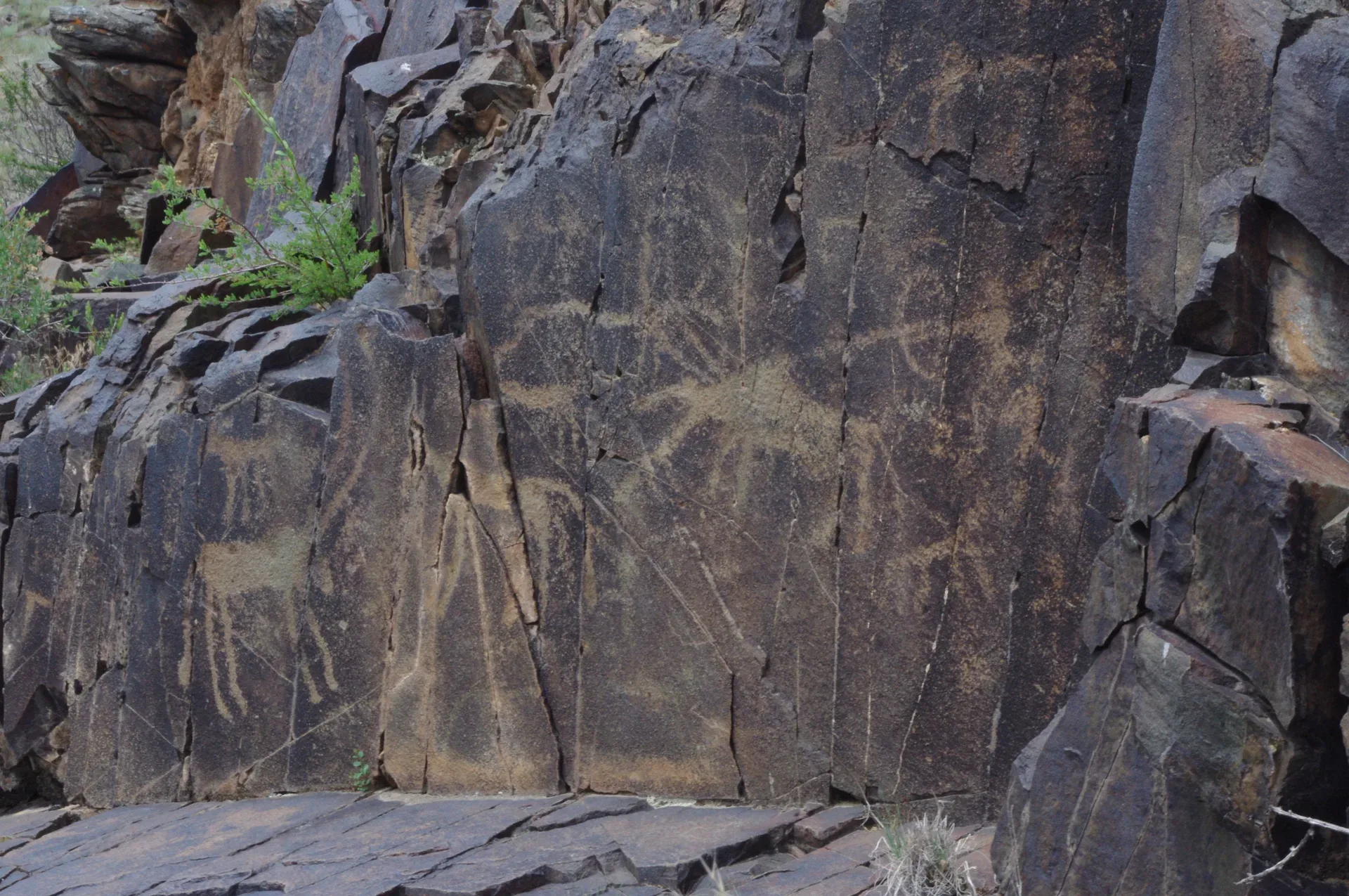
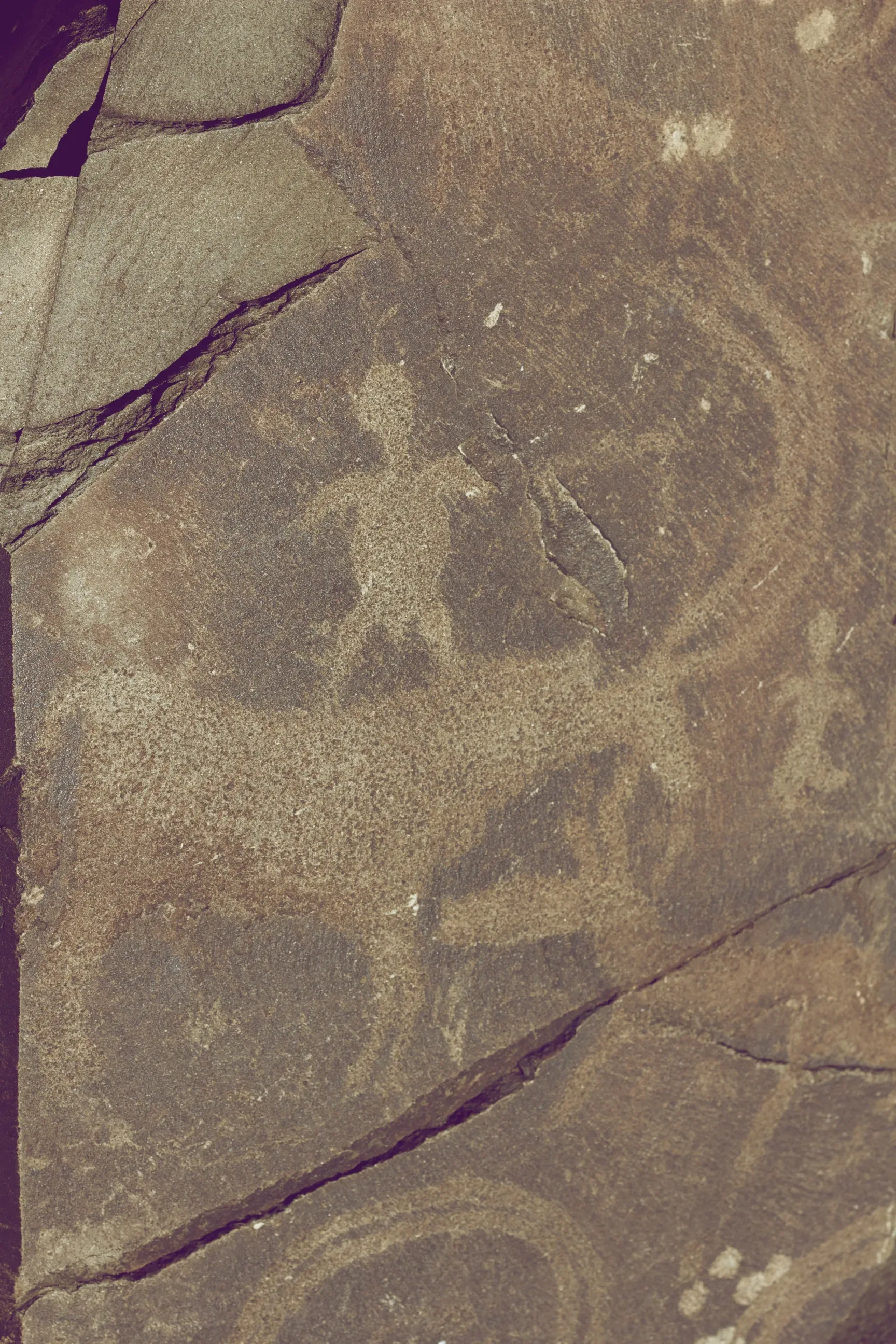
Natural place
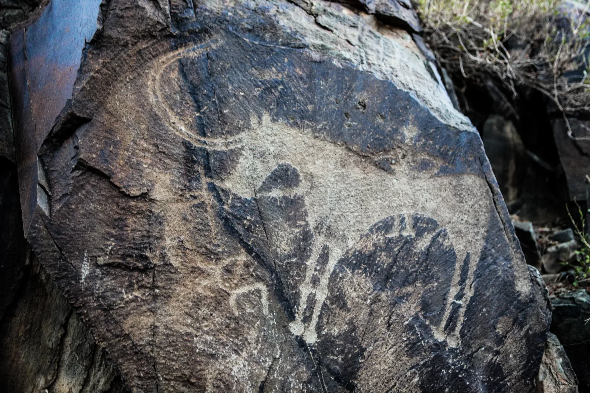
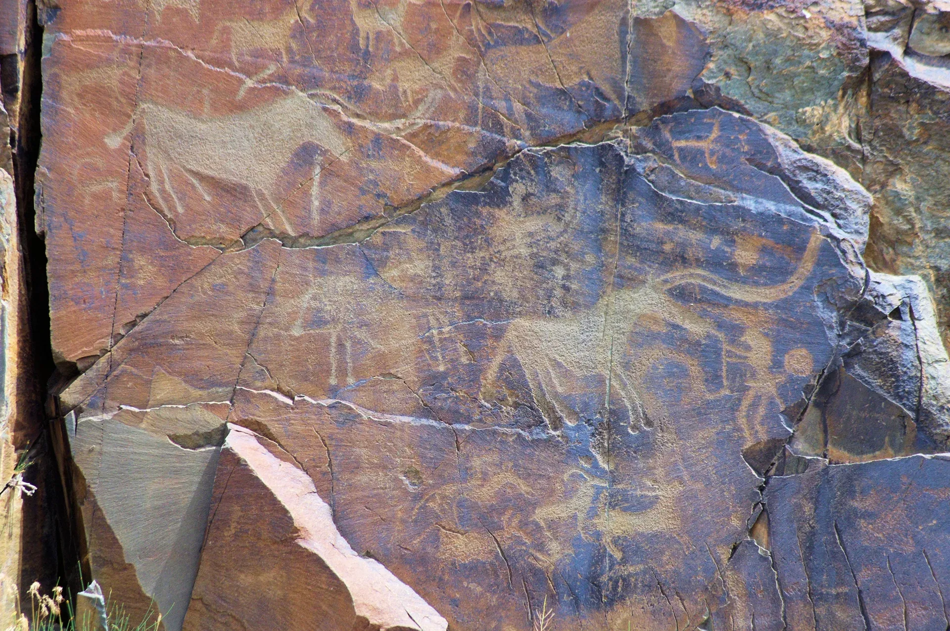
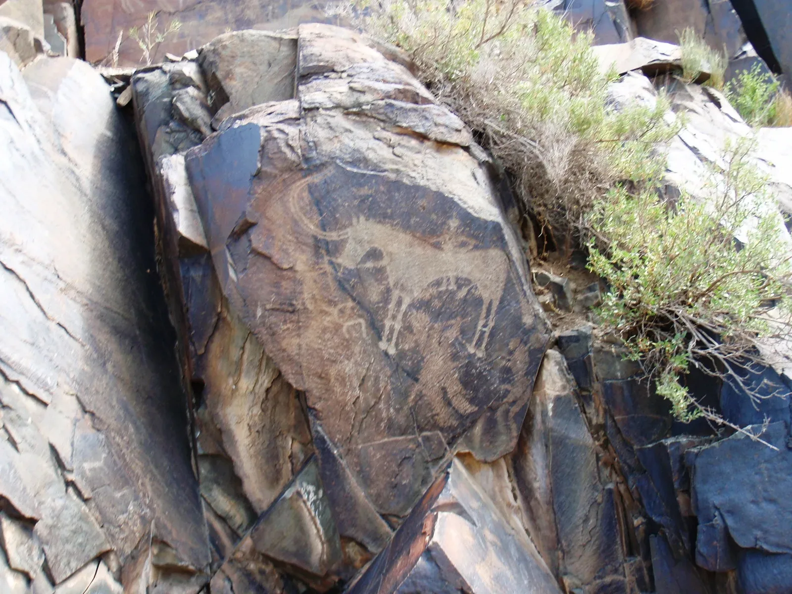
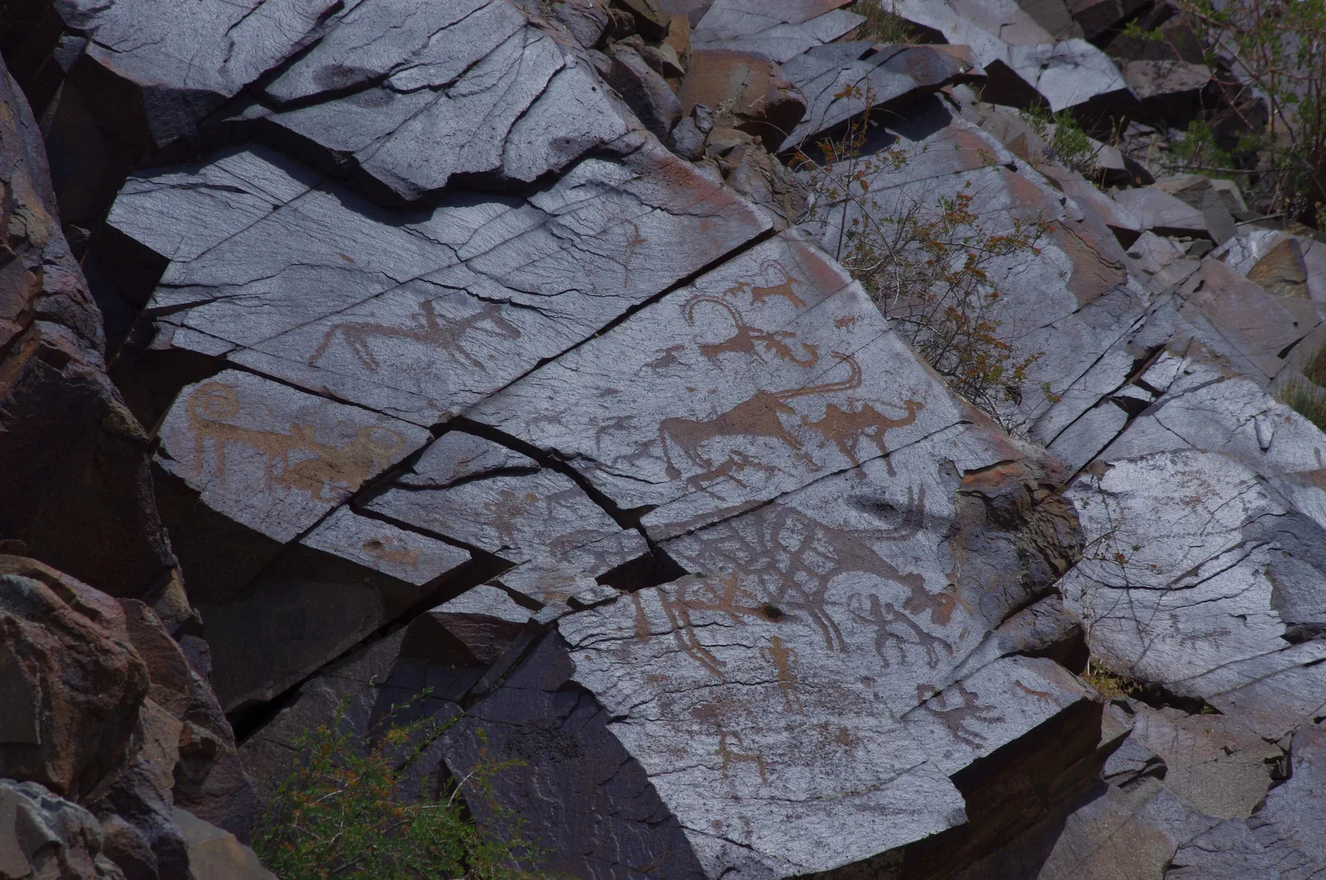
The lower gorges of the Eshkiolmes ridge (particularly gorges 1–9) concentrate the oldest petroglyphs, attributed to the Bronze-Age Andronovo horizon (12th–9th century BCE).
Used in 1 trip
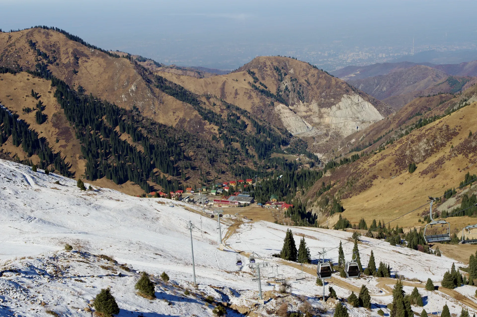
Trailhead
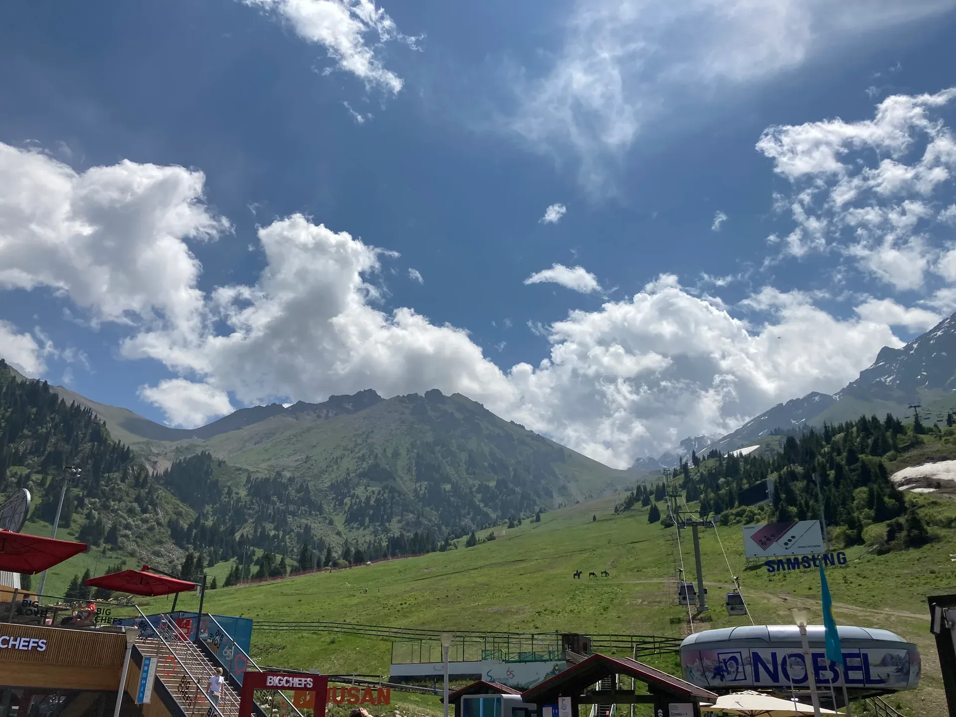
Medeu sits at 1,691 m and is best known for its outdoor speed-skating oval, which hosted world records through the Soviet era.
Used in 3 trips
Natural place
Bear Waterfall is the easiest and most-visited waterfall in the gorge.
Used in 1 trip
Natural place
The middle lake at 2,252 m is considered the most scenic of the three — wider, more open, and backed by higher ridgelines.
Used in 1 trip
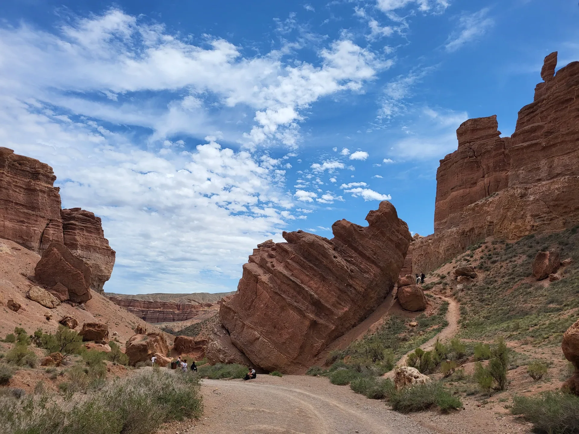
Natural place
From the Valley of Castles, backtrack briefly and cross the Charyn River bridge onto an unpaved gravel track that runs south-southwest along the river for roughly 10 km to Uzunbulak canyon — known in tourist literature as Лунный каньон (Moon Canyon) or Жёлтый каньон (Yellow Canyon).
Used in 2 trips
Natural place
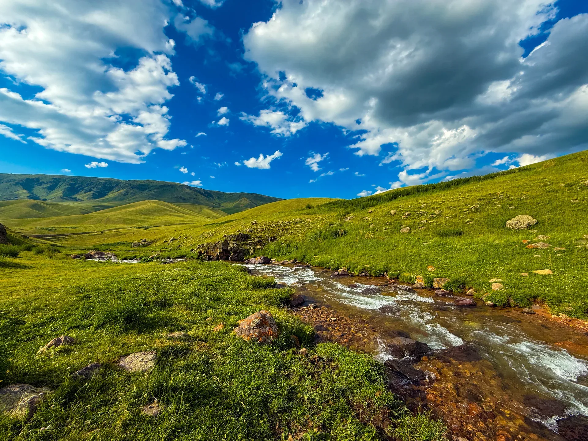
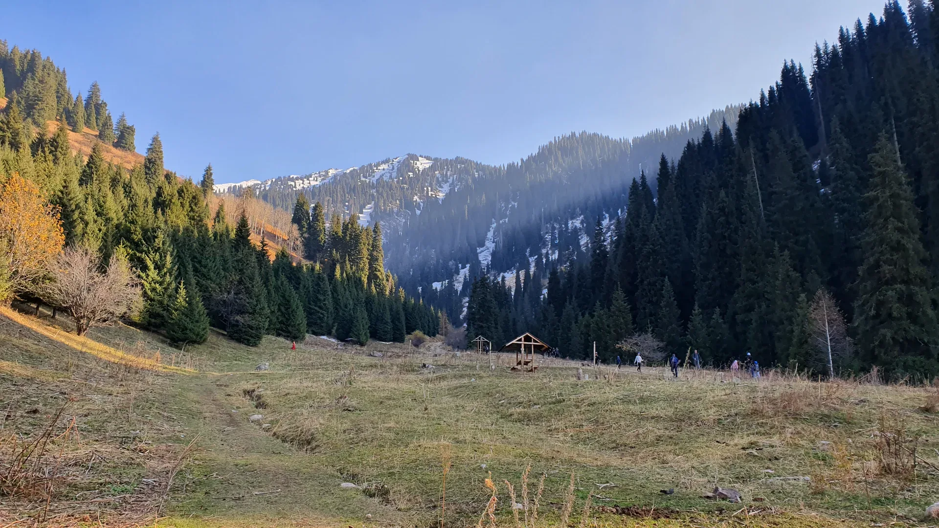
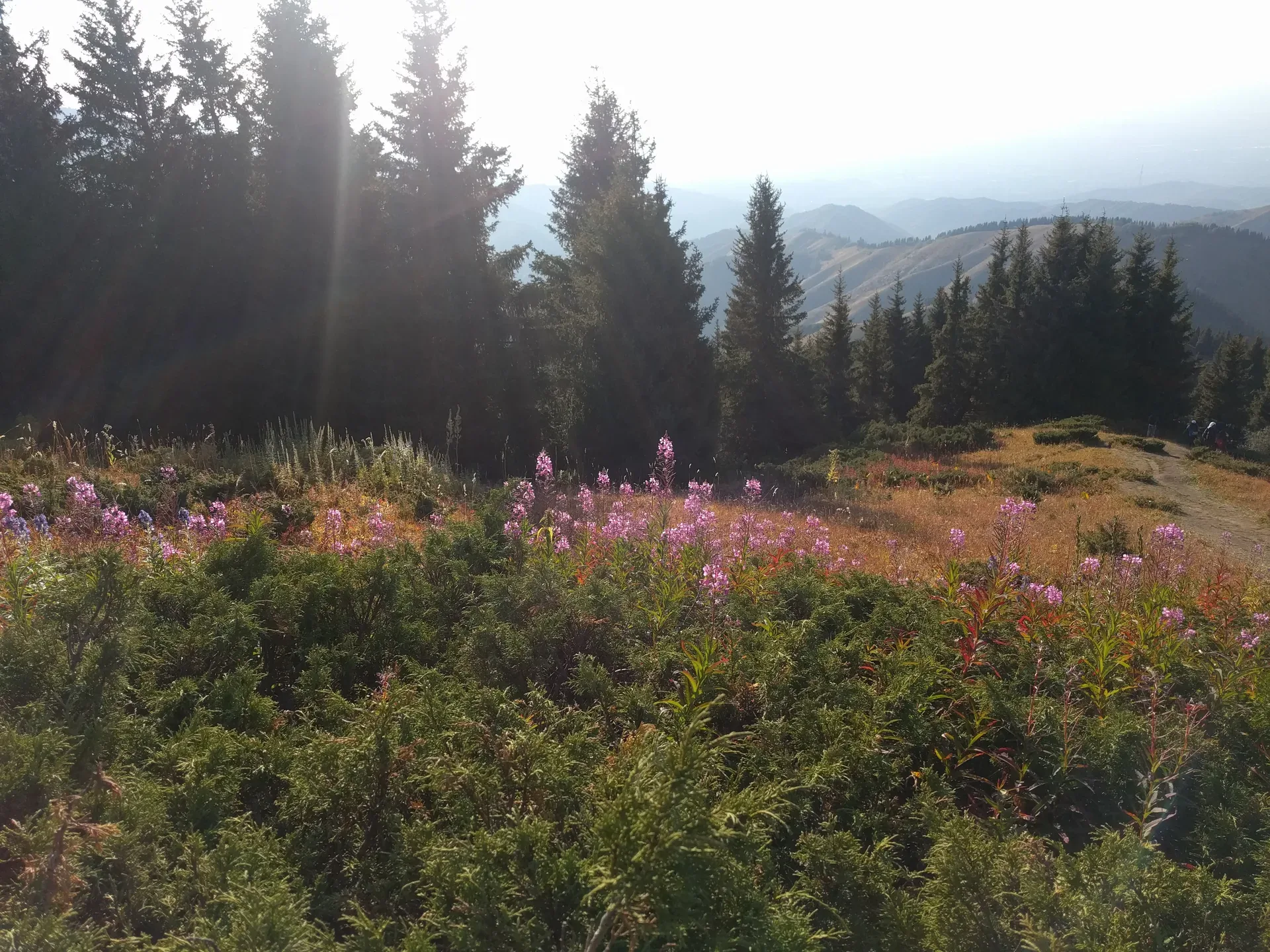
The gorge opens abruptly onto the Mynzhylki plateau at 3,000 m — a wide, flat alpine valley whose Kazakh name means 'a thousand mares,' reflecting its historical use as high-altitude pasture.
Used in 1 trip
Natural place
From Tekeli, head south on the unpaved track that follows the right (north) bank of the Koksu River.
Used in 1 trip
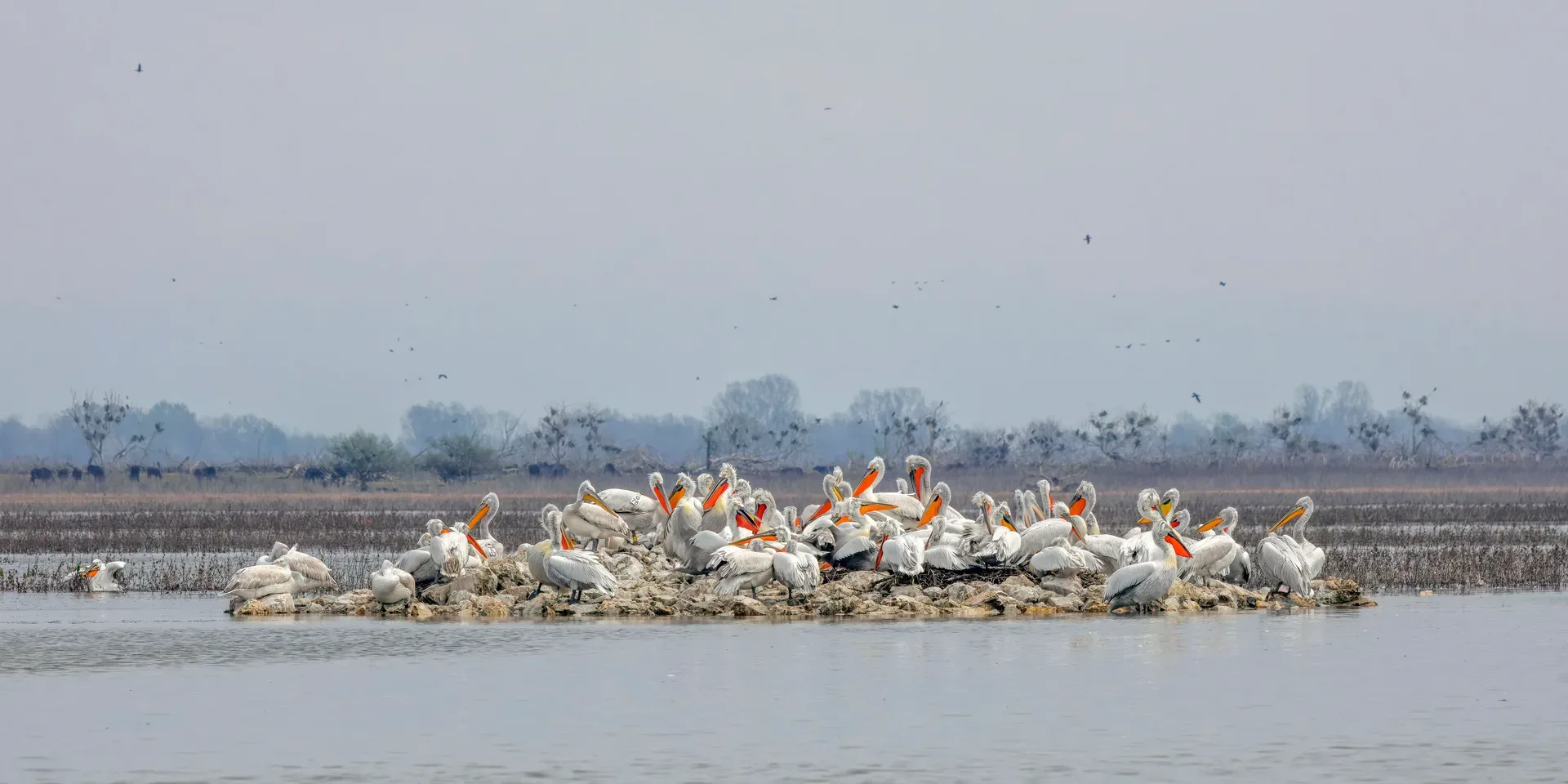
Natural place
The Dalmatian pelican (Pelecanus crispus) colony at Sorbulak supports up to 300 breeding pairs — one of the largest colonies in Kazakhstan for a globally vulnerable species with a world population of around 10,000 birds.
Used in 1 trip
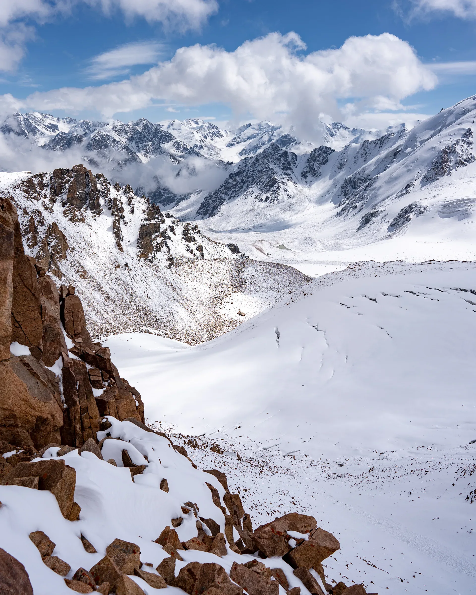
Natural place
From the T-1 station a short scramble onto the lateral moraine ridge above the left bank of the glacier reaches the Ordzhonikidze cirque viewpoint, gaining roughly 100 m over 30 minutes of rough walking on loose rock.
Used in 1 trip
Trailhead
The Ile-Alatau National Park ecopost is located roughly 10 km into the gorge from the main road junction.
Used in 1 trip
Natural place
From Kegen, graded dirt tracks lead south roughly 30 km to the plateau rim, climbing from the 1,800 m valley floor to about 2,000 m.
Used in 1 trip
Natural place
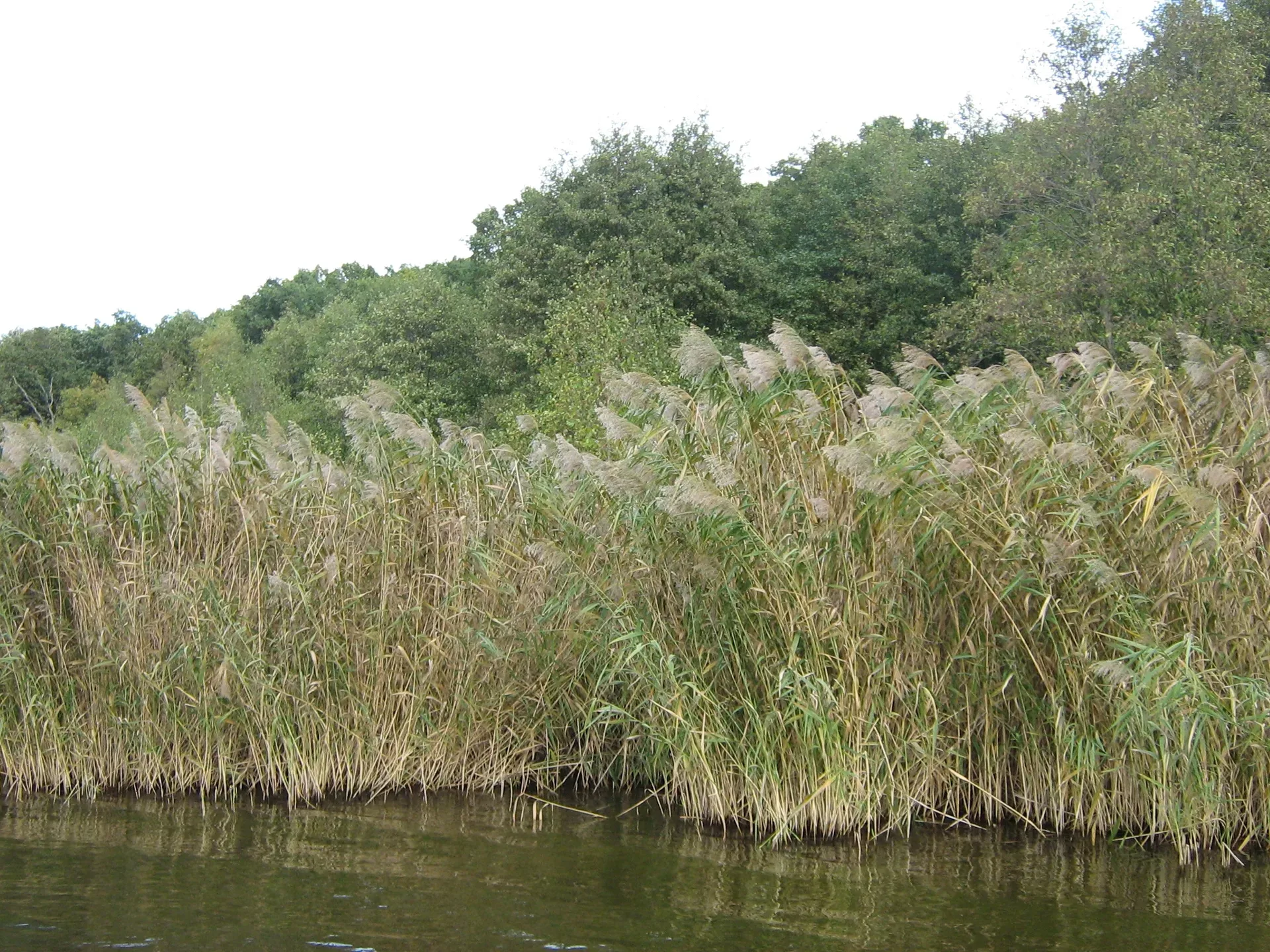
The reed beds lining the south and east shores of Sorbulak stretch several hundred metres from water's edge and hold a separate suite of species from the open water.
Used in 1 trip
Trailhead
The return drive from Katutau to Basshi covers approximately 47 km and takes 60–80 minutes on the park track.
Used in 1 trip
Natural place
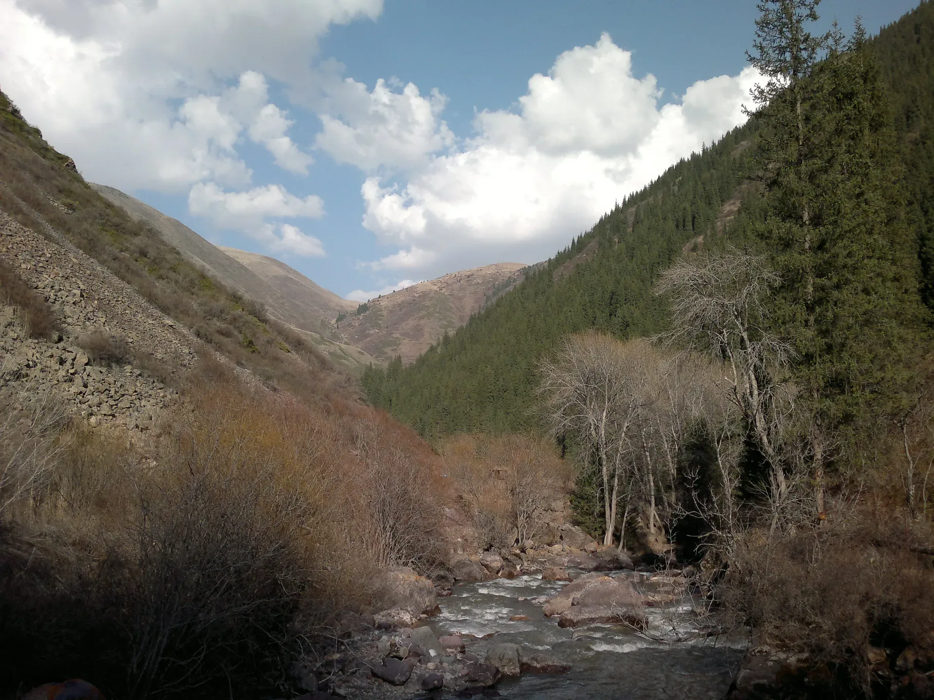
At roughly 1,400–1,500 m elevation, the gorge floor widens briefly and the riverbank hosts the densest wild-apple and apricot stands in the area.
Used in 1 trip
Village
Saty is a small village of around 1,400 people at 1,450 m, tucked into the foothills south of the canyon country.
Used in 5 trips
Trailhead
From the Medeu gondola station, 8-person cabins depart for Shymbulak, rising 570 m over 4.5 km in roughly 15–20 minutes.
Used in 2 trips
Natural place
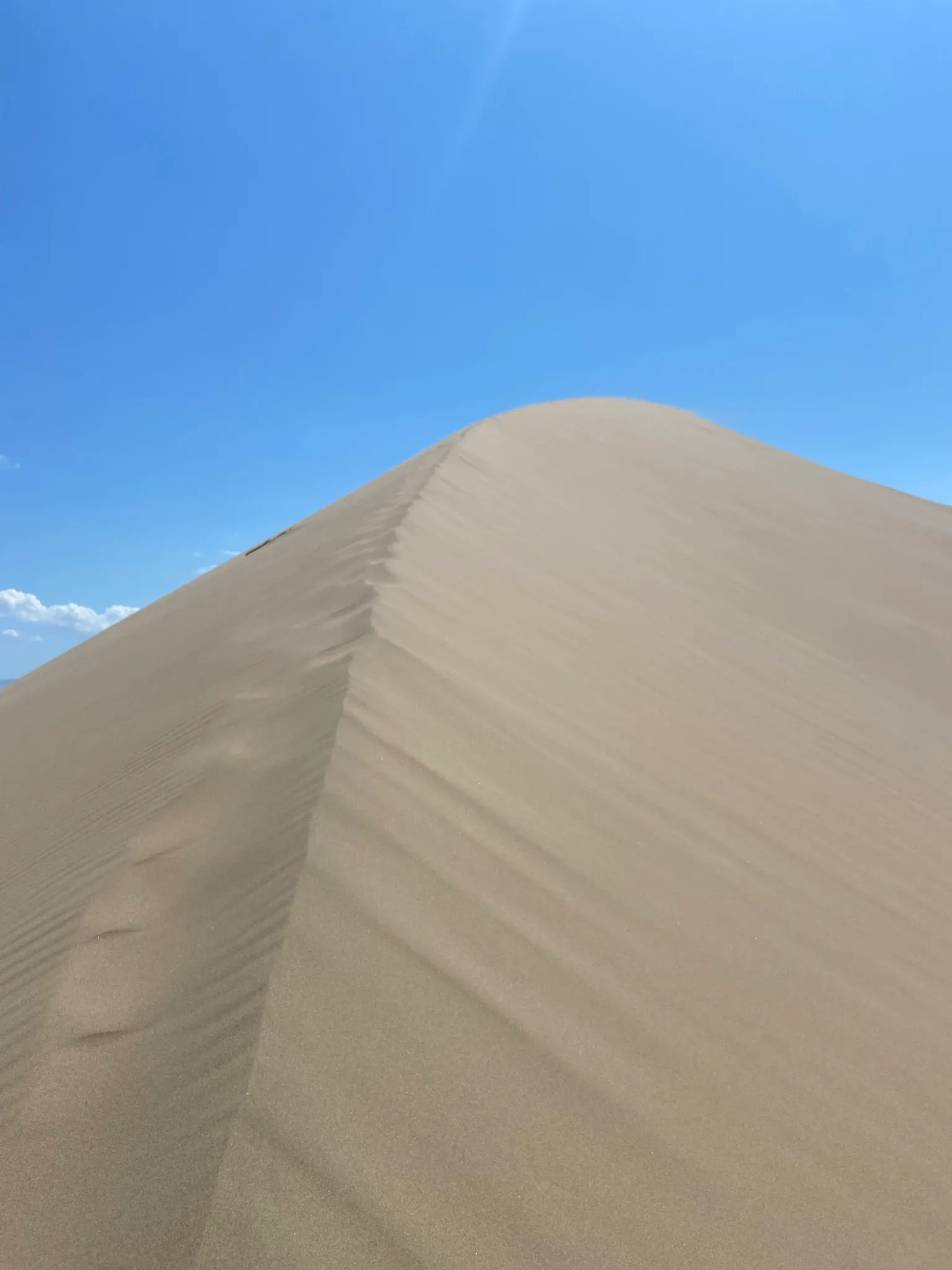
The Singing Dune rises abruptly from the flat steppe like a sand mountain — 3 km wide, 150 m tall, formed from pure quartz grains deposited by ancient winds into a crescent barchan shape.
Used in 1 trip

Natural place
The first view of Sorbulak hits without preamble: the track crests the dam berm and the full expanse of the lake opens below, water surface interrupted by the dark lines of reed beds and, in summer and spring, dense rafts of cormorants, coots, and ducks.
Used in 1 trip
City
Taldykorgan is the regional capital of Zhetisu Oblast and the last reliable supply point before the Koksu valley.
Used in 2 trips
Natural place
A second gondola stage continues south from the Shymbulak base to Talgar Pass at 3,200 m — the highest point accessible by the cable car system.
Used in 1 trip
Town
Talgar is a district centre of around 70,000 people, 25 km east of Almaty on the A-2.
Used in 1 trip
Natural place
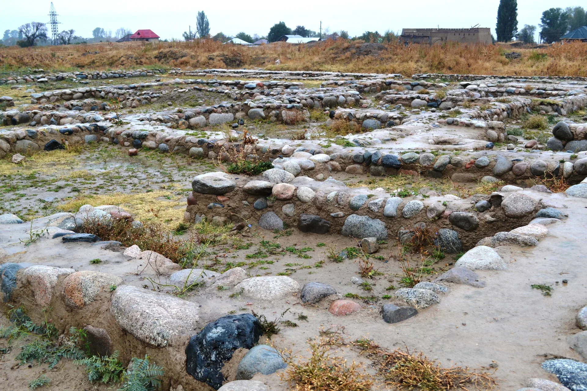
Within the Talkhiz enclosure, excavations begun in 1974 under a team that included Karl Baipakov revealed a layered urban fabric: residential structures, craft production areas, and the outlines of a medieval bath complex (hammam-type), consistent with other Karakhanid urban centres of the region.
Used in 1 trip
Cultural site
The ancient settlement of Talkhiz sits on the southern outskirts of Talgar, roughly 2 km south of the main highway.
Used in 1 trip
Cultural site
The reserve entrance has a ticket office, parking, and basic covered pavilions.
Used in 1 trip
Cultural site
From Konaev, cross the Ili dam bridge and continue north 19 km on the Bakanas road until a sign for «Полигон МЧС» (MChS training ground).
Used in 1 trip
Cultural site
The Tegiszhol sector of the gorge, at approximately 1,600–1,700 m, contains scattered Bronze-Age and Saka-period rock carvings on dark-patinated cliff faces along the right bank of the Kaskelen.
Used in 1 trip
Natural place
The Tekes River in Kazakhstan flows through a broad intermountain valley roughly 112 km long, at an elevation of 1,700–1,800 m on the valley floor.
Used in 1 trip
Cultural site
A rough track climbs 2 km above the lake to the Tien Shan Astronomical Observatory, a working scientific facility operated by the Fesenkov Astrophysical Institute.
Used in 1 trip
Natural place
The Turgen Gorge runs roughly 30 km from the national park gate up to the Asy Pass.
Used in 1 trip
Trailhead
The trail south from Shymbulak passes through the Tuyuksu mountaineering camp and reaches the Alpinists' Memorial at around 2,500 m — a monument to climbers killed in the Zailiysky Alatau.
Used in 1 trip
Natural place
Gorges 10, 12, 13, and 20 of the Eshkiolmes ridge hold the densest concentration of Saka Iron-Age imagery (6th–4th century BCE), documented by Maryashev and Nuskabayev as representing the peak artistic period at the site.
Used in 1 trip
Town
Ushtobe is a compact railway town of roughly 25,000 residents in Karatal District.
Used in 1 trip
Natural place
Uy-Tas — Kazakh for 'stone house' or 'yurt stone' — sits alone on the ridge crest at approximately 2,000 m elevation, 1.5–2 km from the upper parking area on a clear trail through birch groves.
Used in 1 trip
Cultural site
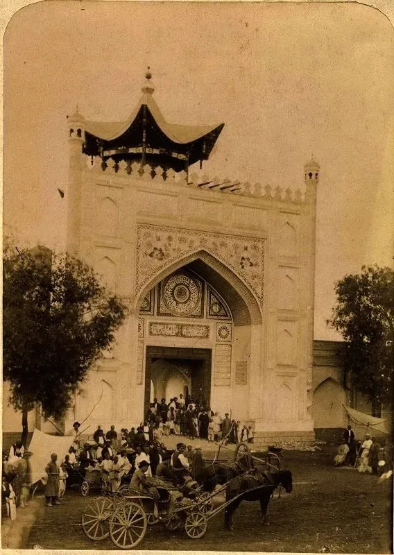
The Zharkent Mosque stands near the centre of Zharkent, 350 km from Almaty.
Used in 1 trip
Fuel stops, crossings, departures, and other route-structure pages kept public for itinerary continuity.
15 entries
Practical stop
A short 4x4 drive brings you to the base of the Aktau ridge — the highest accessible point on the Aktau escarpment, where the stacked sedimentary layers are visible in cross-section from above.
Used in 1 trip
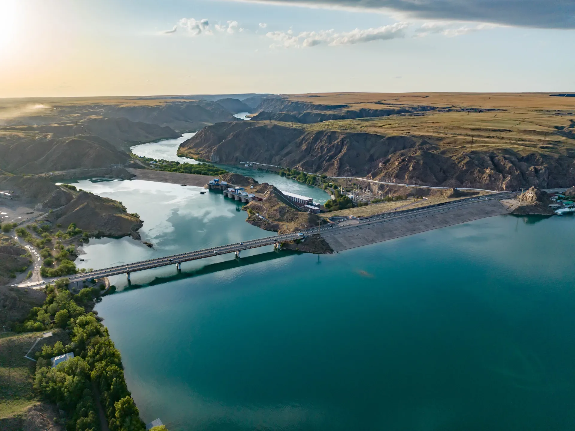
Practical stop
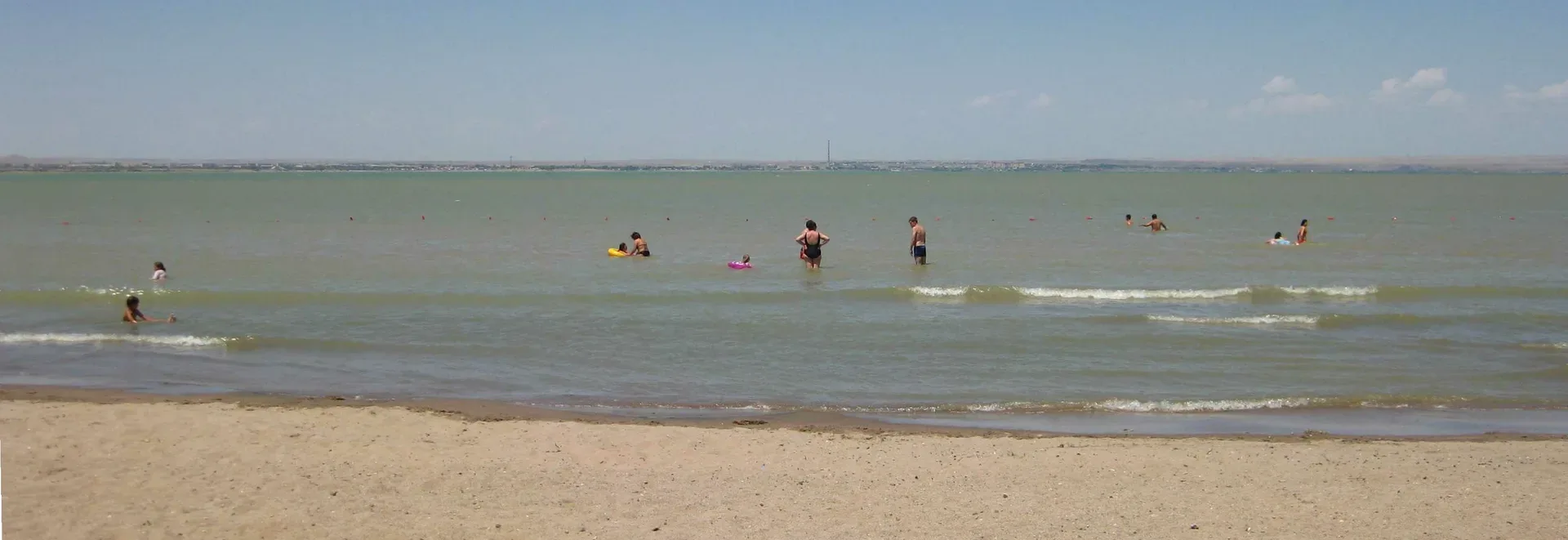
89 km from Almaty, Kapchagai (now Qonaev) sits at the southern end of the Kapshagay Reservoir, where the Kapshagay hydroelectric dam — built 1965–1970, 364 MW capacity — created a 180 km lake from the Ile River.
Used in 1 trip
Practical stop
The A-3 crosses the Kapchagai Reservoir via the dam road approximately 70 km northeast of Almaty.
Used in 1 trip
Practical stop
The Kapchagai reservoir, 89 km from Almaty, was created in 1970 by damming the Ili River for the Kapchagay hydroelectric plant.
Used in 1 trip
Practical stop
Konaev (Konaev city, formerly Kapchagai) is 80 km northeast of Almaty on the A3 and sits beside the Kapchagai reservoir, the Ili River's wide impoundment behind a 1970 hydro dam.
Used in 1 trip
Practical stop
Zharkent has several small hotels and guesthouses, including family-run operations that function as basic homestays.
Used in 1 trip
Practical stop
The return follows the A3 southwest from Taldykorgan.
Used in 1 trip

Practical stop
Return to Kegen on the plateau tracks, refuel, and drive the 250 km back to Almaty via Shelek and the A351.
Used in 1 trip
Practical stop
Depart Saty after breakfast on day two.
Used in 2 trips

Practical stop
Descend via the same gorge road to the valley floor.
Used in 1 trip
Practical stop
Retrace the Koksu valley track to Tekeli and then the R-122 to Taldykorgan.
Used in 1 trip

Practical stop
Shelek (the town formerly known as Chilik) sits at the junction where the A351 continues east toward Charyn and a secondary road turns south toward Kegen.
Used in 1 trip

Practical stop
Tekeli (population roughly 30,000) is a former Soviet lead-zinc mining town 40 km from Taldykorgan via the R-122.
Used in 1 trip
Practical stop
The Ushtobe central market, on Tole Bi Street, runs daily until early afternoon.
Used in 1 trip
Practical stop
Zhibek Zholy (Silk Road) street is Zharkent's main commercial corridor, running south from the mosque area through the town centre.
Used in 1 trip