
Overview
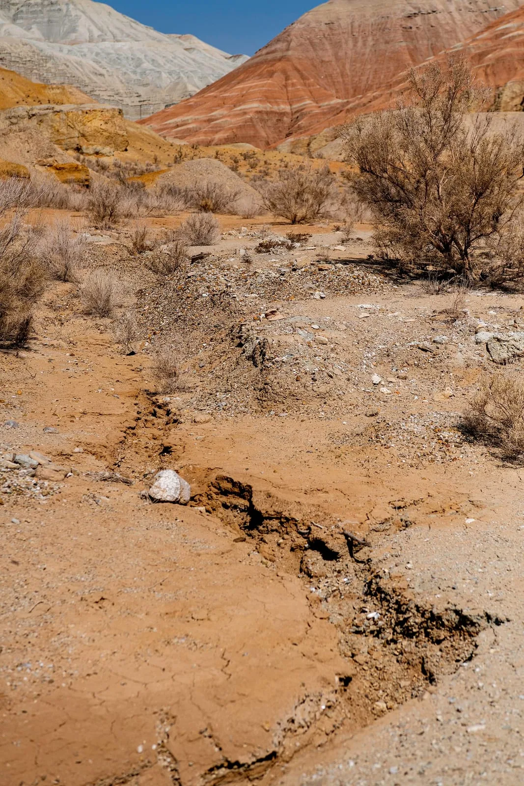
The Singing Dune rises abruptly from the flat steppe like a sand mountain — 3 km wide, 150 m tall, formed from pure quartz grains deposited by ancient winds into a crescent barchan shape. Climbing the slip face takes 20–40 minutes of calf-burning effort in loose sand. At the crest the views extend across the Ili valley and the flat-topped Katutau range. When conditions are right — dry, with a westerly breeze — the sand produces a low, resonant drone audible from several hundred metres. The phenomenon occurs when dry grains avalanche down the steep lee face and friction between grains generates sound waves at around 100 Hz.
Open Singing Dune in maps
Choose a map provider for this destination.
These links open only this place, not a full road-trip route. Links open in a new tab. 2GIS opens the map point; start navigation there.
Curated trails and nearby things from Singing Dune
Singing Dune planning depends on heat, wind, park registration, and the long drive between Altyn-Emel sectors.
Trail options
If the interactive map is unavailable, the trail cards and nearby list include the same critical details.
Selected trail: Singing Dune summit ridge climb. Critical route notes remain in the cards below.
Skip map and read trail details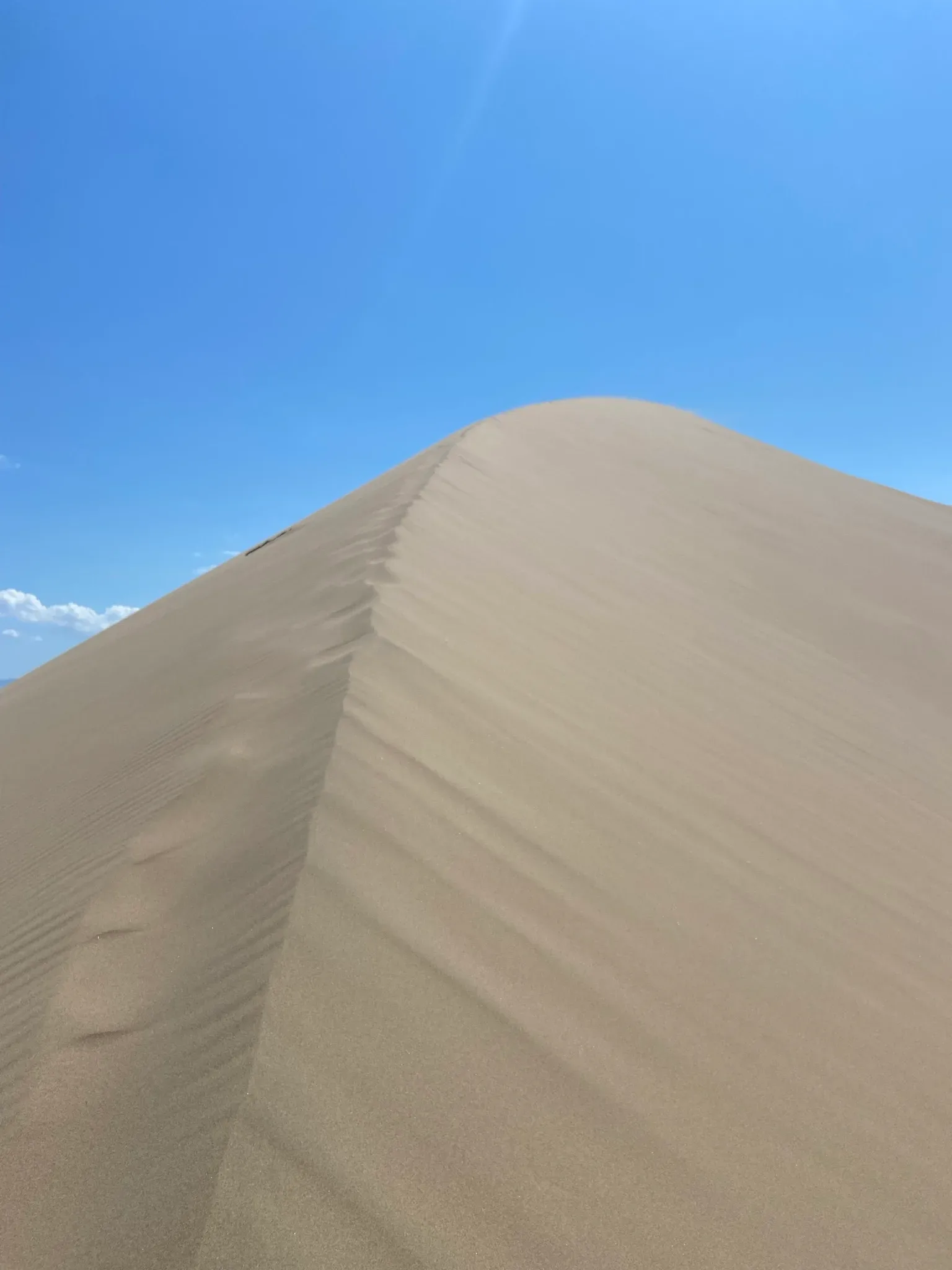
Jjm2311 via Wikimedia Commons · CC-BY-SA-4.0 · Source
Singing Dune summit ridge climb
A short but exposed climb from the Altyn-Emel Route 1 parking area onto the crest of the 150 m Singing Dune.
Use this as the lowest-complexity way to experience the dune on foot, with timing chosen around heat and wind.
The route starts from the signed visitor stop below the Singing Dune and climbs directly through loose sand to the first broad crest. The line is short, but every step sinks in the dry quartz sand and the exposed slope has no shade. Use the crest as the practical turnaround, then descend the same face before wind or heat builds.
- Distance
- 2.4 km
- Time
- 1 hr 15 min
- Difficulty
- Moderate
- Route
- Out and back
Moderate because loose sand, desert heat, wind, and full sun make the short climb slower than the distance suggests.
Approximate geometry: use the waypoint list as planning context, not a navigation track.
Access
Enter Altyn-Emel National Park through the Basshi side and follow official Route 1 toward the Singing Dune visitor stop.
Altyn-Emel National Park entry and route registration rules apply. Confirm current route access in Basshi before driving into the park.
Season: Best in the cool morning or late afternoon from spring to autumn. Avoid midday heat and strong wind.
Cautions
- loose deep sand
- desert heat and dehydration
- windblown sand
- no shade or water on the dune
- protected-area route limits
Waypoints
- Route 1 visitor stop — Start from the official parking and viewing area below the dune.
- Lower sand slope — Loose sand slows the climb immediately.
- Dune crest turnaround — Use the crest as the turnaround unless park staff direct otherwise.
Sources and review notes
- Singing Dune (en, retrieved 2026-04-27)
- Route 1 - Singing Dune (en, retrieved 2026-04-27)
- Altyn-Emel (ru, retrieved 2026-04-27)
Approximate planning geometry based on official Route 1 visitor access and POI coordinates. Owner queue has a non-blocking follow-up to revisit wording if Route 1 rules change.
Nearby from Singing Dune
Basshi Village — Basshi is the administrative entry point for Altyn-Emel National Park and the only place to register for the Aktau-Katutau sector permits.
- Mode
- Drive
- Approx. time
- 75 min
- Approx. distance
- 52 km
- Kind
- village
Use Basshi for park registration, route confirmation, and overnight logistics before entering the dune sector.
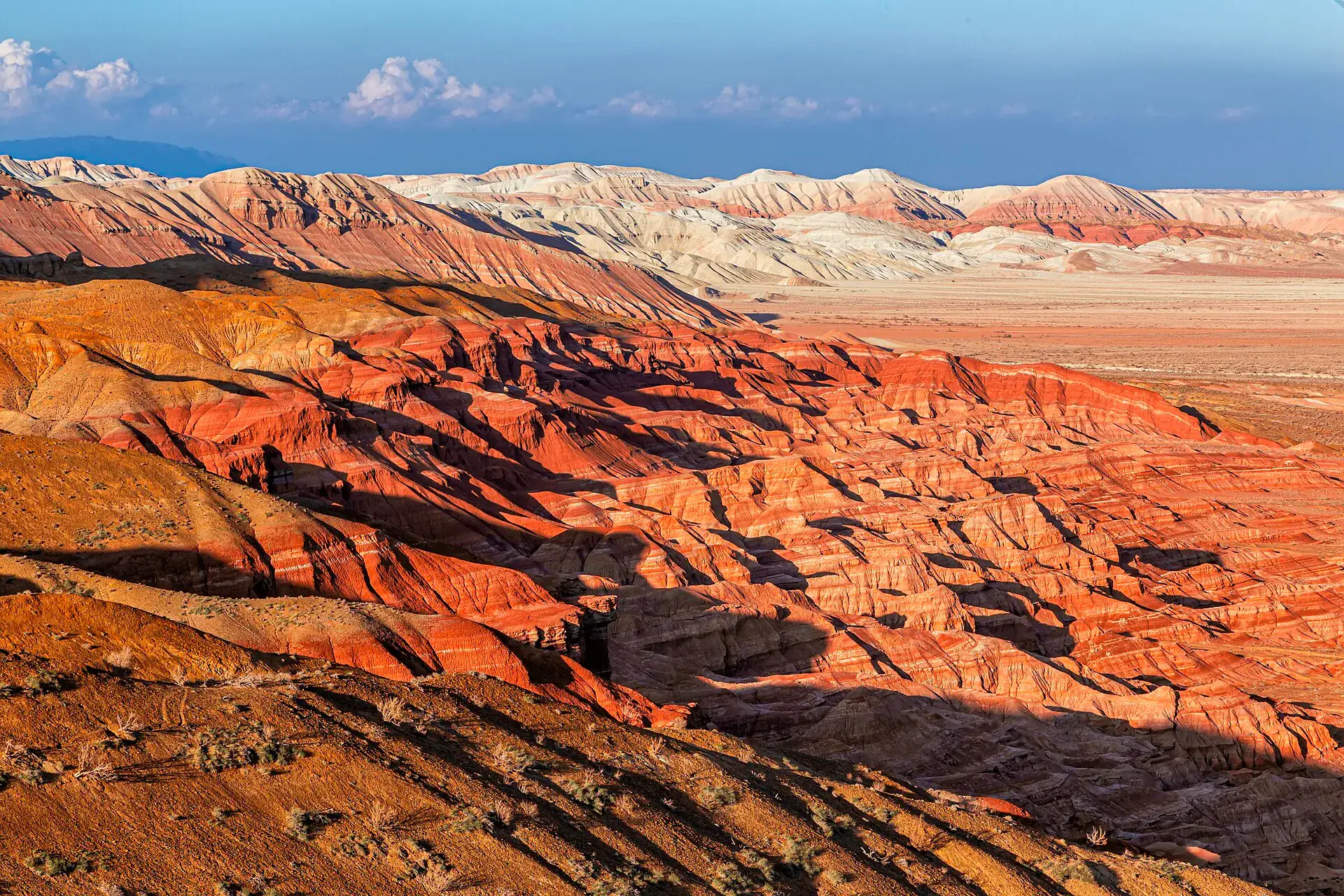
Aktau White Mountains — The Aktau range — the name means 'White Mountains' in Kazakh — is a 30-km-long escarpment of Paleogene and Neogene sedimentary rock along the right bank of the Ili River.
- Mode
- Drive
- Approx. time
- 150 min
- Approx. distance
- 85 km
- Kind
- natural feature
A separate Altyn-Emel sector reached by rougher park roads; combine only with enough daylight and confirmed route access.
Katutau Volcanic Basalt Ridge — Katutau ('Bitter Mountains' or 'Hard Mountains' in Kazakh) lies 25 km west-northwest of Aktau.
- Mode
- Drive
- Approx. time
- 165 min
- Approx. distance
- 95 km
- Kind
- natural feature
Part of the Aktau/Katutau planning day, not a short add-on from the dune parking area.
Besshatyr Burial Mounds — On the right bank of the Ili River, a plain scattered with 31 earthen mounds marks the necropolis of the Semirechye-Saka, nomadic pastoralists who dominated these steppes from the 6th to the 4th century BC.
- Mode
- Drive
- Approx. time
- 240 min
- Approx. distance
- 120 km
- Kind
- cultural site
A sensitive archaeological sector with separate access logic; check park routing before trying to combine it.
Gallery
Jump to visit notes
Visit notes
Viewing visit notes for Altyn-Emel National Park
Singing Dune (Поющий Бархан)
Step 3 · 50 km from previous · 90 min drive

The Singing Dune rises abruptly from the flat steppe like a sand mountain — 3 km wide, 150 m tall, formed from pure quartz grains deposited by ancient winds into a crescent barchan shape. Climbing the slip face takes 20–40 minutes of calf-burning effort in loose sand. At the crest the views extend across the Ili valley and the flat-topped Katutau range. When conditions are right — dry, with a westerly breeze — the sand produces a low, resonant drone audible from several hundred metres. The phenomenon occurs when dry grains avalanche down the steep lee face and friction between grains generates sound waves at around 100 Hz.