Overview
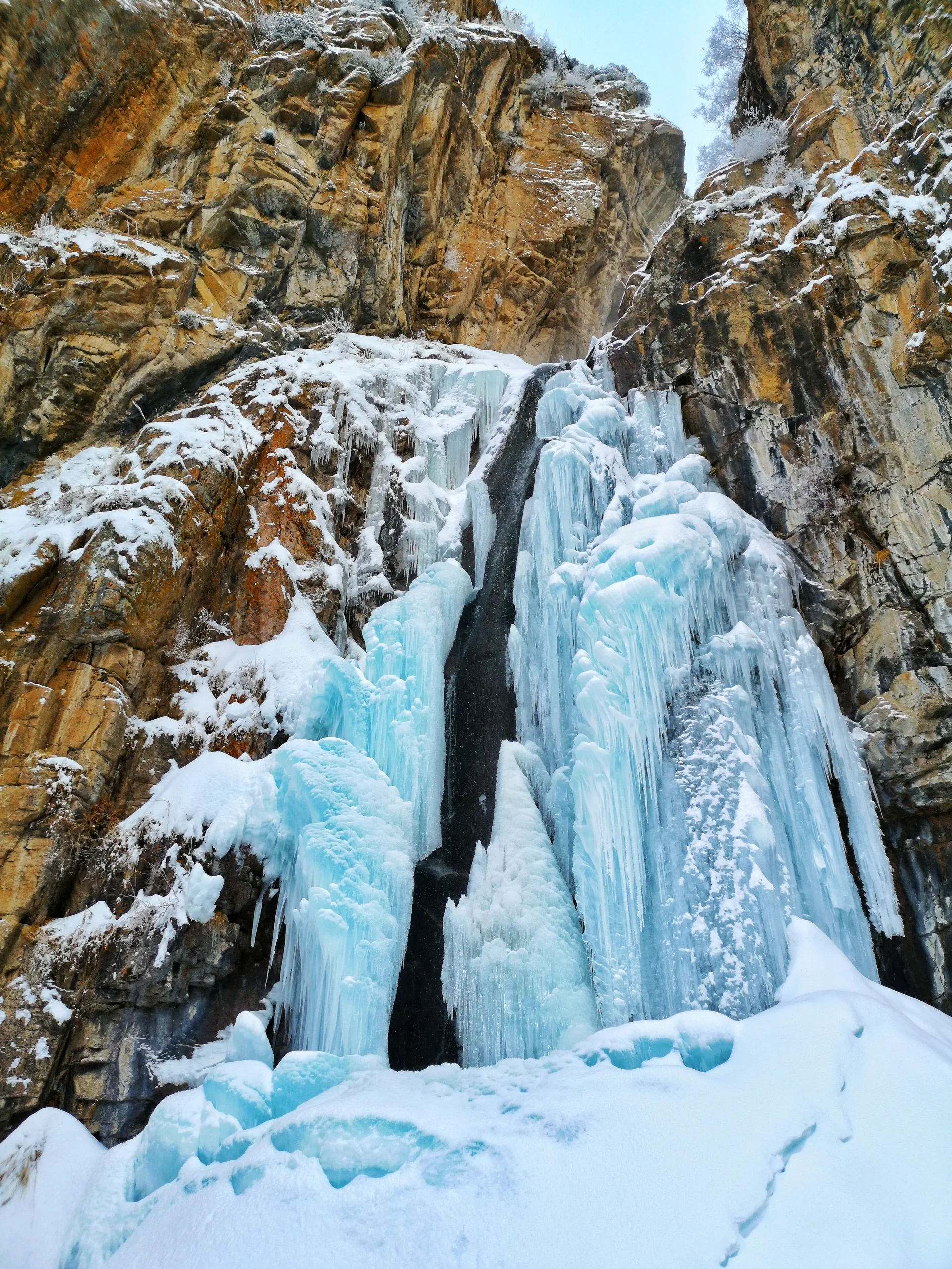
The Lower Butakovka Waterfall spills about 30 m down a wall of dark granite, landing in a shallow pool at roughly 2,100 m altitude. The spray keeps the surrounding rocks and vegetation a vivid green through summer. From here, those with energy can continue up the valley for another 45–60 minutes to reach the Upper Butakovka Waterfall (~20 m, ~2,500 m altitude), which stays partially frozen well into June. Most day-hikers turn back at the lower fall and return by the same trail, making it a 6 km round trip from the eco-post.
Open Lower Butakovka Waterfall in maps
Choose a map provider for this destination.
These links open only this place, not a full road-trip route. Links open in a new tab. 2GIS opens the map point; start navigation there.
Gallery
Jump to visit notes
Visit notes
Viewing visit notes for Butakovka Waterfall
Lower Butakovka Waterfall
Step 3 · 3 km from previous · 0 min drive

The Lower Butakovka Waterfall spills about 30 m down a wall of dark granite, landing in a shallow pool at roughly 2,100 m altitude. The spray keeps the surrounding rocks and vegetation a vivid green through summer. From here, those with energy can continue up the valley for another 45–60 minutes to reach the Upper Butakovka Waterfall (~20 m, ~2,500 m altitude), which stays partially frozen well into June. Most day-hikers turn back at the lower fall and return by the same trail, making it a 6 km round trip from the eco-post.