Overview
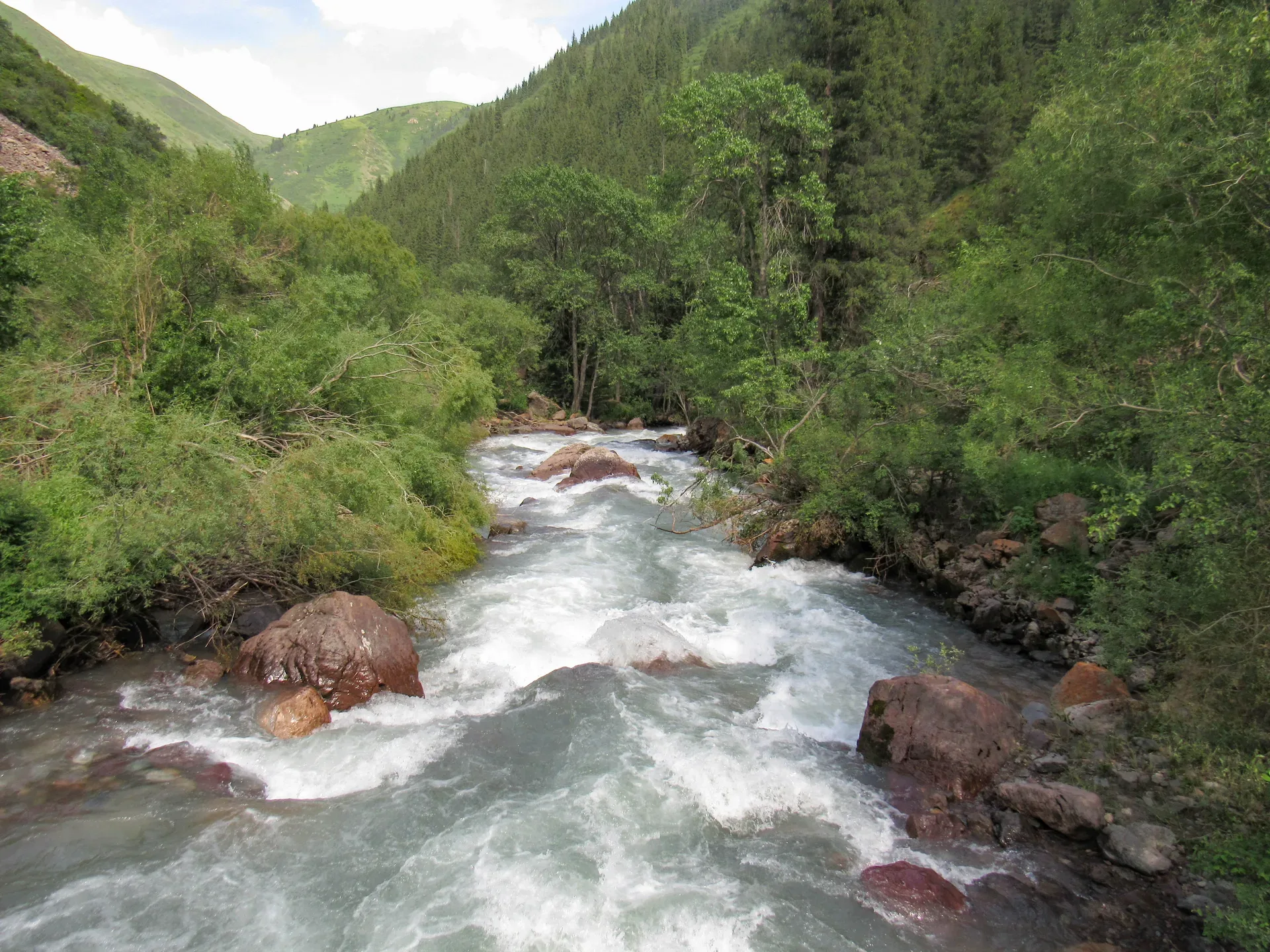
Batan is a small settlement at the confluence of the Turgen and Batan rivers, approximately 83 km from Almaty. The paved road ends here and the landscape opens into broader alpine meadows. The trailhead for Kairak Waterfall starts from the Batan visitors area, which has a café and parking. The trail runs 8 km through dense spruce forest with moss-covered boulders, crossing the river on bridges and improvised log crossings several times. Total hiking time to Kairak is 2.5–3 hours each way, so starting by 10:00 is advisable to return before late afternoon. The trail is straightforward to follow and gains roughly 600 m of elevation.
Open Batan Trailhead Kairak Waterfall in maps
Choose a map provider for this destination.
These links open only this place, not a full road-trip route. Links open in a new tab. 2GIS opens the map point; start navigation there.
Curated trails and nearby things from Batan Trailhead Kairak Waterfall
Batan is the practical start for the long Kairak Waterfall day in the upper Turgen Gorge.
Trail options
If the interactive map is unavailable, the trail cards and nearby list include the same critical details.
Selected trail: Batan to Kairak Waterfall forest trail. Critical route notes remain in the cards below.
Skip map and read trail details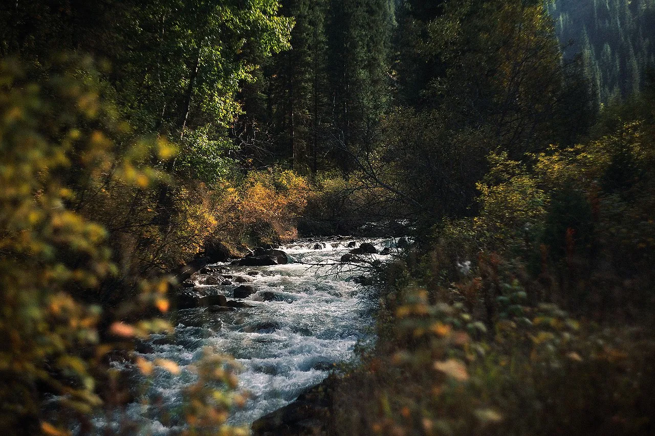
ChekinaElina via Wikimedia Commons · CC-BY-SA-4.0 · Source
Batan to Kairak Waterfall forest trail
A long Turgen Gorge out-and-back from Batan through spruce forest to the 55 m Kairak Waterfall.
Use this when the upper gorge road is passable and you have enough daylight for the full return from Kairak.
The route starts near the Batan trailhead in the upper Turgen Gorge and follows the forested river corridor toward Kairak Waterfall. The walking is longer than the road distance suggests, with a steady climb, streamside sections, and a steeper final approach near the cascade. Keep the waterfall as the turnaround and leave enough daylight for the same trail back to Batan.
- Distance
- 15 km
- Time
- 6 hr
- Difficulty
- Hard
- Route
- Out and back
Hard because the route is a full-day walk with about 700 m of gain, slippery streamside sections, and a long return from the waterfall.
Approximate geometry: use the waypoint list as planning context, not a navigation track.
Access
Drive through the Turgen Gorge park gate toward Batan, then start on foot from the upper visitor/trailhead area before the long forest approach.
Ile-Alatau National Park entry rules apply at the Turgen gorge gate. Confirm road condition and any park access changes before committing to the upper gorge.
Season: Best from late spring to autumn when the upper gorge road and trail are clear. High water, mud, and early snow can make the approach slower.
Cautions
- long return walk
- slippery rock and moss near the waterfall
- stream crossings and high water
- limited daylight in the forested gorge
- upper gorge road condition
Waypoints
- Batan trailhead area — Start on foot from the upper visitor area in Turgen Gorge.
- Forest river approach — The trail follows the wooded river corridor and can be wet underfoot.
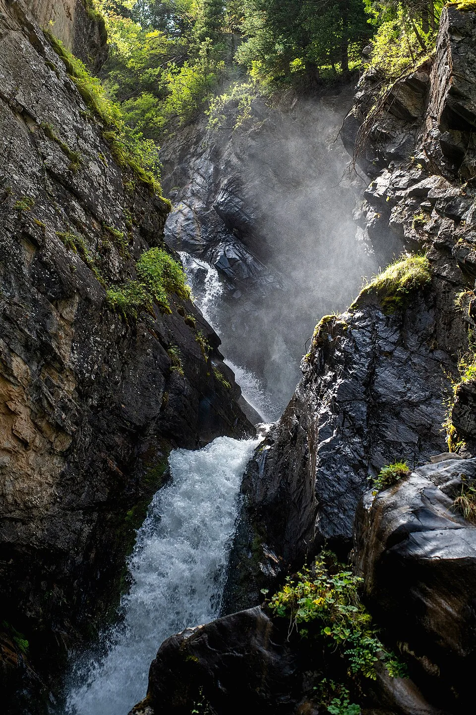
- Kairak final approach — Expect a steeper, damp section before the waterfall viewpoint.
- Kairak Waterfall turnaround — Use the waterfall as the turnaround and return by the same forest route.
Sources and review notes
- Turgen Gorge and waterfalls (en, retrieved 2026-04-27)
- Turgen Gorge (en, retrieved 2026-04-27)
- Turgen Gorge (ru, retrieved 2026-04-27)
Approximate planning geometry; source distances vary and upper gorge road/trail conditions can change. Owner queue has a non-blocking follow-up to revisit route wording if better local data is available.
Nearby from Batan Trailhead Kairak Waterfall
Park Ecopost And Trout Farm — The Ile-Alatau National Park ecopost is located roughly 10 km into the gorge from the main road junction.
- Mode
- Drive
- Approx. time
- 45 min
- Approx. distance
- 18 km
- Kind
- trailhead
Use the lower park stop for entry checks, food, and a fallback if the upper gorge road is poor.
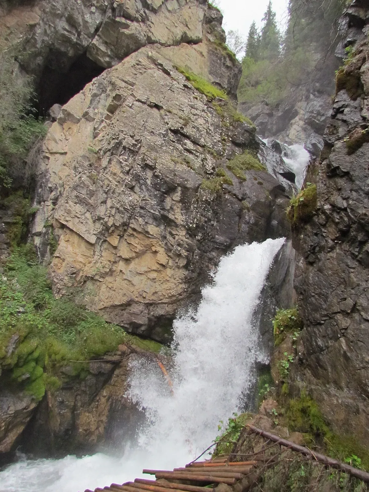
Kairak Waterfall — Kairak Waterfall is the tallest in the gorge at 55 m, situated on a tributary of the Bozgul River at 2,210 m elevation.
- Mode
- Walk
- Approx. time
- 180 min
- Approx. distance
- 7.9 km
- Kind
- natural feature
The main walking objective from Batan; keep time for the same return through the forest.
Medvezhiy Bear Waterfall — Bear Waterfall is the easiest and most-visited waterfall in the gorge.
- Mode
- Drive
- Approx. time
- 35 min
- Approx. distance
- 12 km
- Kind
- natural feature
A shorter waterfall stop lower in the gorge if Kairak is too long for the day.
Gallery

.jpg)
Jump to visit notes
Visit notes
Viewing visit notes for Turgen Gorge
Batan Trailhead (Kairak Waterfall start)
Step 4 · 8 km from previous · 15 min drive

Batan is a small settlement at the confluence of the Turgen and Batan rivers, approximately 83 km from Almaty. The paved road ends here and the landscape opens into broader alpine meadows. The trailhead for Kairak Waterfall starts from the Batan visitors area, which has a café and parking. The trail runs 8 km through dense spruce forest with moss-covered boulders, crossing the river on bridges and improvised log crossings several times. Total hiking time to Kairak is 2.5–3 hours each way, so starting by 10:00 is advisable to return before late afternoon. The trail is straightforward to follow and gains roughly 600 m of elevation.