Overview
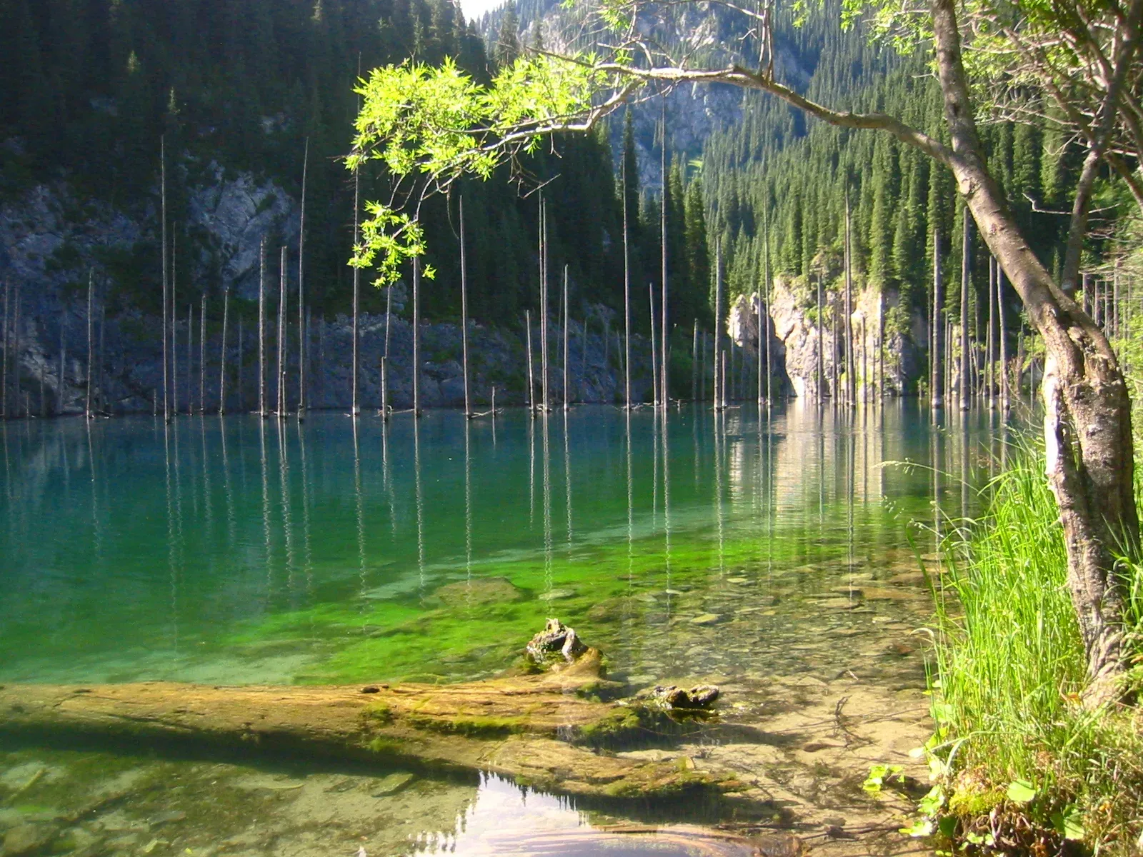
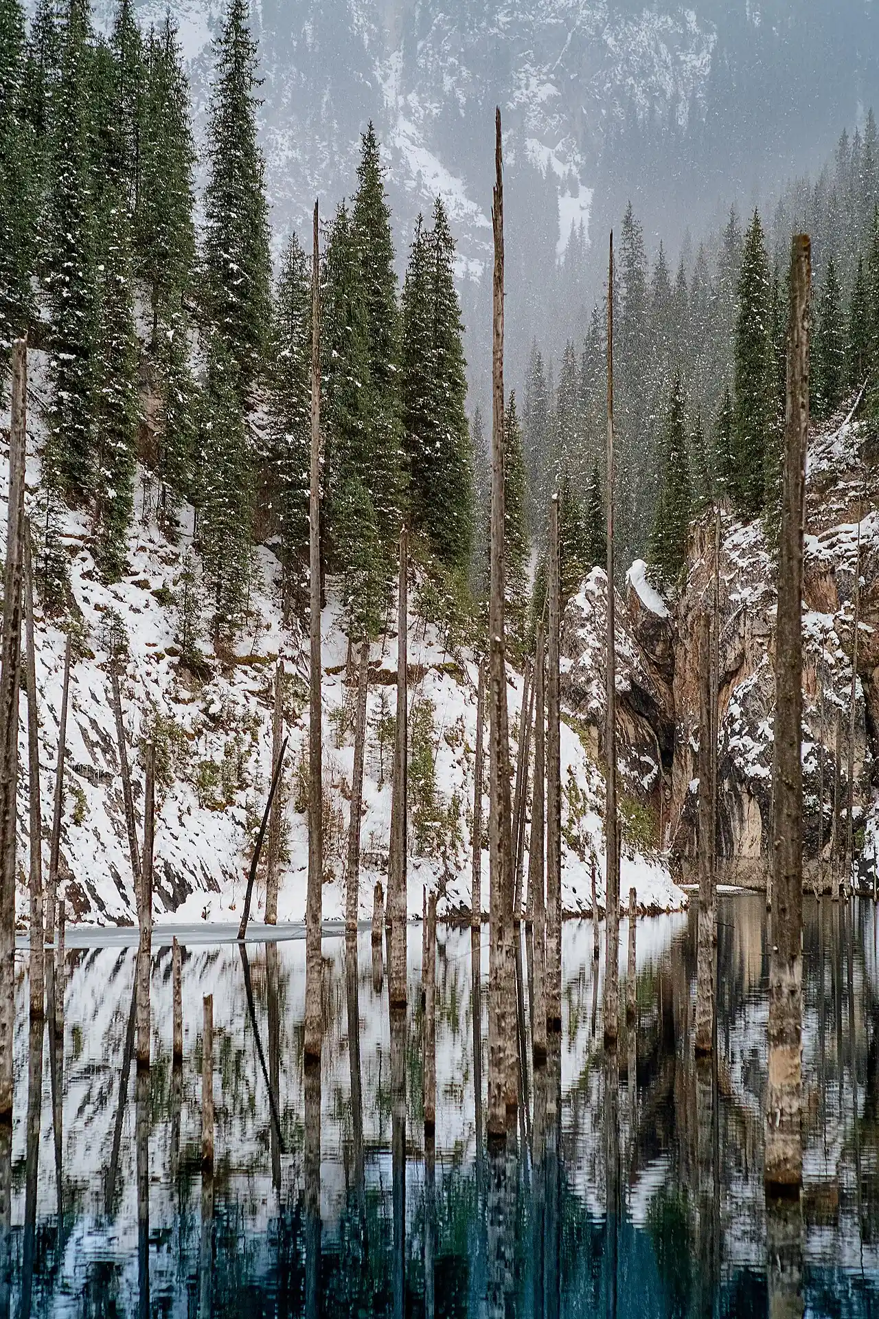
Kaindy Lake sits at 2,000 m and measures roughly 400 m long. A 1911 earthquake triggered a limestone landslide that dammed a narrow gorge, and the impounded water gradually inundated a standing forest of Tien Shan spruce. The trees have not fallen — cold mountain water slows decomposition — and their bare, pale trunks still project above the surface, while submerged branches remain recognizably green. The water is an intense blue-green from dissolved limestone. The unpaved track from Saty crosses several stream fords and takes 50-70 minutes each way; do not attempt it after heavy rain without local knowledge of crossing conditions.
Open Kaindy Lake in maps
Choose a map provider for this destination.
These links open only this place, not a full road-trip route. Links open in a new tab. 2GIS opens the map point; start navigation there.
Nearby planning from Kaindy Lake
Kaindy Lake planning depends on the rough road from Saty and the final access segment from the parking area.
Nearby from Kaindy Lake
Kaindy Parking Area — The 12 km track from the Saty turnoff to the parking area is the crux of the trip.
- Mode
- Walk
- Approx. time
- 30 min
- Approx. distance
- 1.5 km
- Kind
- trailhead
The practical transfer point for the final foot or horse segment; confirm the current lake access locally before following a mapped footpath.
Saty Village — Saty is a small village of around 1,400 people at 1,450 m, tucked into the foothills south of the canyon country.
- Mode
- Drive
- Approx. time
- 60 min
- Approx. distance
- 12 km
- Kind
- village
Use Saty to arrange transport and check road/fords before committing.
Lower Kolsai Lake Kolsai 1 — The lower lake sits at 1,818 m, about 1 km long, with a small beach area and a basic restaurant near the entrance.
- Mode
- Drive
- Approx. time
- 90 min
- Approx. distance
- 27 km
- Kind
- natural feature
A separate lake plan from the same village base; combine only if road timing is realistic.
Gallery

Jump to visit notes
Visit notes
Viewing visit notes for Charyn–Kolsai–Kaindy Loop
Kaindy Lake
Step 5 · 36 km from previous · 65 min drive

Kaindy Lake sits at 2,000 m and measures roughly 400 m long. A 1911 earthquake triggered a limestone landslide that dammed a narrow gorge, and the impounded water gradually inundated a standing forest of Tien Shan spruce. The trees have not fallen — cold mountain water slows decomposition — and their bare, pale trunks still project above the surface, while submerged branches remain recognizably green. The water is an intense blue-green from dissolved limestone. The unpaved track from Saty crosses several stream fords and takes 50-70 minutes each way; do not attempt it after heavy rain without local knowledge of crossing conditions.
Viewing visit notes for Charyn's Canyons, Kaindy & the Kolsai Lakes
Kaindy Lake
Step 5 · 12 km from previous · 60 min drive
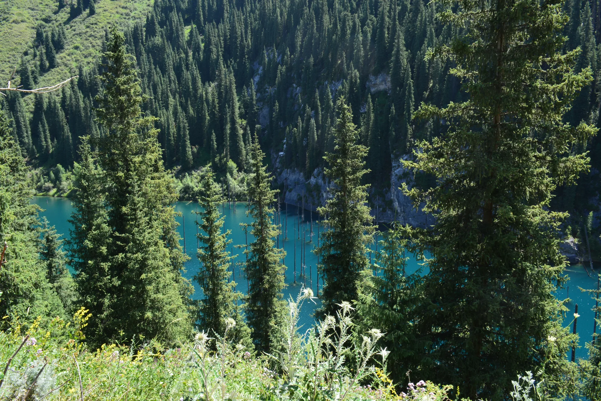
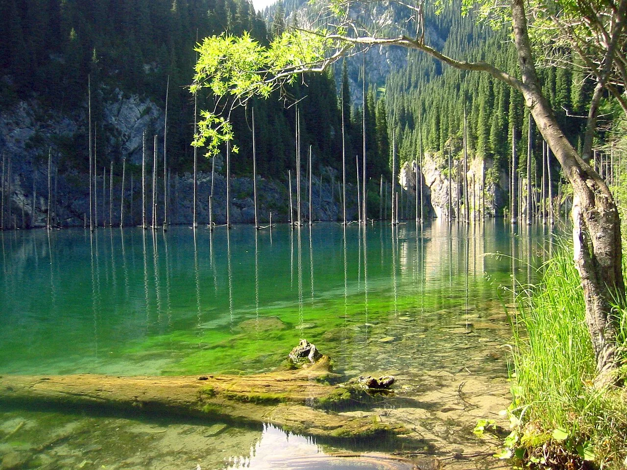
A turquoise lake of standing dead spruce, dammed by the 1911 Kebin earthquake, the pale trunks still rising from water that barely reaches 6 °C. The final 12 km of track in is forded and runs high in June snowmelt.
Viewing visit notes for Kaindy Lake
Kaindy Lake
Step 4 · 2 km from previous · 20 min drive

The path from the parking area descends through dense spruce forest and opens onto the lake after about 20 minutes on foot. The water is a luminous blue-green — the colour comes from limestone dissolved in the glacier melt — and the drowned forest is immediately apparent: dozens of bleached spruce trunks lean at odd angles, their branches long gone but their trunks preserved by water that rarely exceeds 6°C. The lake is 400 m long and roughly 30 m deep. A trail circles part of the shore and rises to a viewpoint above the eastern end, from which the full geometry of the submerged grove is visible. There are no facilities at the water's edge. Allow two to three hours to walk the perimeter and take in the viewpoints before returning to the parking area.