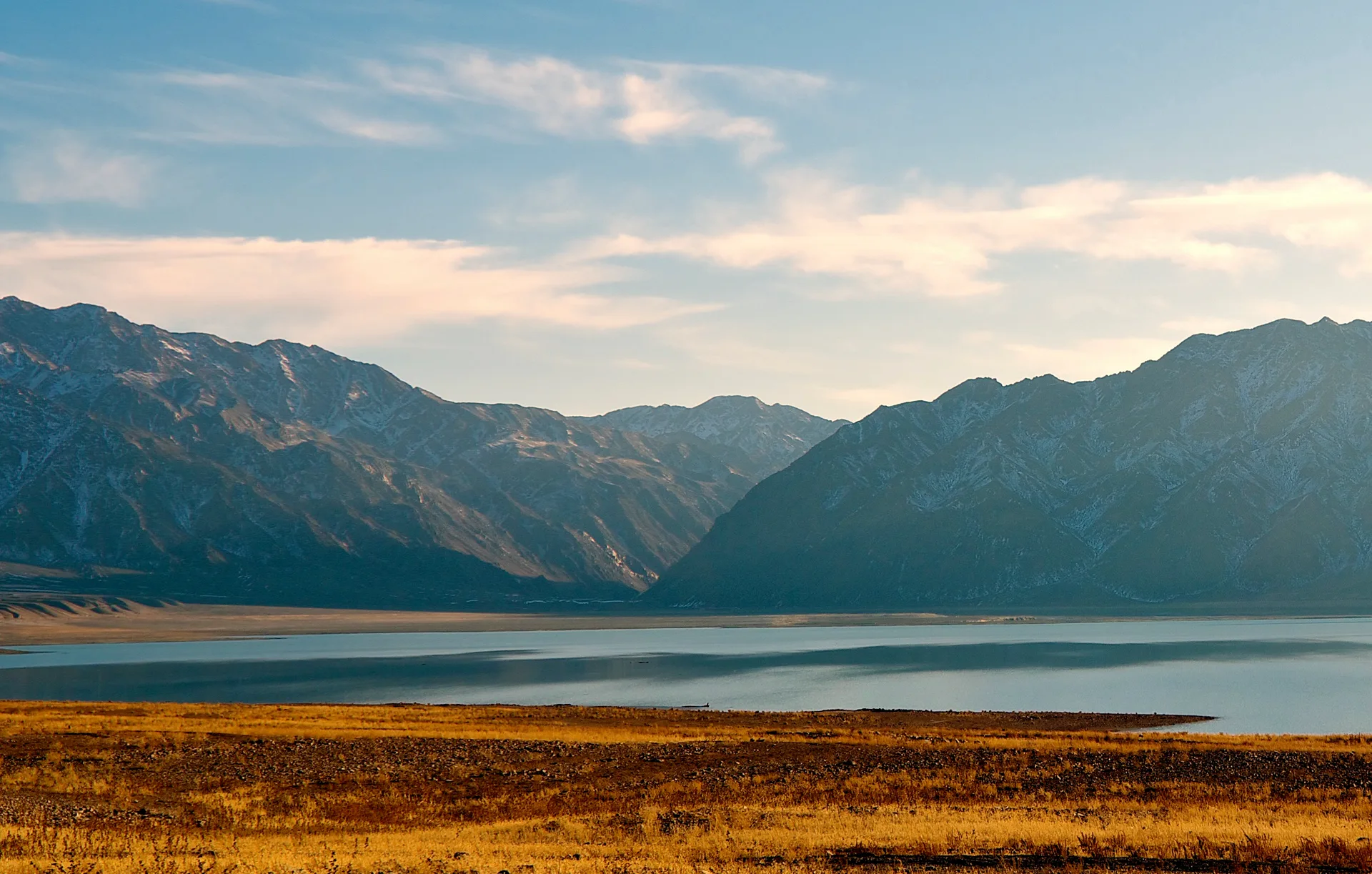
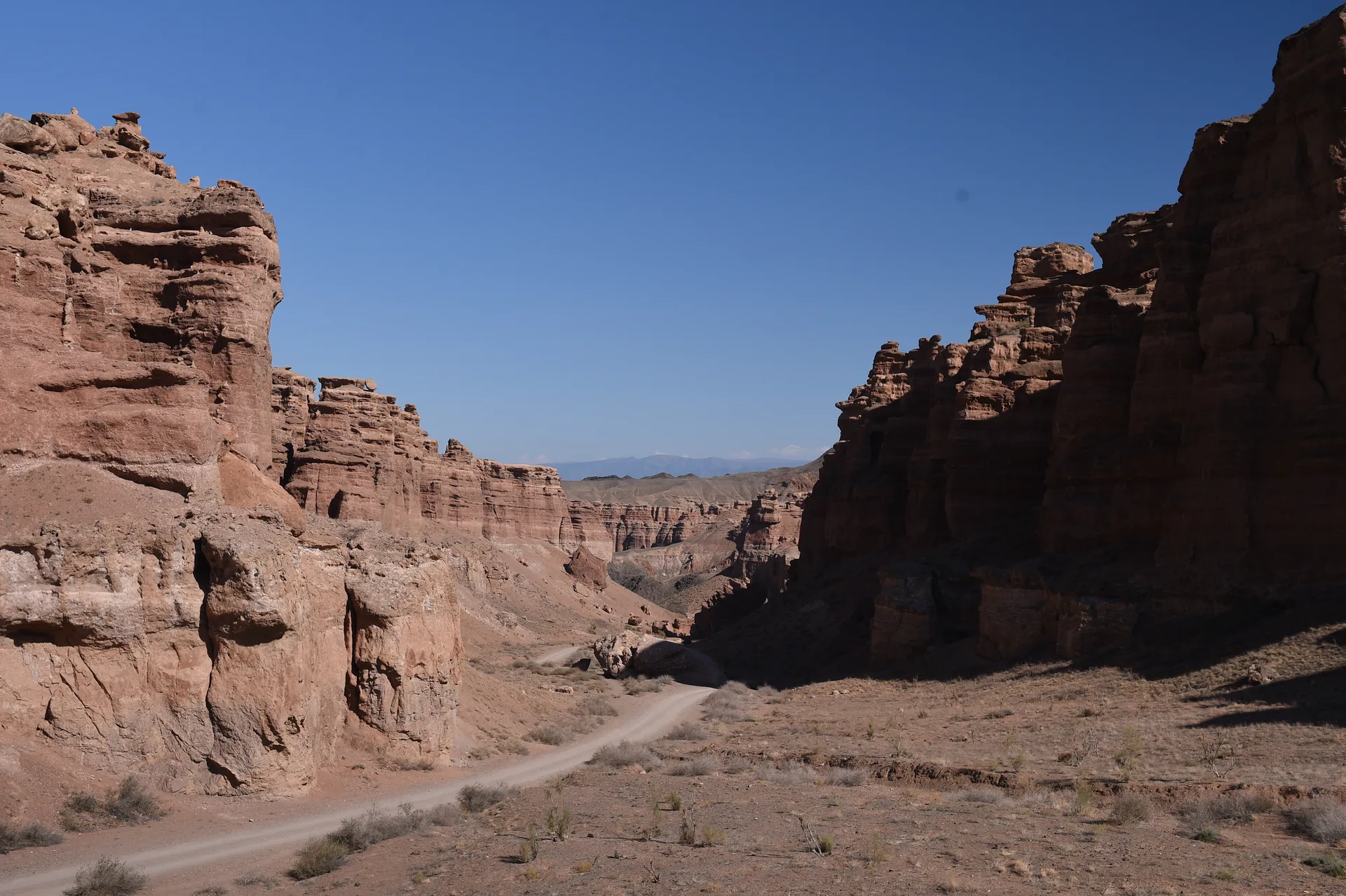
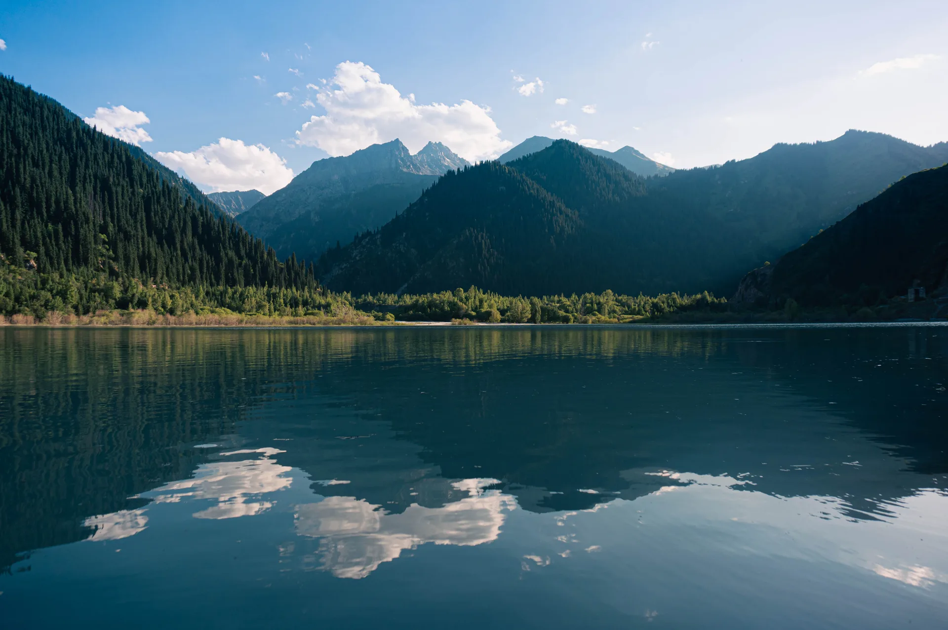
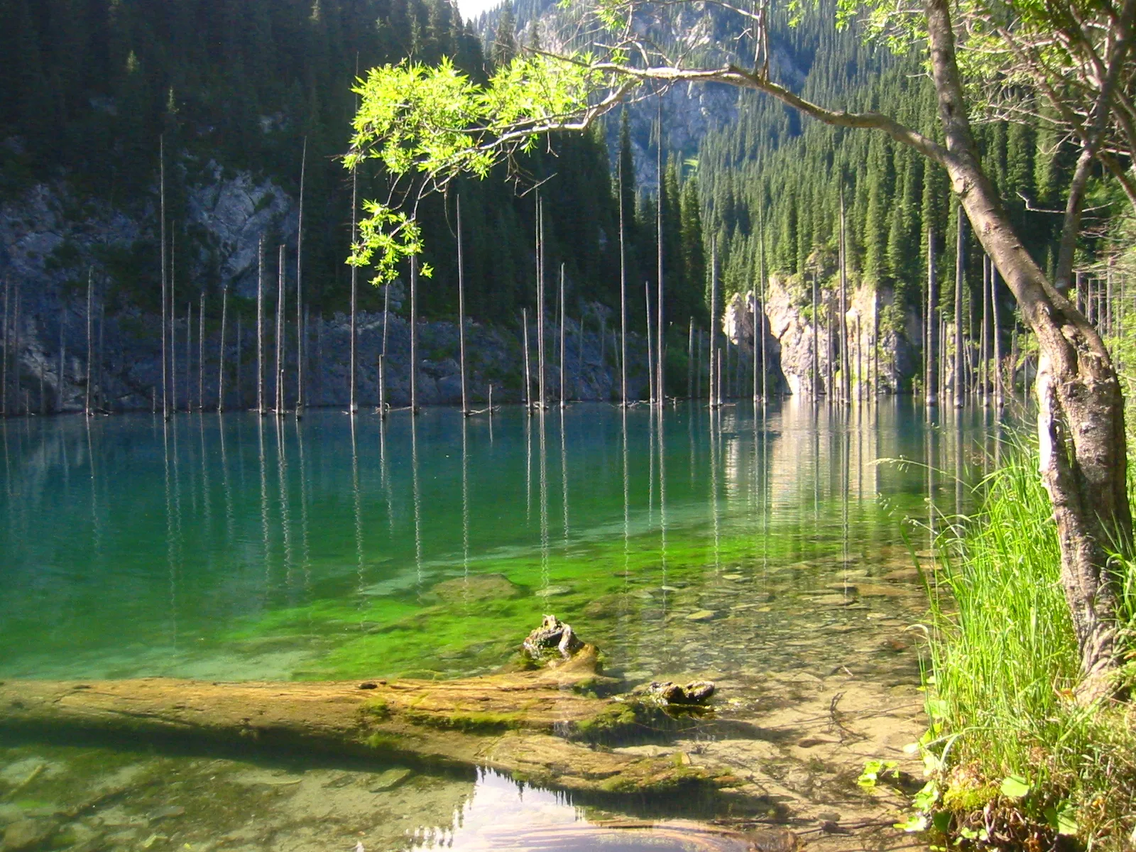
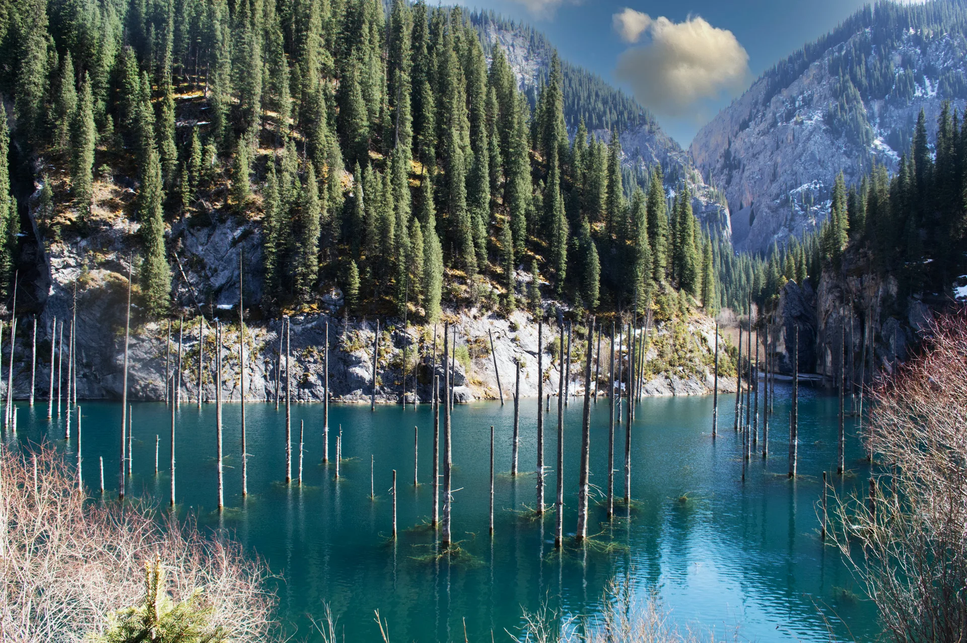
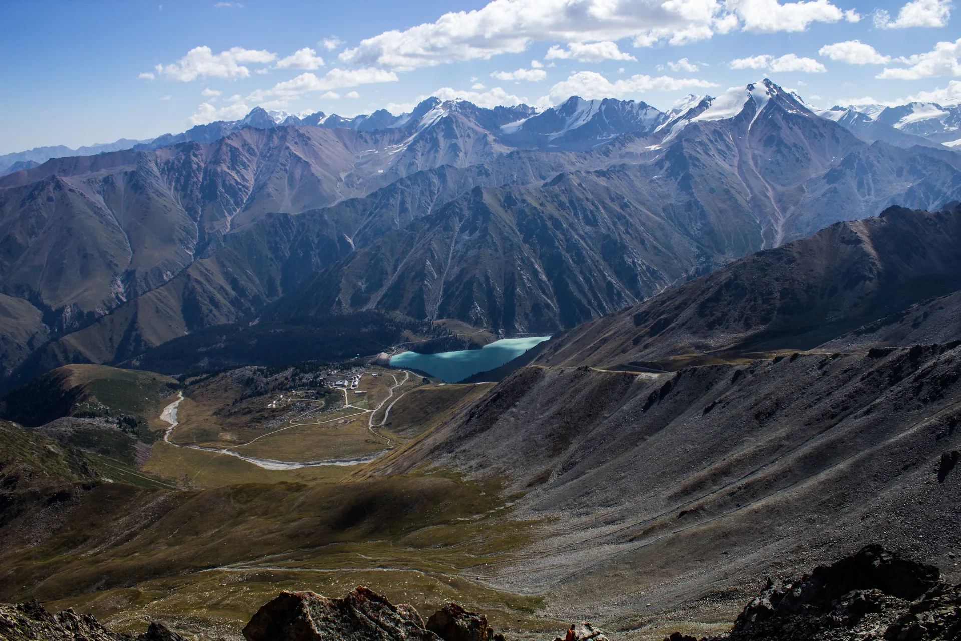
Big Almaty Lake
A turquoise alpine reservoir at 2,511 m in the Ile-Alatau National Park, roughly 28 km south of Almaty — the city's most accessible high-mountain destination and its primary drinking-water source.
Alatau Routes
Curated itineraries across the Ile-Alatau, Charyn and Saka frontier country — with the permits, vehicles and road conditions sorted before you set out.
Showing 27 of 27 trips.

A turquoise alpine reservoir at 2,511 m in the Ile-Alatau National Park, roughly 28 km south of Almaty — the city's most accessible high-mountain destination and its primary drinking-water source.

A half-day hike into the Butakovka Gorge delivers two tiered waterfalls — 30 m and 20 m — tucked inside Ile-Alatau National Park, barely 20 km from Almaty's city center.

A 16 km round-trip trail from Medeu to Furmanov Peak (3,053 m) in Ile-Alatau National Park, climbing through spruce forest and alpine ridges to a summit with an unbroken panorama over Almaty.

A turquoise alpine lake at 1,756 m in the Ile-Alatau foothills, 72 km from Almaty — a rewarding half-day drive through the Issyk Gorge, with forested shores, a reconstructed dam, and the nearby Saka 'Golden Man' burial mounds.

A double-stop day trip north of Almaty: swim at Central Asia's largest reservoir, then walk among 17th-century Buddhist carvings cut into riverside cliffs above the Ili.

A limestone-walled canyon 42 km southwest of Almaty, reached by asphalt to within 5 km of the trailhead, featuring Schrenk spruce forest, wild apple and apricot groves, and Uy-Tas — a 500-tonne granite glacial erratic sitting alone on a 2,000 m ridge.

The Ile-Alatau mountains rise straight from Almaty's southern edge; drive 17 km up the gorge and you reach Medeu's famous high-altitude ice rink, then a gondola carries you another 1,500 m to Talgar Pass at 3,200 m.

Lake Sorbulak — a sewage-fed reservoir 40 km north of Almaty that became Central Asia's most species-rich inland birding site — hosts breeding Dalmatian pelicans, staging greater flamingos, and over 20 Red-Listed species during spring and autumn migration.

Two distinct layers of history within 50 km east of Almaty: the UNESCO-inscribed Karakhanid city of Talkhiz (9th–13th c.) at Talgar, and the Saka royal burial complex near Issyk where the 4th–3rd c. BCE 'Golden Man' was excavated in 1969.

An open gorge in the Chu-Ili mountains holds some 5,000 Bronze Age rock carvings — the densest concentration of prehistoric art in Kazakhstan, inscribed on the UNESCO World Heritage List in 2004.

A 45 km-long gorge in Ile-Alatau National Park, ~90 km east of Almaty, with seven waterfalls, dense spruce forest, and a working trout farm — all reachable on paved road for most of the drive.

A drive-and-hike day trip into the upper Malaya Almatinka gorge, climbing 1,250 m from the Shymbulak resort to the Tuyuk-Su glacier terminus at 3,400 m — one of the few Tien Shan glaciers with an unbroken mass-balance record since 1957.

Two geological formations inside Altyn-Emel National Park — Cretaceous chalk-and-clay badlands at Aktau and 240-million-year-old basalt lava fields at Katutau — occupy a remote eastern sector 320 km from Almaty, reached by a 40 km sandy park track from Basshi.

Kazakhstan's most diverse national park packs singing sand dunes, chalky rainbow cliffs, volcanic badlands, and Iron Age burial mounds into one vast desert reserve 295 km northeast of Almaty.

A vast high-altitude grassland at 2100–2800 m, reached via the Turgen Gorge east of Almaty — home to nomad summer camps, an active astrophysical observatory, and skies clear enough to see the Milky Way with the naked eye.

A 340 km loop east of Almaty along the A-351, tracing the Chilik River to a turquoise seasonal reservoir and continuing to the spruce-lined Kurmety gorge — an unhurried alternative to the Charyn crowds.

The Valley of Castles — 80 km of red sandstone gorges carved by the Charyn River — sits 200 km east of Almaty and rewards a long day behind the wheel with a landscape that looks borrowed from another planet.

A two-day eastern weekend that pairs the full Charyn — the red sandstone Valley of Castles and the off-road clay folds of Moon Canyon — with the drowned spruce forest of Kaindy and the alpine water of the Kolsai Lakes. The 4x4 version of the classic loop.

A full-day combined loop that pairs the red sandstone towers of the Valley of Castles with the pale grey-yellow walls of <span lang="ru">Лунный каньон</span> (Moon Canyon) — a short spur downstream along the Charyn, rarely crowded even in peak season, and strikingly different in colour and character from its better-known neighbour.

A 2-3 day loop east of Almaty that strings together Charyn Canyon, the three-tiered Kolsai Lakes, and the submerged spruce forest of Kaindy Lake — three of the most distinct landscapes in Kazakhstan in a single circuit.

A 30-km ridge above the Koksu River in Zhetisu Region holds over 10,000 rock engravings — spanning Bronze-Age Andronovo ibex panels, Saka-period animal-style deer compositions, and early Turkic Orkhon-script graffiti cut alongside zoomorphic imagery. Unlike the fenced, guide-led Tamgaly UNESCO site, Eshkiolmes is unmanaged: visitors walk the ridge freely.

A 400-metre alpine lake where the trunks of drowned spruce trees still stand decades after a 1911 earthquake dammed the valley, their pale masts rising from water so cold it barely reaches 6°C in summer.

A 2-day loop onto the high-altitude steppe plateau south of Charyn, at 1,800–2,000 m between the Ile-Alatau and Kungey Alatau ranges — Bronze-Age kurgan fields, small Kazakh vernacular mausoleums, and the broad Tekes river valley floor running west along the Kyrgyz border. ~250 km southeast of Almaty via the A351.

Three alpine lakes strung along a single gorge in the Kungey-Alatau range, 300 km east of Almaty — the lowest lake accessible by sedan, the middle lake by foot or 4x4, and the upper lake a two-day wilderness trek near the Kyrgyz border.

Saty — a UN Tourism Best Tourism Village (2023) at 1,448 m in the Raiymbek District — anchors this June–August only trip into the transhumant jailau camps above 2,800 m where herder families operate their summer pasture season with felt-covered yurts and kymyz production. The lakes are not the destination here; the pastoral economy is.

A 2-day drive east along the A-351 to the 1886 Zharkent Mosque — a wooden pagoda-minaret building assembled from Tien Shan spruce without a single nail — and through the Panfilov district, home to Kazakhstan's Uyghur community descended from the 1881 St. Petersburg Treaty migration.

Ushtobe, 295 km northeast of Almaty on the A3, was the first drop-off point in September–October 1937 when NKVD Order 1428-326k moved 171,781 Koreans from the Soviet Far East to the Kazakh steppe. The Koryo-saram community that rebuilt here — via collective-farm rice cultivation and a trilingual Korean–Russian–Kazakh identity — remains present and active today.