Overview
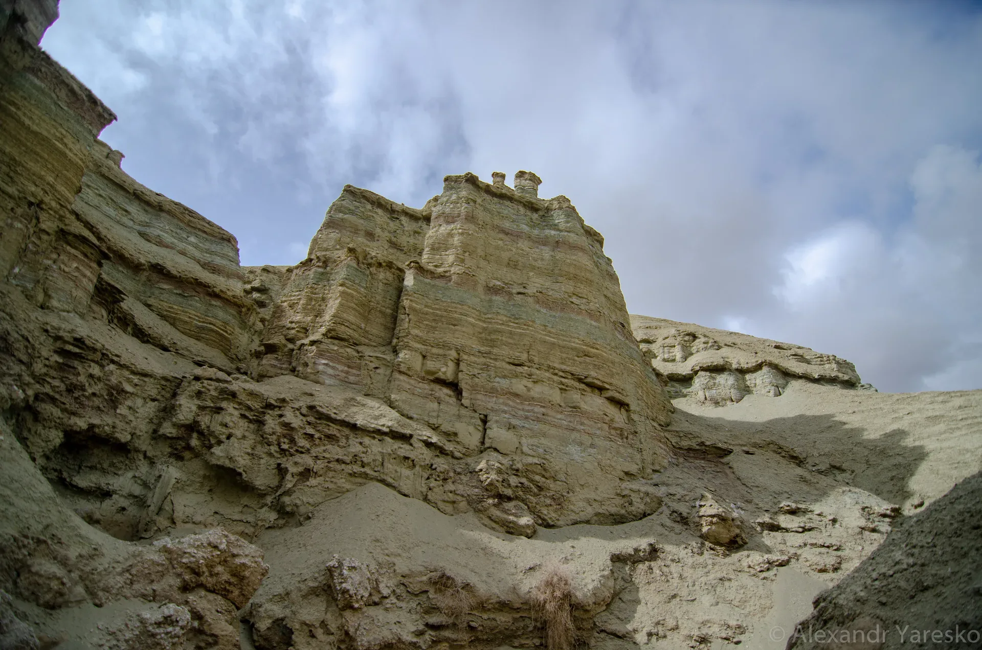
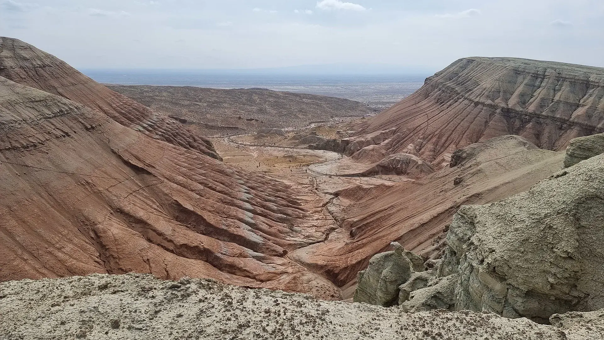
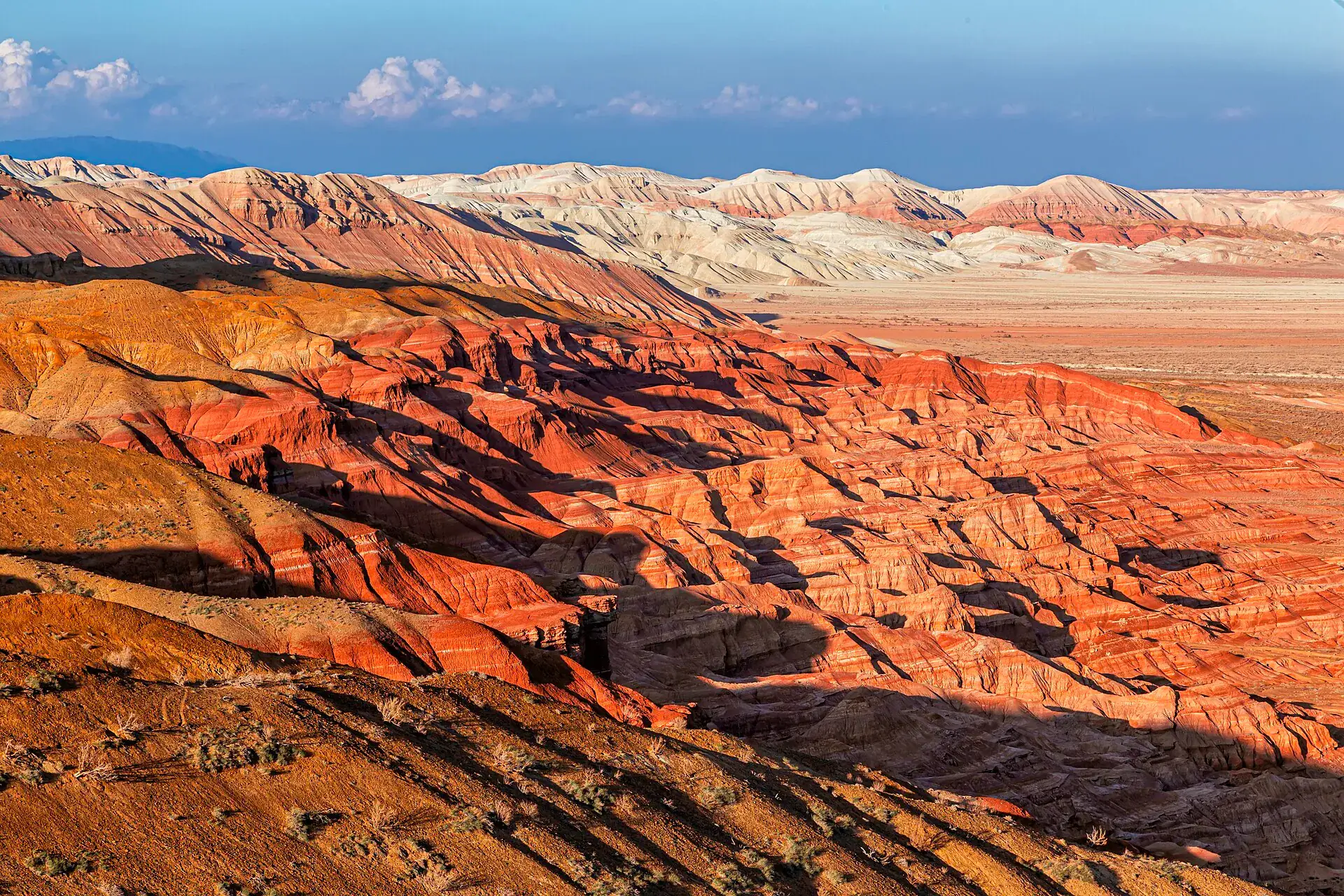
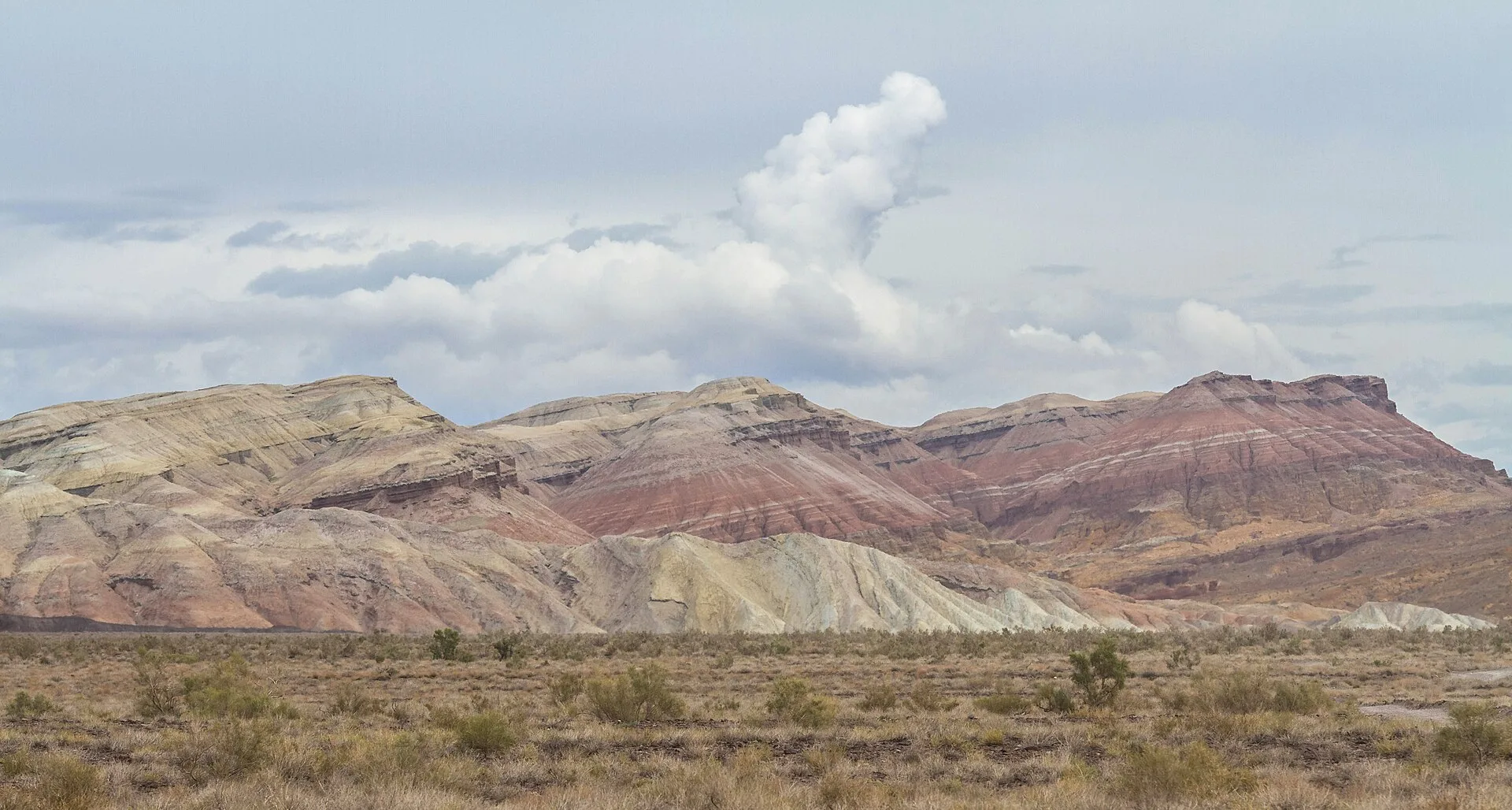
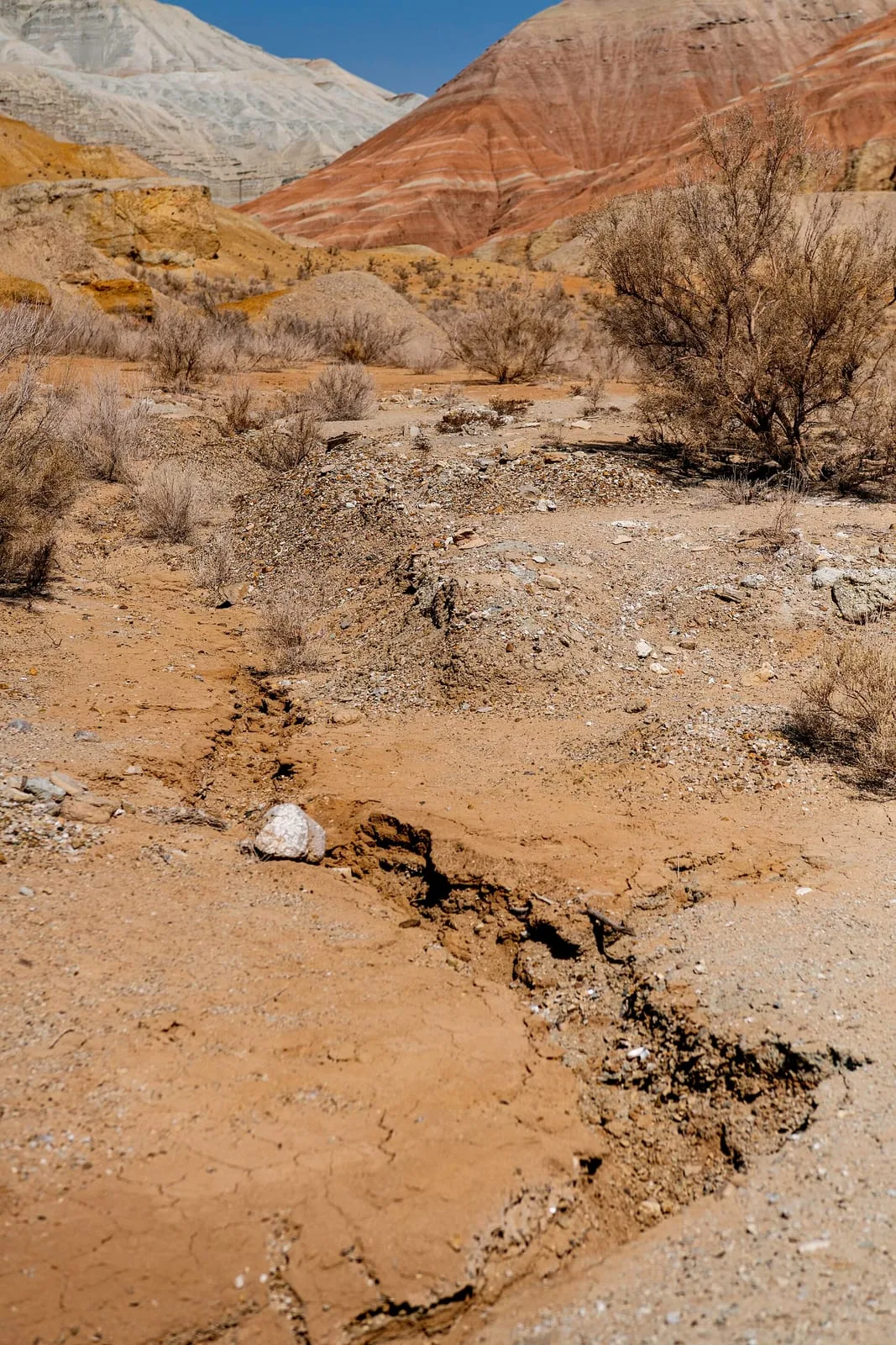
The 72 km track from Basshi to the Aktau Mountains takes 90–120 minutes in dry conditions. The track crosses open sandy steppe, then rounds a ridge to reveal the Aktau escarpment abruptly: a 30-km wall of layered sediment in white, red-orange, ochre, and blue-grey that rises from the flat valley floor. The colours come from the mineral content of lake and river sediments deposited in what was once a humid subtropical basin: white chalk and cream from calcite, red and orange from iron oxides, yellow from limonite, and pale blue-grey from volcanic ash layers. The first viewpoint is at the western end of the massif, where the full extent of the banded formation is visible in one sweep. Fossil bones and shell fragments are occasionally visible in exposed cliff faces — do not remove them; they are protected under national park regulations.
Open Aktau First Viewpoint in maps
Choose a map provider for this destination.
These links open only this place, not a full road-trip route. Links open in a new tab. 2GIS opens the map point; start navigation there.
Nearby planning from Aktau First Viewpoint
The first Aktau viewpoint is a sector-planning stop; route decisions should stay tied to park guidance rather than a standalone trail line.
Nearby from Aktau First Viewpoint
Aktau White Mountains — The Aktau range — the name means 'White Mountains' in Kazakh — is a 30-km-long escarpment of Paleogene and Neogene sedimentary rock along the right bank of the Ili River.
- Mode
- Drive
- Approx. time
- 45 min
- Approx. distance
- 25 km
- Kind
- natural feature
Use the parent Aktau page for the broader formations and walking-time context.
Basshi Village — Basshi is the administrative entry point for Altyn-Emel National Park and the only place to register for the Aktau-Katutau sector permits.
- Mode
- Drive
- Approx. time
- 120 min
- Approx. distance
- 72 km
- Kind
- village
Permits and guide assignment should be settled in Basshi before entering this remote park sector.
Katutau Volcanic Basalt Ridge — Katutau ('Bitter Mountains' or 'Hard Mountains' in Kazakh) lies 25 km west-northwest of Aktau.
- Mode
- Drive
- Approx. time
- 90 min
- Approx. distance
- 55 km
- Kind
- natural feature
A separate rough-track stop; combine only with enough daylight and confirmed park routing.
Gallery
Jump to visit notes
Visit notes
Viewing visit notes for Aktau and Katutau Mountains
Aktau — First Viewpoint
Step 4 · 72 km from previous · 110 min drive

The 72 km track from Basshi to the Aktau Mountains takes 90–120 minutes in dry conditions. The track crosses open sandy steppe, then rounds a ridge to reveal the Aktau escarpment abruptly: a 30-km wall of layered sediment in white, red-orange, ochre, and blue-grey that rises from the flat valley floor. The colours come from the mineral content of lake and river sediments deposited in what was once a humid subtropical basin: white chalk and cream from calcite, red and orange from iron oxides, yellow from limonite, and pale blue-grey from volcanic ash layers. The first viewpoint is at the western end of the massif, where the full extent of the banded formation is visible in one sweep. Fossil bones and shell fragments are occasionally visible in exposed cliff faces — do not remove them; they are protected under national park regulations.