
Overview
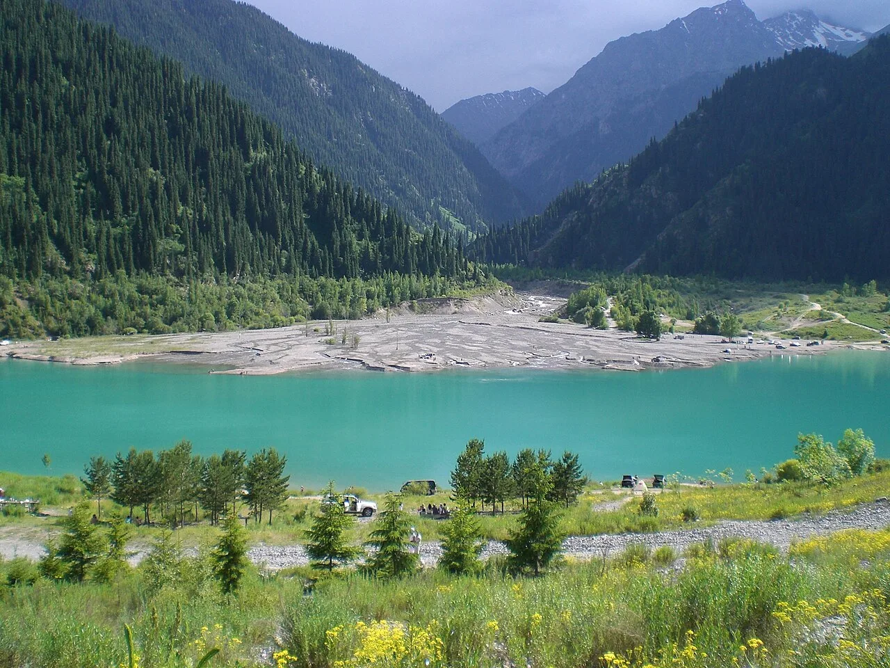
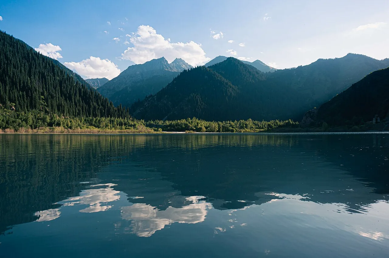
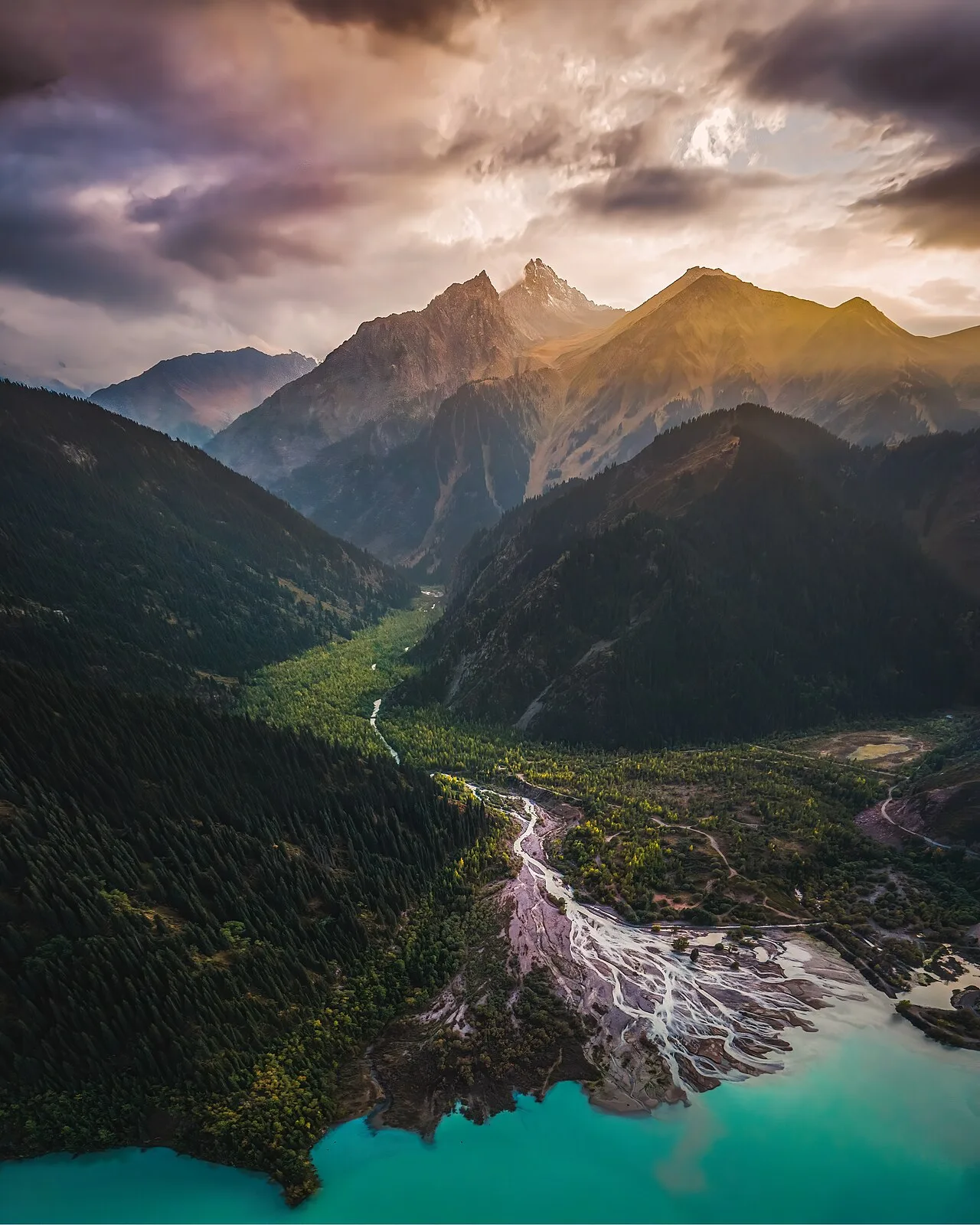
The lake occupies a glacially scoured basin at 1,756–1,780 m, roughly 1,850 m long and 500 m wide. The shoreline path is easy and well-maintained, with gazebos and picnic spots at intervals. The water is a clear blue-green fed by glacial meltwater; do not expect to swim — it rarely exceeds 9–10 °C even in July. The man-made dam at the western end is visible from the main viewpoint and serves as a reminder of the 1963 mudflow that emptied the original lake. From the eastern end a rough trail continues up the gorge for those wanting a longer walk.
Open Issyk Lake in maps
Choose a map provider for this destination.
These links open only this place, not a full road-trip route. Links open in a new tab. 2GIS opens the map point; start navigation there.
Nearby planning from Issyk Lake
Issyk Lake planning is strongest as a nearby cluster around the lake, park checkpoint, and Yesik archaeological stops.
Nearby from Issyk Lake
Ile Alatau National Park Checkpoint — About 62 km from Almaty the road passes through the ecological post at the edge of Ile-Alatau National Park.
- Mode
- Drive
- Approx. time
- 15 min
- Approx. distance
- 10 km
- Kind
- trailhead
Required lower-gorge fee and access stop before the final lake road.
Issyk Yesik Golden Man Museum — The town of Yesik sits about 48 km east of Almaty and is worth a short stop for the Issyk State Historical and Cultural Reserve-Museum.
- Mode
- Drive
- Approx. time
- 35 min
- Approx. distance
- 24 km
- Kind
- cultural site
Best cultural add-on before or after the lake, with easier timing than trying to extend higher into the gorge.
Issyk Kurgan Field — About 2 km west of the museum, on the northern side of the A-2 highway, the kurgan field is visible from the road: a series of low grass-covered mounds ranging from 4 to 15 metres in height and 30 to 90 metres in diameter, forming the royal necropolis of a Saka tribal elite.
- Mode
- Drive
- Approx. time
- 35 min
- Approx. distance
- 24 km
- Kind
- cultural site
Use as a low-key archaeology stop only from established access areas; do not wander through mounds.
Gallery
Jump to visit notes
Visit notes
Viewing visit notes for Issyk Lake
Issyk Lake
Step 4 · 10 km from previous · 15 min drive
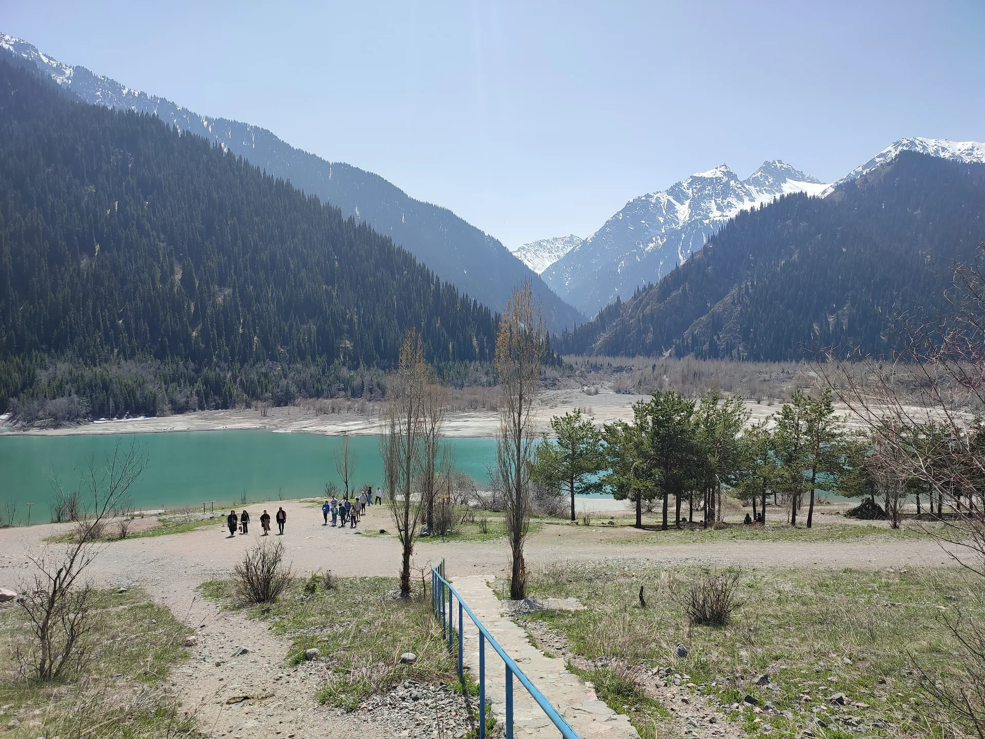
The lake occupies a glacially scoured basin at 1,756–1,780 m, roughly 1,850 m long and 500 m wide. The shoreline path is easy and well-maintained, with gazebos and picnic spots at intervals. The water is a clear blue-green fed by glacial meltwater; do not expect to swim — it rarely exceeds 9–10 °C even in July. The man-made dam at the western end is visible from the main viewpoint and serves as a reminder of the 1963 mudflow that emptied the original lake. From the eastern end a rough trail continues up the gorge for those wanting a longer walk.