Before you go
- Vehicle
- High-clearance recommended
- Permit
- Not required
- Peak altitude
- 2000 m
- Cell coverage
- Patchy
- Fuel
- Last reliable fuel is at Kegen village (~250 km from Almaty). No fuel on the plateau. Refuel before leaving Kegen in both directions. On the return, refuel again at Kegen before the 250 km drive back.
- Road status
- A351 from Almaty to Shelek is paved dual-carriageway. Shelek to Kegen: mostly paved with some patchy sections, passable to sedans. South from Kegen onto the plateau: graded dirt and gravel tracks, passable to high-clearance vehicles when dry. Tracks become slippery clay when wet. River crossings on plateau tracks are shallow in summer.
- Closed months
- Jan, Feb, Mar, Apr, May, Oct, Nov, Dec
About this trip
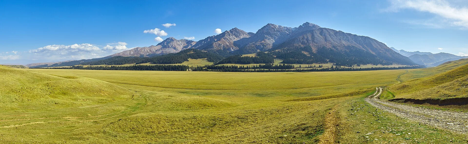
The Kegen–Tekes plateau occupies a wide intermountain basin between the Ile-Alatau to the north and the Kungey Alatau (Kyrgyz range) to the south, sitting at 1,800–2,000 m above sea level in Raiymbek District, Almaty Region. Unlike the north-facing Assy plateau, this is a south-facing, largely treeless rolling steppe — wide skies, dry summer grass, and volcanic dyke intrusions breaking the horizon. The Tekes River flows roughly 112 km across Kazakhstan territory in a broad intermountain valley before joining the Chilik and ultimately the Ili. The valley floor lies at about 1,700–1,800 m and carries clear glacial meltwater from the Terskey Alatau system.
The route from Almaty runs 250 km southeast via the A351 (Almaty–Khorgos highway), turning south through Shelek toward Kegen. Kegen village, population roughly 9,000, is the administrative seat of Raiymbek District and the last reliable fuel and supply point before the plateau tracks. A Friday livestock bazaar is held in the village, with cattle, sheep, and horses traded from the surrounding jailau communities. From Kegen, graded dirt roads climb south onto the plateau rim in about 30 km.
The plateau hosts Bronze-Age kurgan fields — earth mounds of the Saka and Wusun periods (roughly 7th century BCE to 4th century CE) — spread across the open steppe in loose clusters. No permit is required to visit the plateau, the Tekes valley floor, or the kurgan and kesene sites at this distance from the border. The Kyrgyzstan border follows the Tekes River's upper course; the plateau viewpoints and valley access points used on this route remain on the Kazakhstan side and are unrestricted. Cell coverage is absent once you leave Kegen.
The kesene (vernacular Kazakh mudbrick mausoleums, 14th–17th century, post-Mongol Kazakh Khanate formation period) that dot the district are modest dome-on-drum structures built from packed mud and fired brick, distinct from the monumental tile-faced mausoleums of the Silk Road cities. Several stand in varying states of preservation near shepherds' camps and along seasonal tracks. They mark the continuation of Central Asian funerary traditions into the high-plateau pastoral communities that formed the Kazakh Khanate.
Route
Skip map, jump to step listWhere to sleep
- Night 1 of 1Dala GuesthouseGuesthouseBudget
Budget · ~8–15k KZT/night. Mid-range · ~15–40k KZT. Premium · ~40k+ KZT.
Itinerary
Stop 1
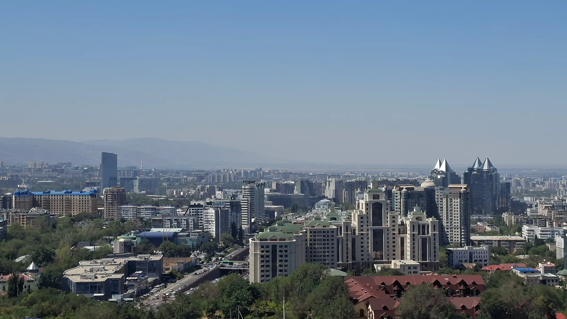
Almaty
Leave Almaty eastbound on the A351 (Almaty–Khorgos highway). The road exits the city via the Seifullin avenue interchange and quickly reaches four lanes of clear motorway. Fuel up before departure — station density drops once you leave the Almaty agglomeration. The drive to the Shelek turnoff is about 120 km and takes roughly 1.5 hours. Grocery shopping is easiest in Almaty; the Green Bazaar on Zhetysu or any large supermarket covers everything needed for two days.
Tip: Leave by 07:00. The A351 east of Almaty carries heavy truck traffic toward Khorgos — earlier departures miss the worst of it. Buy provisions before leaving; Kegen has small shops but limited stock.
Stop 2
Shelek (Chilik) — A351 fuel and rest
- From previous:
- 120 km · 90 min drive
- Stay:
- ~0.5 h
Shelek (the town formerly known as Chilik) sits at the junction where the A351 continues east toward Charyn and a secondary road turns south toward Kegen. The town is at roughly 800 m, surrounded by apple orchards and dry steppe hillsides — the Chilik River valley is fertile enough here for irrigated agriculture before the terrain rises sharply. Fuel stations operate at the main junction. From here, the road south climbs steadily through the Kegen pass area, reaching about 1,945 m before descending into the Kegen basin. Driving time from Shelek to Kegen is about 1.5 hours (roughly 130 km on a road that mixes paved sections with some rough patches).
Tip: Refuel at Shelek even if your tank is half-full — this is the last certain fuel point for roughly 130 km. The road south follows the Kegen River valley for much of the climb.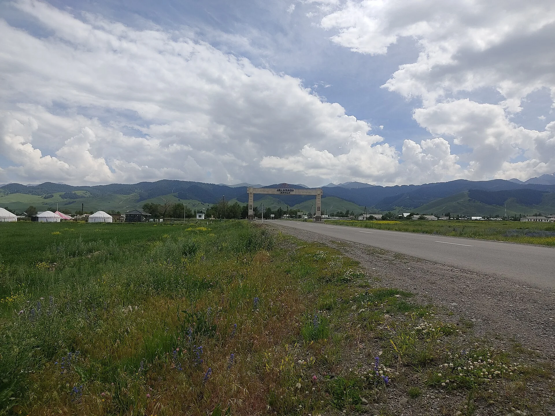
Stop 3
Kegen village — bazaar and supply
- From previous:
- 130 km · 90 min drive
- Stay:
- ~1 h
Kegen village (pop. ~9,000) is the administrative seat of Raiymbek District, sitting at about 1,800 m in the Kegen valley. The weekly livestock bazaar runs on Fridays — sheep, cattle, and horses are brought down from surrounding jailau (summer pasture) communities and traded along the main road. Even outside market day, a few small shops and canteens operate near the bazaar ground. A local history museum (opened 1987) documents the Saka and Wusun archaeology of the Kegen basin, including kurgan finds from the surrounding steppe. The village is the last point with any mobile signal and the last fuel stop before the plateau tracks.
Tip: If visiting on Friday, arrive by 09:00 — the livestock bazaar is active from early morning and winds down by noon. Fill water containers here; the plateau has no reliable springs. Ask locally about current track conditions south of the village.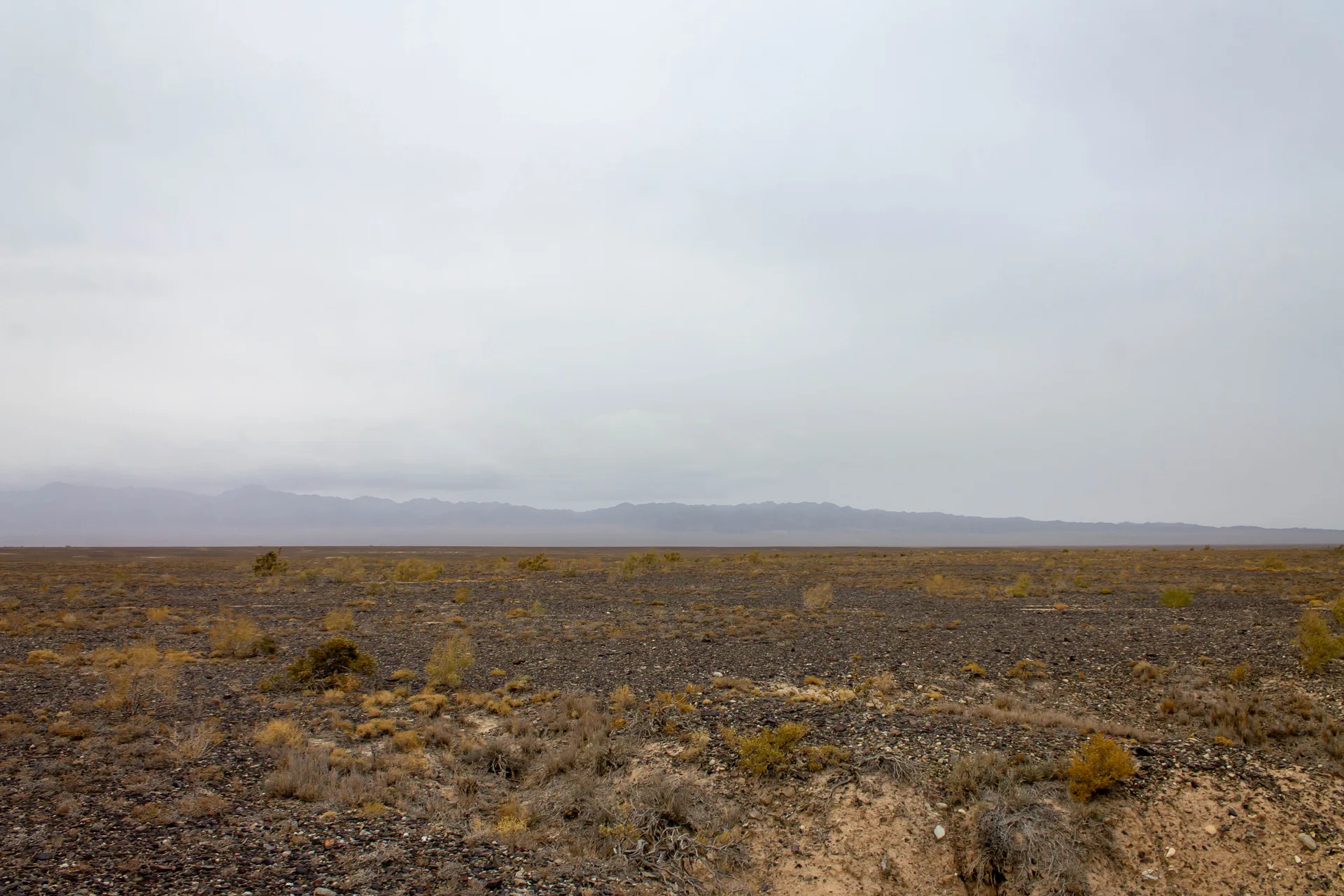
Stop 4
Plateau rim overlook — 2,000 m
- From previous:
- 30 km · 50 min drive
- Stay:
- ~1.5 h
From Kegen, graded dirt tracks lead south roughly 30 km to the plateau rim, climbing from the 1,800 m valley floor to about 2,000 m. The character of the terrain changes noticeably: the valley agriculture gives way to open, nearly treeless steppe, with rounded ridgelines and wide saddles of dry grass. From the rim, the Tekes valley floor opens to the southwest — a pale green band of riparian vegetation following the river, flanked by the Kungey Alatau range on the Kyrgyzstan side. On clear days the snowfields of the Terskey Alatau are visible to the southeast. Volcanic dyke intrusions appear as dark linear ridges cutting across the steppe surface — remnants of ancient igneous activity in this section of the Tien Shan system.
Tip: Afternoon thunderstorms build over the plateau from late July onward. Do this section in the morning. Tracks become slippery clay when wet; pull off and wait if a storm catches you on a slope.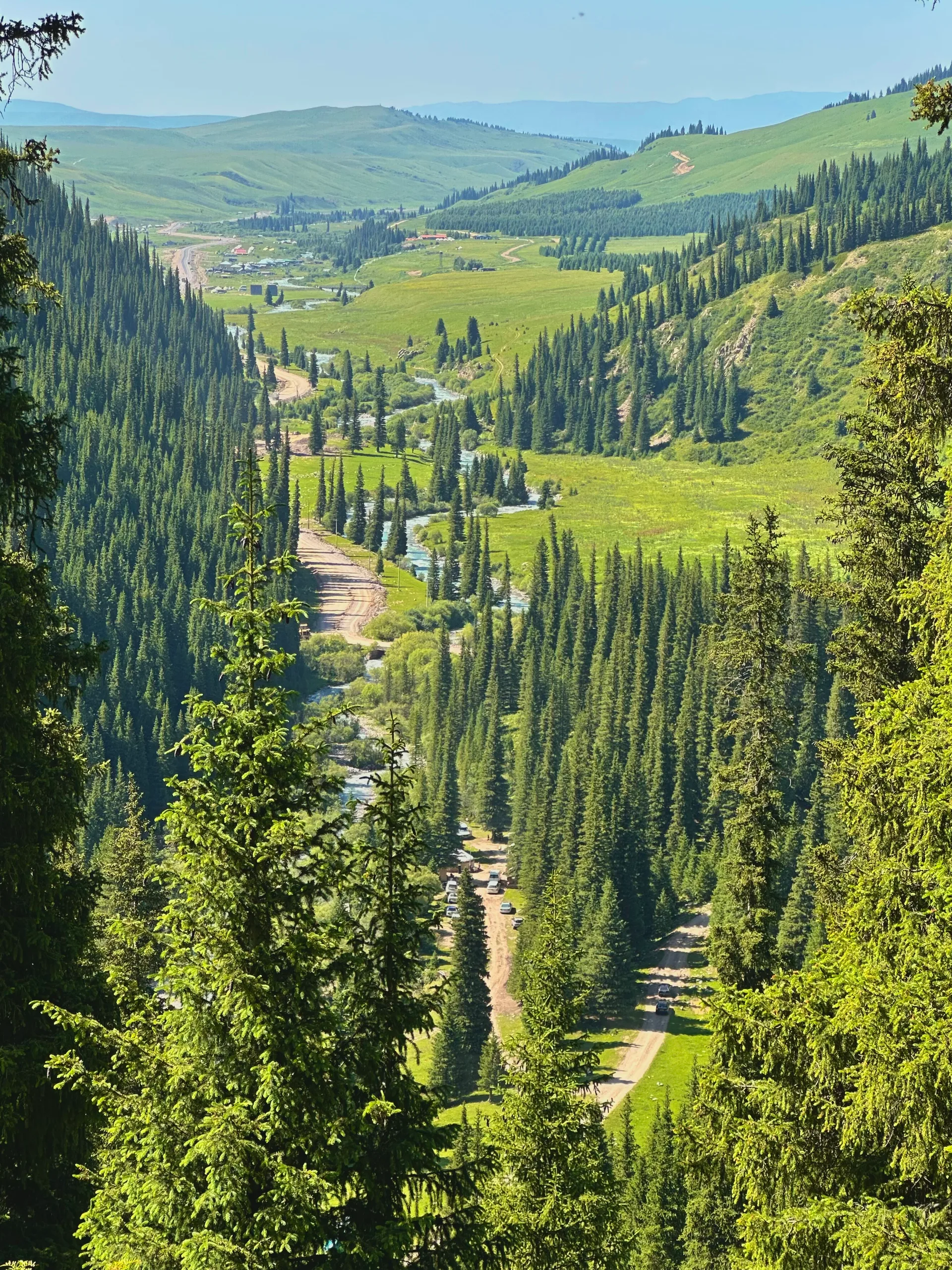
Stop 5
Tekes riverbank
- From previous:
- 15 km · 30 min drive
- Stay:
- ~1.5 h
The Tekes River in Kazakhstan flows through a broad intermountain valley roughly 112 km long, at an elevation of 1,700–1,800 m on the valley floor. The river carries clear glacial meltwater from the northern slopes of the Terskey Alatau range and supports a narrow band of willow and sedge vegetation along its banks. The wide valley separates the Eastern Tien Shan from the Ketmen Ridge. The Kyrgyzstan border follows the upper Tekes further east and south, but the valley access points on this route — north of the river near Kegen — are unrestricted. Small herder camps appear along the valley in summer, moving livestock between the valley floor and higher jailau. The river is easily waded in most summer conditions.
Tip: This area has no cell signal. Camp on the river terraces above the flood line; the bank proper gets cold dew and moisture from the riparian vegetation. Mosquitoes are active at dusk in July–August.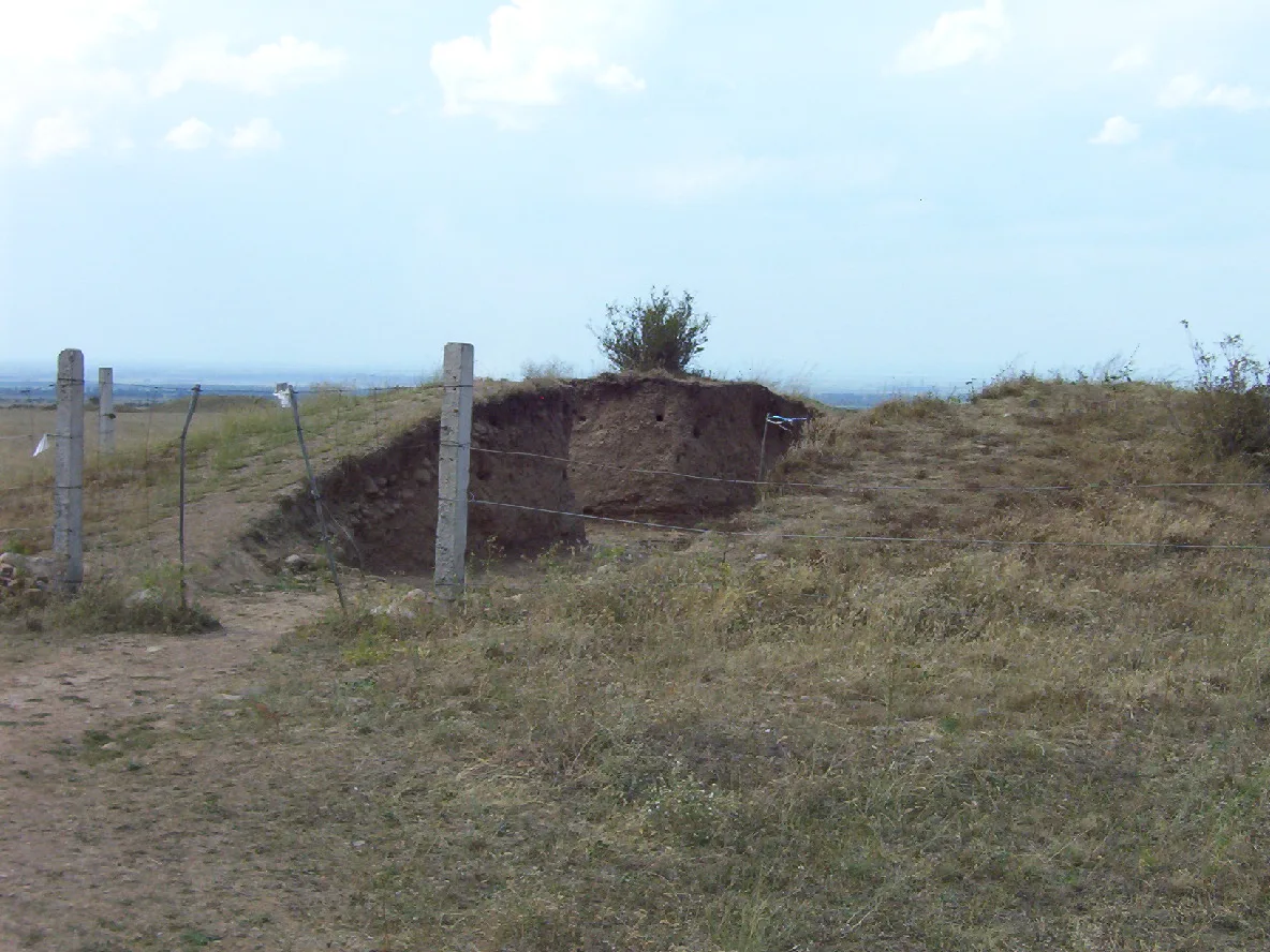
Stop 6
Bronze-Age kurgan field
- From previous:
- 12 km · 25 min drive
- Stay:
- ~1 h
The Kegen basin and surrounding plateau contain numerous kurgan fields — earth mounds of the Saka and Wusun (Usun) periods, roughly 7th century BCE through 4th century CE. The kurgans appear as rounded earth mounds 1–5 m high scattered across the open steppe, often arranged in loose rows or clusters following the natural contours of the land. They are the most numerous archaeological monuments on the plateau. Some have been excavated by Kazakhstani archaeologists and returned to visible surface mounds; many remain unexcavated. Walking through the field gives a sense of scale: these mounds cover burial chambers of wooden log construction, surrounded by stone enclosures, topped with rammed earth. Artifacts from Kegen-area kurgans are held at the regional history museum in Kegen village and at the Central State Museum in Almaty.
Tip: Do not dig, disturb, or remove any stones or artifacts from kurgan sites — these are protected archaeological monuments under Kazakhstani law. Photography is fine. Walk around the mounds rather than climbing them.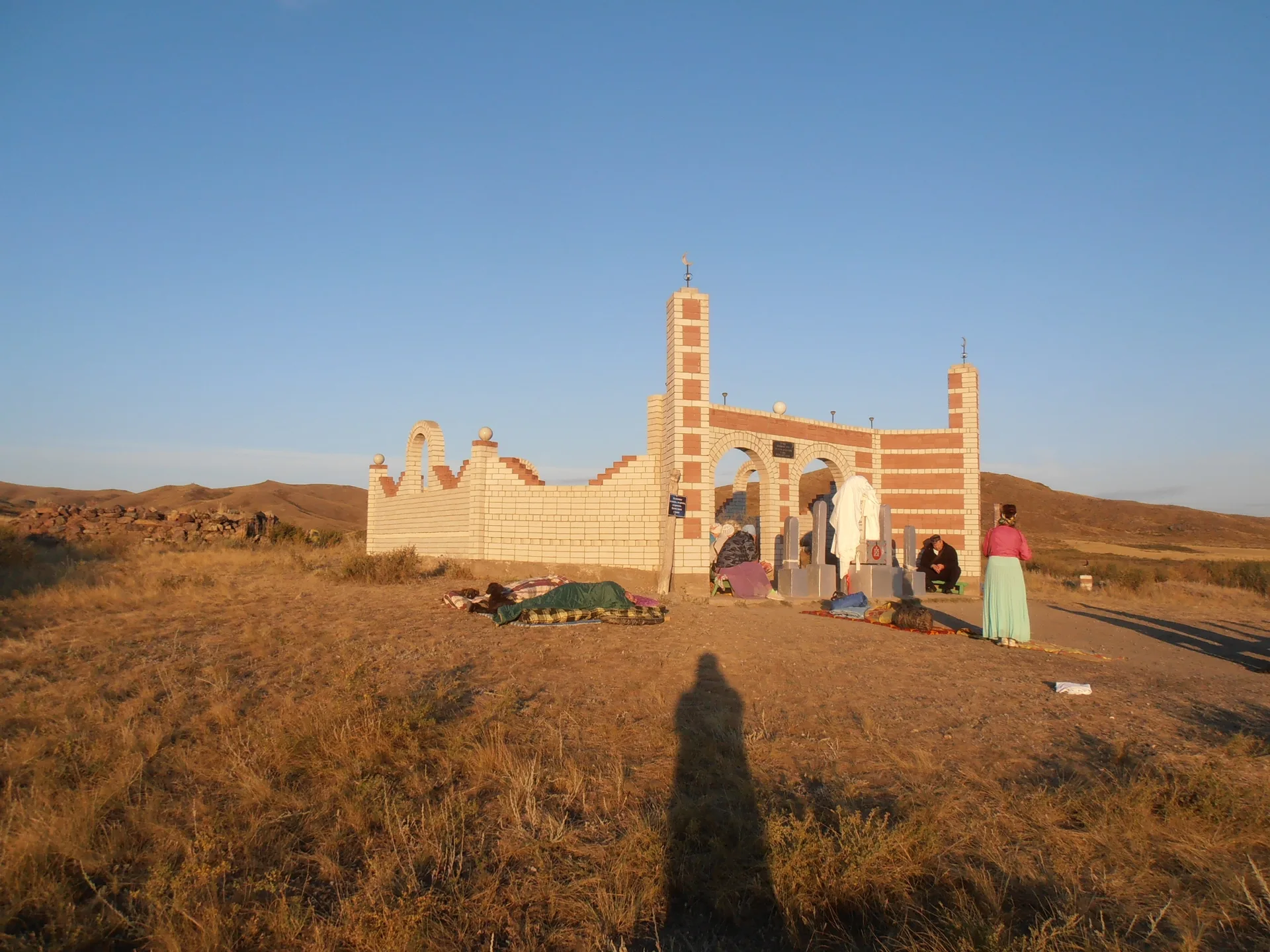
Stop 7
Kazakh kesene mausoleum
- From previous:
- 5 km · 15 min drive
- Stay:
- ~1 h
Small vernacular mausoleums known as kesene (кесене) dot the steppe of the Kegen and Tekes districts — mudbrick dome-on-drum structures built during the 14th–17th century as the Kazakh Khanate consolidated across these high-plateau territories after the dissolution of the Mongol Empire. They are modest in scale compared to the tile-faced mausoleums of the Silk Road cities: a square base of packed mud and fired brick, tapering to a cylindrical drum, topped by a hemispherical dome. The dome-on-drum form is the direct architectural precedent of Central Asian Islamic funerary architecture, adapted here with local materials and labour. Several examples survive in varying states of preservation in the Kegen district; some stand in active use as pilgrimage sites visited by local communities. Image sourcing for specific Kegen-district kesene is thin — the image here shows a comparable brick mausoleum from eastern Kazakhstan for structural reference; owner review recommended before publication.
Tip: If the mausoleum appears to be an active pilgrimage site with offerings present, observe quietly and ask before photographing. Do not touch or enter a structure that looks structurally fragile — mudbrick degrades with freeze-thaw cycles.
Stop 8
Return — Kegen, Shelek, Almaty
- From previous:
- 255 km · 230 min drive
Return to Kegen on the plateau tracks, refuel, and drive the 250 km back to Almaty via Shelek and the A351. The return drive is straightforward: the road north from Kegen climbs back over the Kegen pass area before descending to Shelek and then west along the A351 into Almaty. Total return driving time is roughly 3.5–4 hours including a brief stop at Shelek. Plan to be back on the A351 by 15:00 to reach Almaty before dark. The drive back in afternoon light gives a different perspective on the Ile-Alatau range, visible as a wall to the north as you approach the city.
Tip: Refuel at Kegen before starting the return — do not assume the Shelek station will be open in the evening. The A351 between Shelek and Almaty carries heavy truck traffic on weekday afternoons; leave Kegen by 13:00 to avoid the Almaty evening rush.
Night 1 of 1 · after Step 3: Kegen village — bazaar and supply
Dala GuesthouseГостевой дом «Дала»
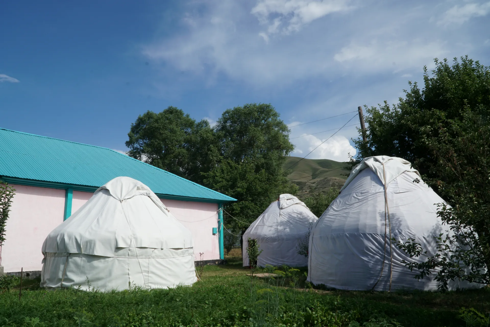
A family-run guesthouse in the centre of Kegen village, roughly 250 m from the weekly bazaar ground. Four rooms sleep 2–4 guests each, with shared bath and a kitchen where the host prepares a set breakfast of bread, kurt, and tea. Yurt frames are sometimes erected in the yard in summer for groups who prefer sleeping under felt.
- Breakfast included
- Kitchen use
- Local guide referral
- Luggage storage
- Parking
- Shared bathroom
4 rooms, 2–4 guests each; 1 outdoor yurt available May–September on request
Also nearby
Tekes Steppe Yurt CampYurt campMid-range· Bonfire area
Tekes Steppe Yurt CampЮрточный лагерь «Текес»
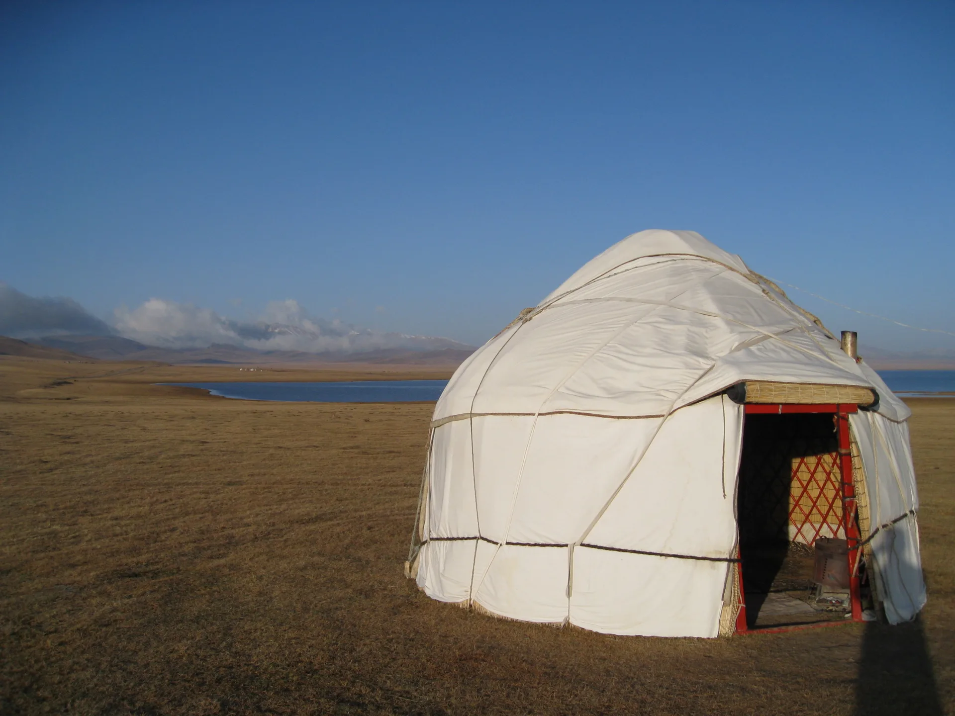
A small ethnographic yurt camp on the rolling steppe 4 km south of Kegen, operated by a local Kazakh family from mid-May through September. Three traditional felt yurts sleep 2–3 guests each and come furnished with handmade rugs and low wooden beds. Evening meals feature qymyz, beshbarmak, and shubat prepared with livestock from the family's own herd.
- Bonfire area
- Full board (breakfast, lunch, dinner)
- Horse riding
- Stargazing platform
- Traditional qymyz and shubat
- Transfer from Kegen on request
3 yurts, 2–3 guests each; advance booking strongly recommended for July–August
What to bring
- Water (5 L per person — no reliable springs on plateau)
- Fuel jerry can (10 L minimum for plateau detours)
- Tent and sleeping bag rated to 5°C (nights cool sharply)
- Food for 2 days (no shops past Kegen)
- Offline GPS or downloaded maps (no cell signal on plateau)
- Cash (Kegen has no card terminals at many shops)
- High-SPF sunscreen (high-altitude UV exposure)
- Warm layers and windproof jacket (plateau wind at 2000 m)
- First-aid kit
- Recovery tow rope and traction boards
- Paper map of Raiymbek District
Sources
Researched from English and Russian sources. Inaccuracies are mine.
- https://silkadv.com/en/content/valley-river-tekes
- https://en.wikipedia.org/wiki/Kegen
- https://ru.wikipedia.org/wiki/%D0%9A%D0%B5%D0%B3%D0%B5%D0%BD%D1%81%D0%BA%D0%B8%D0%B9_%D1%80%D0%B0%D0%B9%D0%BE%D0%BD
- https://wildticketasia.com/572-tekes-river-almaty-region-kazakhstan.html
- https://wildticketasia.com/816-tekes-mountain-valley.html
- https://aboutkazakhstan.com/blog/nature/autumn-in-the-valley-of-the-tekes-river/
- https://awaywiththesteiners.com/kegen-border-crossing/
- https://www.sciencedirect.com/science/article/pii/S2095263518300724
- https://commons.wikimedia.org/wiki/Category:Kegen_District
Similar trips
Day trip
Big Almaty Lake
A turquoise alpine reservoir at 2,511 m in the Ile-Alatau National Park, roughly 28 km south of Almaty — the city's most accessible high-mountain destination and its primary drinking-water source.
Day trip
Kaskelen Gorge
A limestone-walled canyon 42 km southwest of Almaty, reached by asphalt to within 5 km of the trailhead, featuring Schrenk spruce forest, wild apple and apricot groves, and Uy-Tas — a 500-tonne granite glacial erratic sitting alone on a 2,000 m ridge.
2 days
Charyn: Valley of Castles and Moon Canyon
A full-day combined loop that pairs the red sandstone towers of the Valley of Castles with the pale grey-yellow walls of <span lang="ru">Лунный каньон</span> (Moon Canyon) — a short spur downstream along the Charyn, rarely crowded even in peak season, and strikingly different in colour and character from its better-known neighbour.