Before you go
- Vehicle
- High-clearance recommended
- Permit
- Not required
- Entrance fee
- Ile-Alatau National Park eco-post fee approximately 380–500 KZT per person; no vehicle surcharge reported. Pay in cash at the barrier 3 km inside the gorge.
- Peak altitude
- 2000 m
- Cell coverage
- None
- Fuel
- Fill up in Almaty before departure. Kaskelen town has fuel stations roughly 19 km west of Almaty — last reliable stop before the gorge. No fuel in the gorge.
- Road status
- A-2 / Upper Kaskelen highway to Kaskelen town is paved. The gorge road is paved for 13–14 km from the valley turn-off. The remaining 4–5 km to the upper parking area is compacted gravel, passable to high-clearance vehicles in dry conditions but muddy and slick after rain. Do not attempt in a standard sedan when wet.
- Closed months
- Jan, Feb, Dec
About this trip
Kaskelen Gorge cuts south through the western Trans-Ili Alatau along the Kaskelen River, a 177 km tributary of the Ili. The lower slopes hold the only significant wild apple and apricot woodland west of Almaty — a relic of the Malus sieversii gene pool from which the domestic apple derives. Higher up, dense Schrenk spruce transitions to open meadow at around 1,800 m. The gorge ends, for most visitors, at a 2,000 m ridge where Uy-Tas sits: a monolithic grey granite boulder 5 m high and 6 m across, weighing roughly 500 tonnes, without a single crack. Glacial transport from the peaks above is the accepted explanation; there are no other stones of comparable size anywhere nearby.
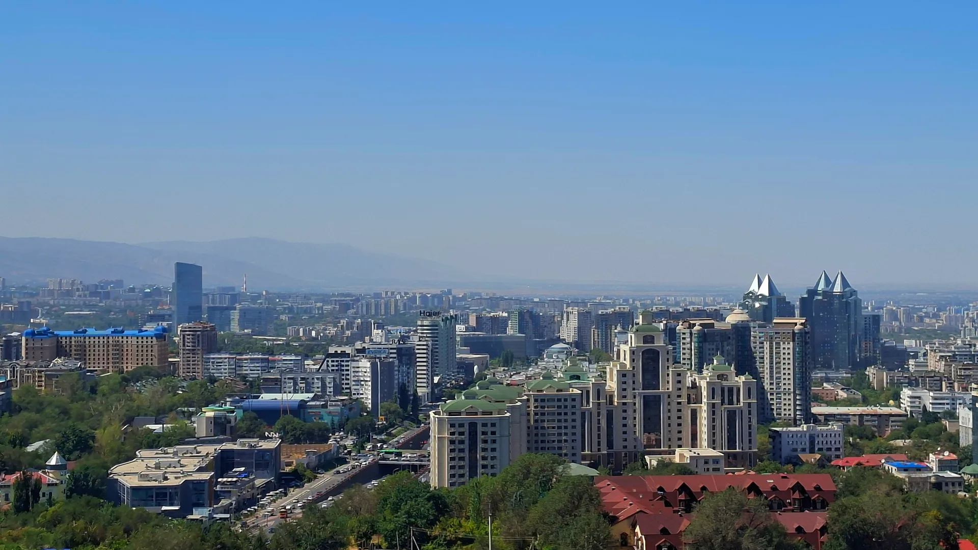
The drive from central Almaty heads west on the A-2 (Raiymbek/Tole Bi) or via the Upper Kaskelen highway to Kaskelen town, then south into the gorge. The paved section runs 13–14 km into the gorge from the valley turn-off; beyond the eco-post and the Maral farm, 5 more km of compacted gravel are passable to high-clearance vehicles. Total driving distance from Almaty to the upper parking area is about 55 km one-way. A round-trip hike from the parking area to Uy-Tas and back covers roughly 4–5 km with 400 m of elevation gain on a clear trail.
The gorge is part of Ile-Alatau National Park. An eco-post collects an entry fee of approximately 380–500 KZT per person. The Alatau Maral farm near the parking area breeds wapiti for velvet-antler therapy and is open to visitors by arrangement. The lower gorge attracts heavy weekend picnic traffic from Almaty in summer; early starts reduce congestion. Cell signal is absent above the eco-post. The road into the gorge is unpaved above the asphalt end and becomes difficult in wet conditions.
The gorge sits in the conspicuous west-corridor coverage gap among Almaty's mountain destinations — all the busier gorges (Ayusay, Alma-Arasan, Kaskelen upper tributary, Kok-Zhailau) lie east or south of the city. That means lighter crowds, different flora, and a drier microclimate. The ridge beyond Uy-Tas connects to Aydarys Pass and Cossack Lakes for those who want to extend to a two-day traverse.
Route
Skip map, jump to step listItinerary
Stop 1
Almaty — City Departure
Head west from central Almaty along Raiymbek Avenue (A-2) or the parallel Tole Bi street toward the ring road. At the ring road, continue west on the Upper Kaskelen highway (signed for Kaskelen). The drive to the gorge turn-off covers about 35–40 km from the city centre and takes 45–60 minutes depending on traffic. Fill the tank before leaving — there are no fuel stations beyond Kaskelen town. Bring cash for the eco-post fee inside the gorge. The route is straightforward and flat until the approach to the foothills.
Tip: Leave by 07:00 on weekdays to clear city traffic before the ring road. Weekend mornings see heavy outbound traffic on the Upper Kaskelen highway from 09:00 onward.
Stop 2
Kaskelen Town
- From previous:
- 22 km · 30 min drive
- Stay:
- ~0.25 h
Kaskelen is a district-centre town of about 70,000 people, 19 km west of Almaty's city boundary and the last place before the gorge with reliable fuel, an ATM, and shops. The town sits at roughly 860 m elevation on the alluvial plain of the Kaskelen River. From the town centre, follow signs south toward the gorge turn-off — about 3 km south of the main road. The valley road runs south through small farming settlements before the terrain begins to rise and the gorge mouth becomes visible. Stock up on water and snacks here if you did not already.
Tip: The main bazaar on the central square has fresh fruit in season (apricots from June, apples from August). Last ATM before the gorge.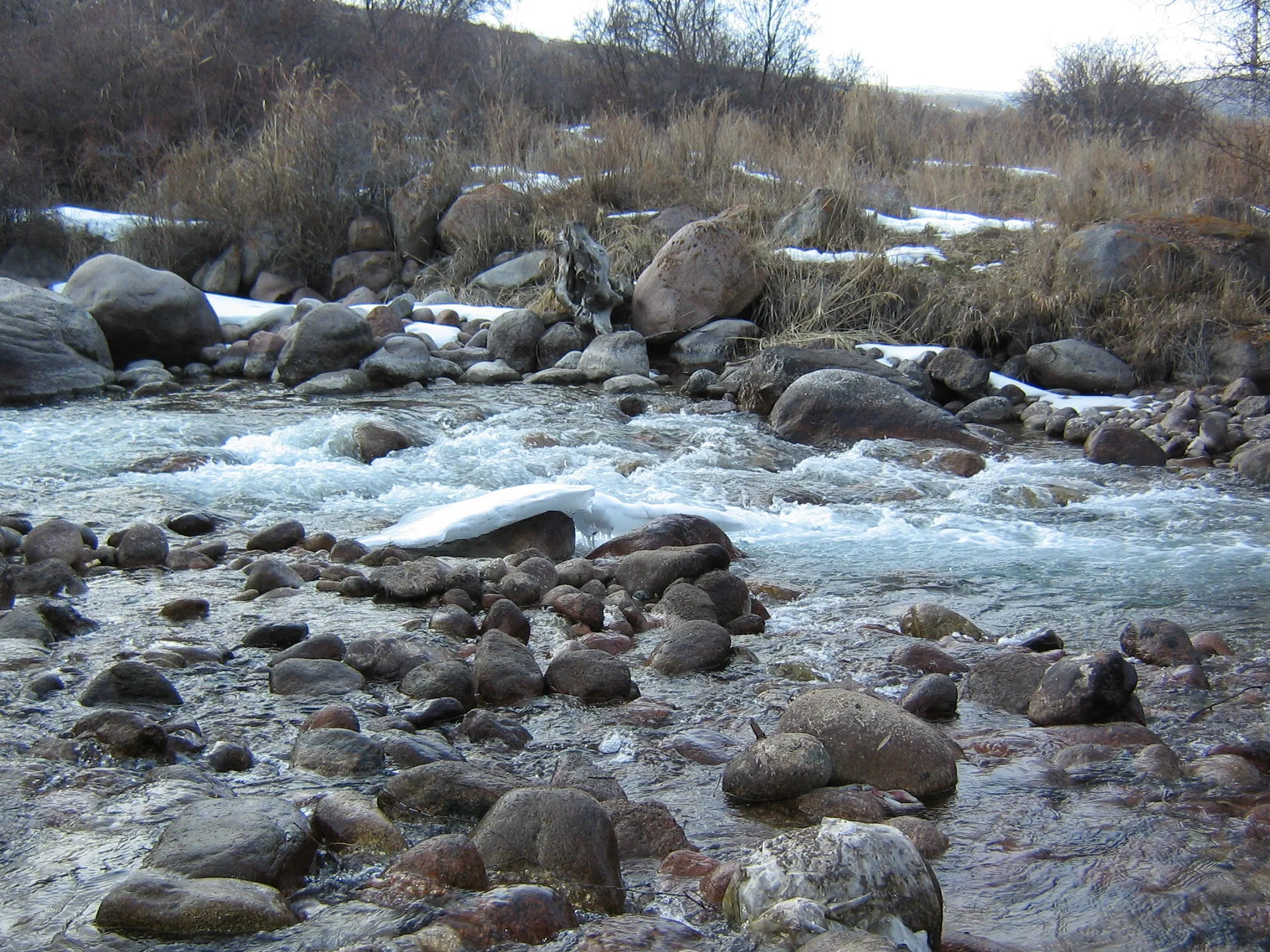
Stop 3
Gorge Canyon Entry — Eco-Post
- From previous:
- 16 km · 25 min drive
- Stay:
- ~0.25 h
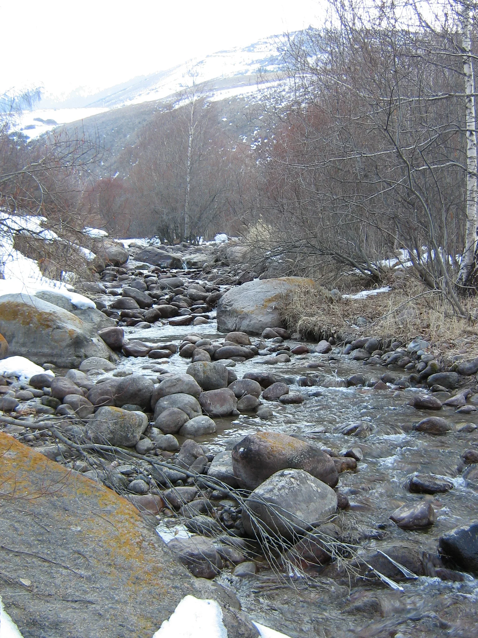
The gorge narrows noticeably about 3 km past the valley turn-off, where a barrier marks the Ile-Alatau National Park boundary. The eco-post collects the entry fee (approximately 380–500 KZT per person, cash only). The paved road continues another 10–11 km beyond this point, winding alongside the Kaskelen River through widening spruce-and-birch woodland. The canyon walls here are composed of folded metamorphic rock rather than the softer limestone in the lower section — the transition between rock types is visible in the cliff colours as you drive south. The river runs fast and cold even in summer and is audible but not always visible through the trees.
Tip: Card readers are not available at the eco-post. 500 KZT per person in small bills covers it. The barrier is open from approximately 08:00.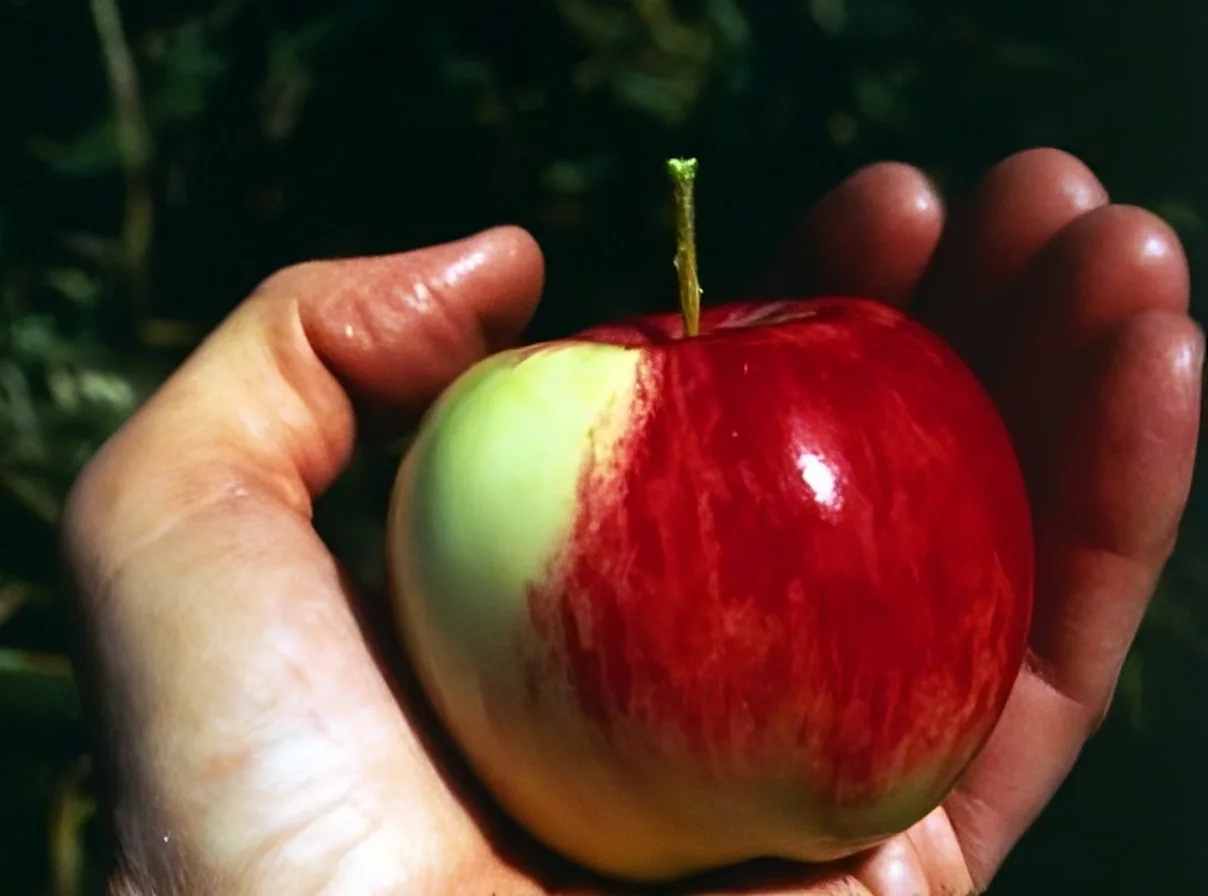
Stop 4
Riverbed Walk — Wild Apple Grove
- From previous:
- 8 km · 15 min drive
- Stay:
- ~0.75 h
At roughly 1,400–1,500 m elevation, the gorge floor widens briefly and the riverbank hosts the densest wild-apple and apricot stands in the area. These are Malus sieversii trees — the progenitor species of the cultivated apple, first scientifically described from specimens near Almaty by Carl von Ledebour in 1830. The trees grow 5–10 m tall with rough grey bark; in late April and early May they flower white-pink, and in August–September they carry small, tart fruit ranging from yellow-green to red. Wild apricots bloom earlier, in March. Barberry and hawthorn fill the understorey. The riverbank here is the standard picnic area for day-trippers; flat stones near the river crossing make a good rest stop before the climb.
Tip: Do not pick fruit in the national park. The apple trees are protected — they are among the last wild populations of a vulnerable species. Photograph freely.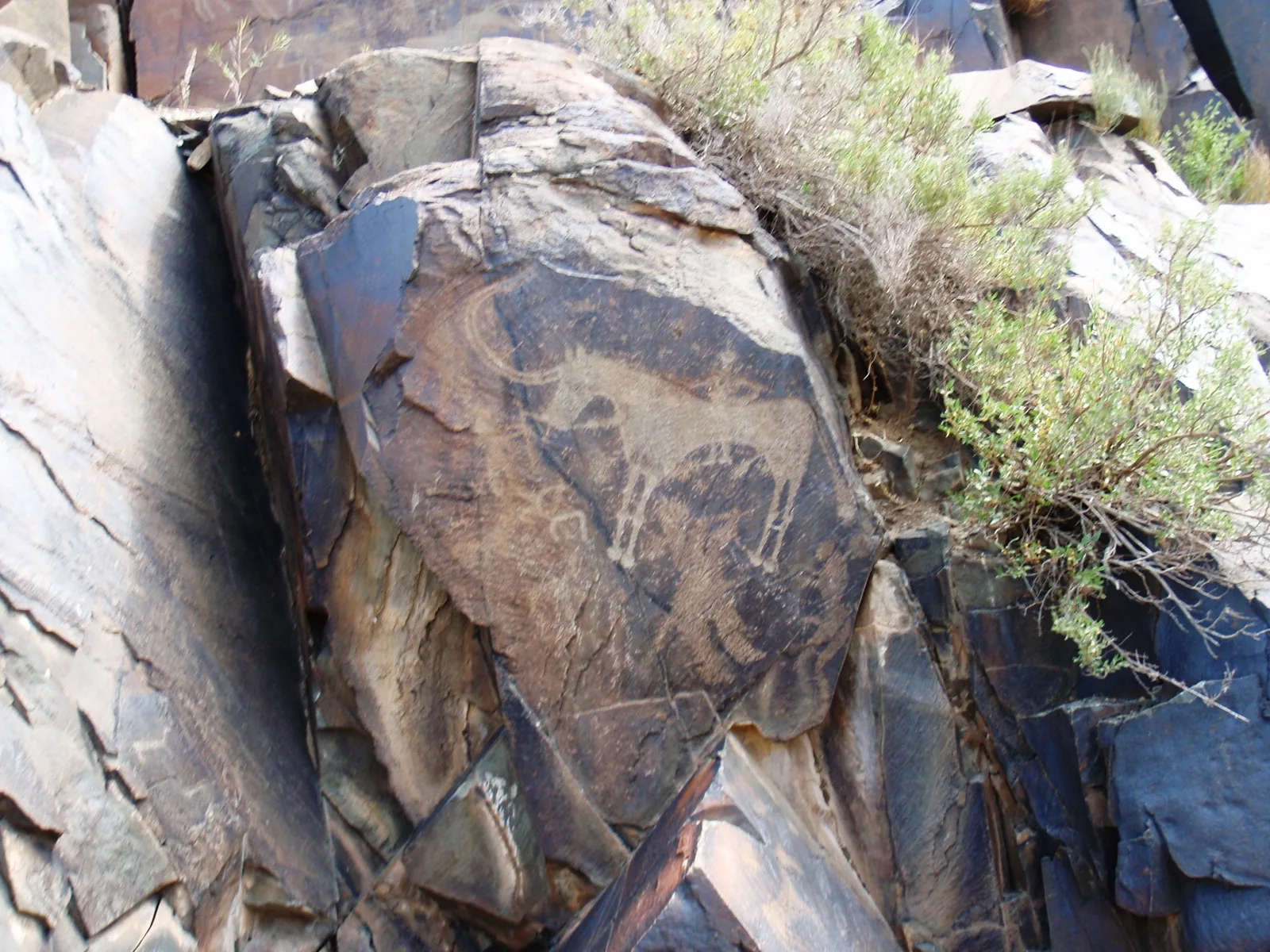
Stop 5
Tegiszhol Petroglyph Area
- From previous:
- 3 km · 10 min drive
- Stay:
- ~0.5 h
The Tegiszhol sector of the gorge, at approximately 1,600–1,700 m, contains scattered Bronze-Age and Saka-period rock carvings on dark-patinated cliff faces along the right bank of the Kaskelen. Documentation of this site is thin — it lacks the academic profiling of Tamgaly or Eshkiolmes, and the carvings are not formally signed or fenced. The main motifs reported include ibex, deer, and mounted riders typical of the Saka horizon (7th–3rd century BC). Finding the panels requires picking across rocky ground above the main trail; locally hired guides familiar with the gorge are the most reliable means of locating the precise outcrops. Treat the carvings as read-only — no touching, no chalk, no rubbings.
Tip: Site coverage is thin — if no guide is available, skip and continue to the dry waterfall. The gorge itself rewards the walk even without finding the carvings.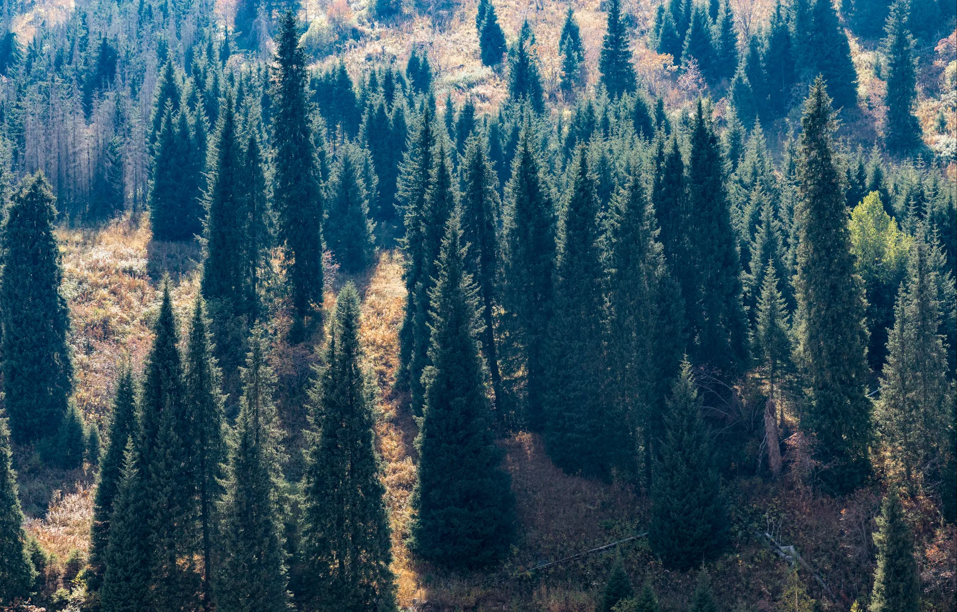
Stop 6
Dry Waterfall — Limestone Strata
- From previous:
- 2 km · 0 min drive
- Stay:
- ~0.5 h
A seasonal waterfall drops over a limestone ledge at around 1,750 m. By mid-July the upper catchment is dry and the fall runs as a trickle or stops entirely, leaving a polished channel and a stepped cascade of pale limestone bands that read clearly in afternoon light. The exposed strata show the alternating carbonite layers typical of the western Trans-Ili Alatau — a geological contrast to the granite-dominated eastern ranges around Almaty. The pool below the ledge holds water longer into summer and is a reliable rest point before the final push to the Uy-Tas ridge. Schrenk spruce trees thin out above this point and give way to sub-alpine meadow.
Tip: Visit in May–June for the waterfall in full flow. From July onward the cascade is decorative at best. The limestone ledge is slippery when wet — step carefully.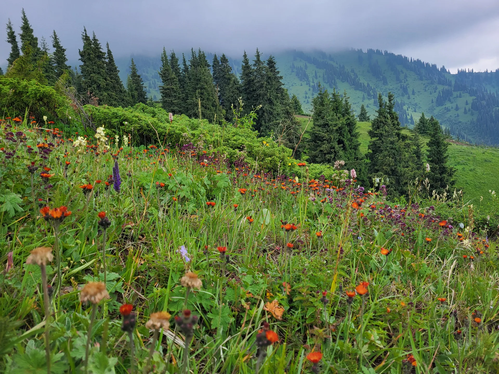
Stop 7
Uy-Tas Glacial Erratic — 2,000 m
- From previous:
- 2 km · 0 min drive
- Stay:
- ~1 h
Uy-Tas — Kazakh for 'stone house' or 'yurt stone' — sits alone on the ridge crest at approximately 2,000 m elevation, 1.5–2 km from the upper parking area on a clear trail through birch groves. The boulder is 5 m high and 6 m in diameter, composed of monolithic grey granite without a crack or chip. It weighs roughly 500 tonnes. The nearest rock of comparable size is nowhere visible on the surrounding slope, and there is no cliff directly above from which it could have fallen. Glacial transport from the high peaks is the scientific consensus. The stone has been a local landmark and informal ritual site for a long time — look for faded ribbons tied to nearby trees. From the ridge beside Uy-Tas, the view opens north over the Kaskelen valley floor and the Almaty lowlands, and south toward the high snowfields above 3,000 m.
Tip: The trail to Uy-Tas from the parking area takes 40–50 minutes. A primitive stone shelter near the boulder offers shade. From the ridge you can continue on a marked track toward Aydarys Pass (2,800 m) and Cossack Lakes — add 4–6 hours each way.Stop 8
Return — Uzynagach Loop
- From previous:
- 30 km · 55 min drive
Descend via the same gorge road to the valley floor. For a loop return instead of retracing the outbound route, turn west at the gorge mouth onto the road through Uzynagach — a market-garden settlement 44 km west of Almaty, known historically as the site of an 1860 battle between Russian Imperial forces and the Kokand Khanate. The Uzynagach–Almaty road runs northeast along the foothills, rejoining the city ring road and taking roughly 50–60 minutes. The loop adds about 25 km but avoids repeating the Kaskelen town stretch. Fuel up in Uzynagach if needed before the final run into Almaty.
Tip: The Uzynagach loop cuts 15–20 minutes from the return journey compared to retracing through Kaskelen town. The road surface is paved and in reasonable condition.
Extend to overnight
Hotel Madonna SPAHotelPremium· Breakfast

Hotel Madonna SPA
A Kaskelen route-hub hotel that works for both Kaskelen Gorge and the longer Tamgaly road. It is not near either site itself, but it is a practical west-side overnight base once the route leaves Almaty.
- Breakfast
- Spa
- Town access
Use as the main Kaskelen overnight base for west-corridor day-trip extensions.
Also featured on: Tamgaly Petroglyphs
What to bring
- Water (2 L per person minimum — no sources at trailhead)
- Cash KZT for eco-post fee
- Sturdy hiking boots (trail is rocky above the spruce line)
- Sun protection (UV exposure at 2,000 m is high)
- Warm layer (temperature drops sharply on the ridge)
- Snacks or packed lunch (no food vendors in the gorge)
- Offline maps (no cell signal above eco-post)
- Rain jacket (afternoon thunderstorms possible in summer)
- Trekking poles (ridge ascent to Uy-Tas is steep)
Sources
Researched from English and Russian sources. Inaccuracies are mine.
- https://en.wikipedia.org/wiki/Kaskelen_gorge
- https://zabugorshiki.com/en/kaskelen-gorge/
- https://wildticketasia.com/763-sights-kaskelen-gorge-almaty-reserve-kazakhstan.html
- https://silkadv.com/en/content/sights-kaskelen-gorge
- https://x-travels.ru/odnocnevnye-gornye-poxody/kaskelenskoe-ushhele/
- https://x-travels.ru/gornye-poxody/kaskelenskoe-ushhele-kamen-uj-tas-gora-2500-m/
- https://welcome.kz/en/info-cities/almaty-region/kaskelen-gorge
- https://demal.kz/route/zailiyskiy-alatau/kaskelenskoe-ushchele/uy-tas/
- https://adventur.kz/34-kaskelenskoe_ushhele
- https://en.wikipedia.org/wiki/Malus_sieversii
- https://ru.wikipedia.org/wiki/%D0%9A%D0%B0%D1%81%D0%BA%D0%B5%D0%BB%D0%B5%D0%BD%D1%81%D0%BA%D0%BE%D0%B5_%D1%83%D1%89%D0%B5%D0%BB%D1%8C%D0%B5
Similar trips
Day trip
Big Almaty Lake
A turquoise alpine reservoir at 2,511 m in the Ile-Alatau National Park, roughly 28 km south of Almaty — the city's most accessible high-mountain destination and its primary drinking-water source.
2 days
Charyn: Valley of Castles and Moon Canyon
A full-day combined loop that pairs the red sandstone towers of the Valley of Castles with the pale grey-yellow walls of <span lang="ru">Лунный каньон</span> (Moon Canyon) — a short spur downstream along the Charyn, rarely crowded even in peak season, and strikingly different in colour and character from its better-known neighbour.
2 days
Charyn–Kolsai–Kaindy Loop
A 2-3 day loop east of Almaty that strings together Charyn Canyon, the three-tiered Kolsai Lakes, and the submerged spruce forest of Kaindy Lake — three of the most distinct landscapes in Kazakhstan in a single circuit.