Before you go
- Vehicle
- 4×4 required
- Permit
- Required — Entry to Altyn-Emel National Park requires registration at the Basshi headquarters (2 Mametova St., open daily 08:00–17:30, lunch break 13:00–14:30). As of 2024: 800 KZT per person per day plus 200 KZT for the vehicle. Cash only — no ATMs in Basshi. A park guide is recommended for the interior Aktau and Katutau tracks and can be hired at registration (fees negotiated on-site); recent visitors report these routes are also driven self-guided, so confirm current requirements when you register. Overnight camping near Aktau (Shygan/Mynbulak ranger station) requires a separate camping permit issued at the Basshi office; confirm availability by phone before arrival (+7 72840 45209). For groups, book permits two to three days ahead in high season (May–June, September–October).
- Entrance fee
- 800 KZT per person per day plus 200 KZT for the vehicle (as of 2024). Cash only. No ATMs in Basshi village or inside the park.
- Peak altitude
- 1720 m
- Cell coverage
- None
- Fuel
- Fill up in Almaty before departure and top off again in Konaev (Kapchagai, ~80 km from Almaty) or Saryozek (~180 km from Almaty) — the last guaranteed petrol stations before Basshi. The Basshi village station exists but can be unreliable; treat Saryozek as the confirmed last stop. Carry an extra 20 L in a jerry can for the Aktau-Katutau track inside the park.
- Road status
- Almaty to Konaev on the A3 highway: paved, good condition. Konaev to Saryozek on the A3/A351: paved with some rough sections. Saryozek to Basshi: partially paved, deteriorates near the Altyn-Emel mountain pass. Basshi to Aktau (72 km): sandy and clay track, passable in dry conditions with 4x4 high-clearance only. The clay surface becomes impassable within hours of rain. Basshi to Katutau (47 km): similar sandy track, some rocky creek crossings. Carry a tyre repair kit and full spare — sharp desert stones cause frequent punctures.
- Closed months
- Jan, Feb, Dec
About this trip
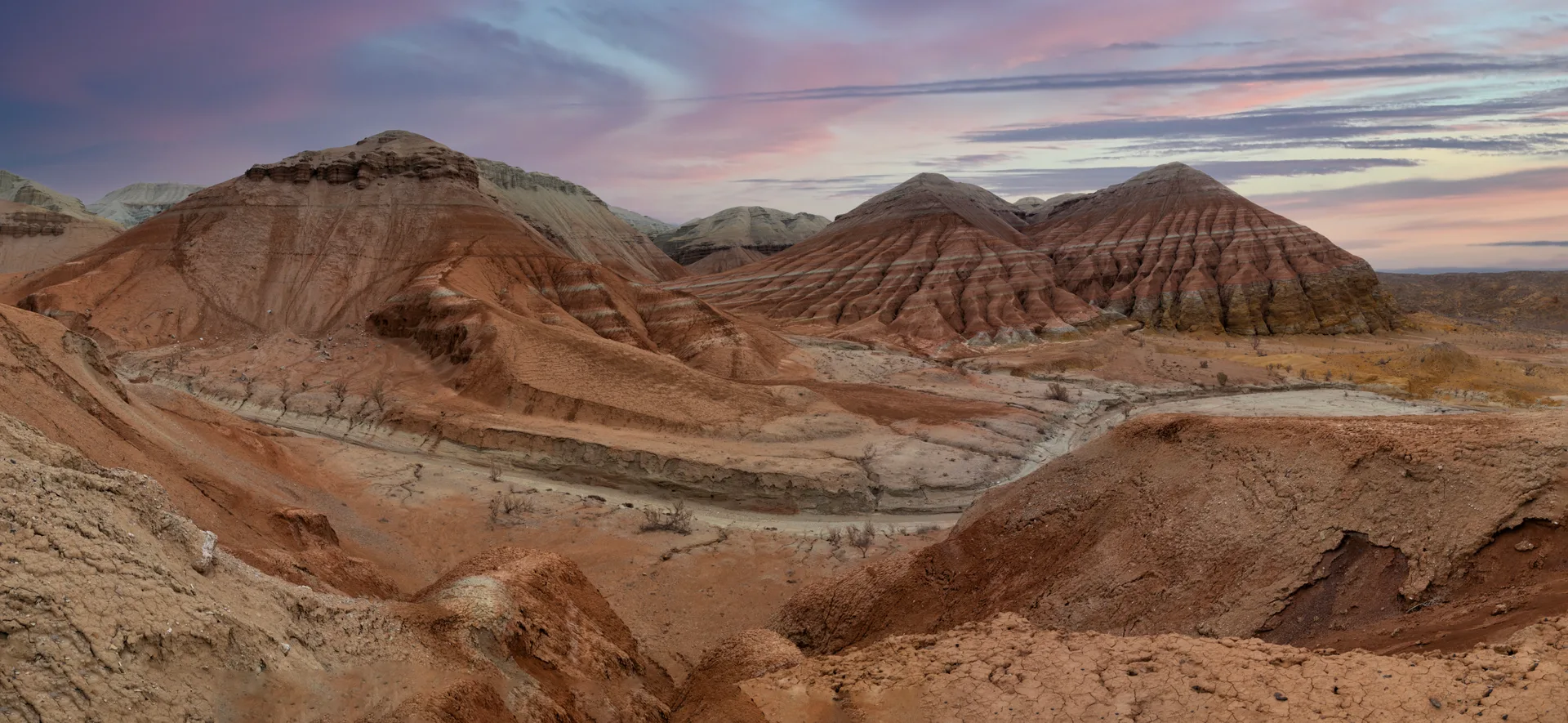
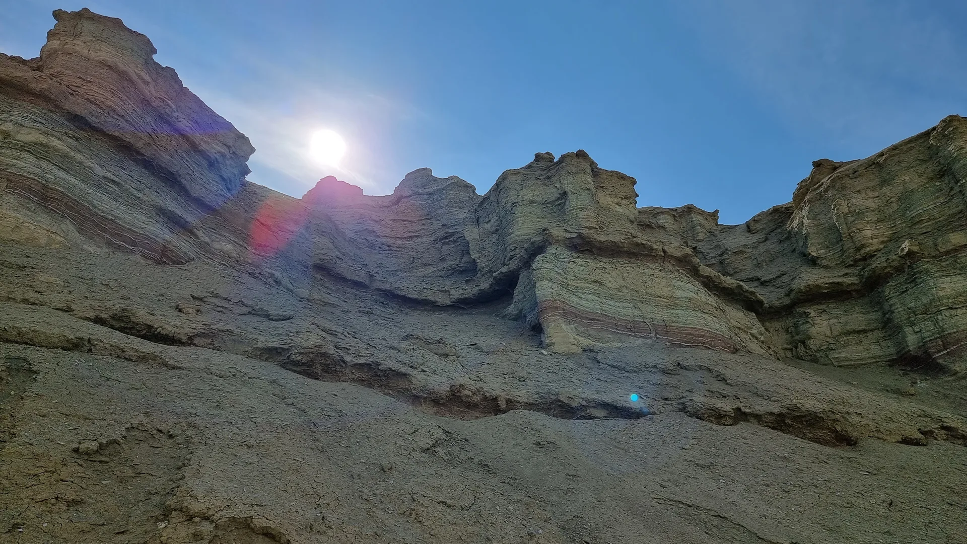
The Aktau massif runs roughly 30 km east to west along the right bank of the Ili River, its eroded flanks exposing Paleogene and Neogene lake sediments laid down 25–50 million years ago. The vertical bands of white chalk, red iron oxide, blue clay, and yellow limonite are the work of ancient drainage from what was once a subtropical inland basin. The same layers that produce the colour contain crocodile vertebrae, rhinoceros teeth, and freshwater turtle carapaces — the park's on-site palaeontologist can sometimes show visitors exposure faces where bone fragments protrude. The formations are softer than they look; the clay surface turns to grease in rain and the access track from Basshi becomes impassable within hours of a downpour.
Katutau sits 25 km west of Aktau and looks like a different planet: dark red, purple, and violet-grey basalt ridges where two large volcanoes erupted roughly 240 million years ago and their lava cooled in a shallow lake, producing hollow formations and wind-carved arches. The highest point reaches 1,720 m. The contrast between the pale sedimentary Aktau world and the dark volcanic Katutau one is the defining experience of the two-day circuit. From either ridge you can often see kulans (Asiatic wild asses) crossing the steppe below.
The Altyn-Emel National Park permit office in Basshi village (2 Mametova St.) handles entry to both formations. As of 2024, the park entry fee was 800 KZT per person per day plus 200 KZT for the vehicle, payable in cash — there is no card reader at Basshi and no ATM in the village. Guides are assigned for all interior park routes; guide fees are agreed on-site. A ranger camp at the foot of the Aktau Mountains (Shygan or Mynbulak station, ~72 km from Basshi) allows permit-approved overnight camping, which makes the Aktau-then-Katutau two-day itinerary practical without returning to Basshi between days.
This trip covers the Aktau white-chalk and Katutau volcanic sectors only. It does not visit the Singing Dune, which lies in a different park sector and is the focus of the companion trip in this guide. The two trips share the Almaty–Basshi drive but diverge inside the park, and are best treated as separate journeys rather than combined in one outing.
Route
Skip map, jump to step listWhere to sleep
- Night 1 of 1Shygan Ranger CampCampingBudget
Budget · ~8–15k KZT/night. Mid-range · ~15–40k KZT. Premium · ~40k+ KZT.
Itinerary
Stop 1
Almaty
Leave Almaty by 05:30 to reach Basshi by 10:00, allowing time to complete permit registration before the lunch-break closure at 13:00. Take the A3 northward out of the city toward Konaev (formerly Kapchagai), then continue northeast on the A3/A351 toward Saryozek. The road is paved throughout and moves quickly in the early morning. Download 2GIS or Maps.me offline maps for the Zhetysu Region before you leave — cell signal becomes unreliable after Konaev and disappears entirely inside the park. The park lies about 295 km from Almaty, taking four to four and a half hours without stops. The Aktau-Katutau circuit covers an additional 140 km of park tracks on top of the Almaty-Basshi drive, so a full fuel load at departure is essential.
Tip: Bring enough KZT cash for two days of park permits (800 KZT/person/day plus 200 KZT/vehicle/day), guide fees (typically 10,000–20,000 KZT per day depending on group size), and overnight accommodation at the Shygan ranger camp. No ATM between Almaty and Basshi. The overnight at the park camp adds roughly 5,000–8,000 KZT per person.
Stop 2
Konaev — Fuel and Supply Stop
- From previous:
- 80 km · 70 min drive
- Stay:
- ~0.5 h
Konaev (Konaev city, formerly Kapchagai) is 80 km northeast of Almaty on the A3 and sits beside the Kapchagai reservoir, the Ili River's wide impoundment behind a 1970 hydro dam. The petrol stations here are more reliably stocked than those further east, making this a sensible first fuel stop. The town has a small supermarket for any last-minute supplies. The Kapchagai reservoir stretches north and is visible from the bypass road; in spring the water level is visibly higher after snowmelt from the Tian Shan foothills. From here the route continues east through open semi-desert steppe on the A3 toward Saryozek, where a second fuel top-off is advisable before the turn south toward Basshi.
Tip: Top up the fuel tank here and again at Saryozek (~100 km further east). After Saryozek the road to Basshi has no fuel. Carry an extra 20 L jerry can for the park interior tracks — Aktau and Katutau combined add around 140 km of unpaved driving.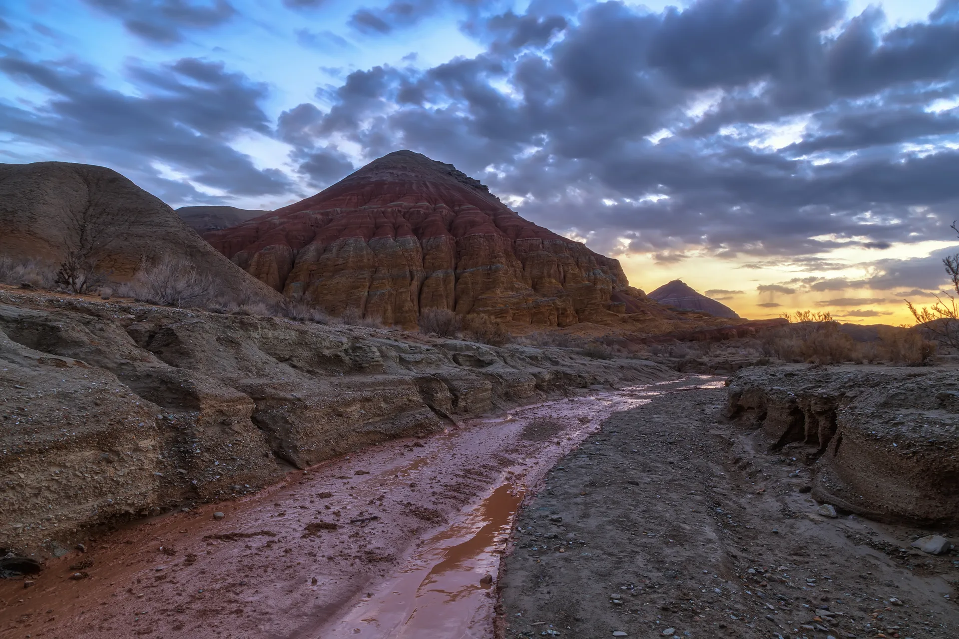
Stop 3
Basshi Village — Altyn-Emel Permit Office
- From previous:
- 220 km · 145 min drive
- Stay:
- ~1 h
Basshi is the administrative entry point for Altyn-Emel National Park and the only place to register for the Aktau-Katutau sector permits. The headquarters at 2 Mametova St. issues route-specific permits and can assign a park guide (recommended for the interior tracks; confirm whether one is required for your route). Budget 30–60 minutes for registration. The 2024 entry fee is 800 KZT per person per day plus 200 KZT for the vehicle, payable in cash — there is no card reader. At the permit desk, confirm that your route covers both Aktau and Katutau and that camping at the Shygan or Mynbulak ranger station is included. The Aktau Mountains lie 72 km from Basshi along a sandy track that is accessible to 4x4s in dry conditions but closes quickly after rain. Basshi has a small grocery store and a basic guesthouse if you prefer not to camp in the park.
Tip: The permit office closes for lunch 13:00–14:30 and shuts at 17:30. Arriving before noon leaves enough time to reach the Aktau first viewpoint before the late-afternoon light fades. Call ahead (+7 72840 45209) if your arrival may run late. Confirm that your guide knows the Aktau track — guides assigned for the Singing Dune sector do not always have recent Aktau route experience.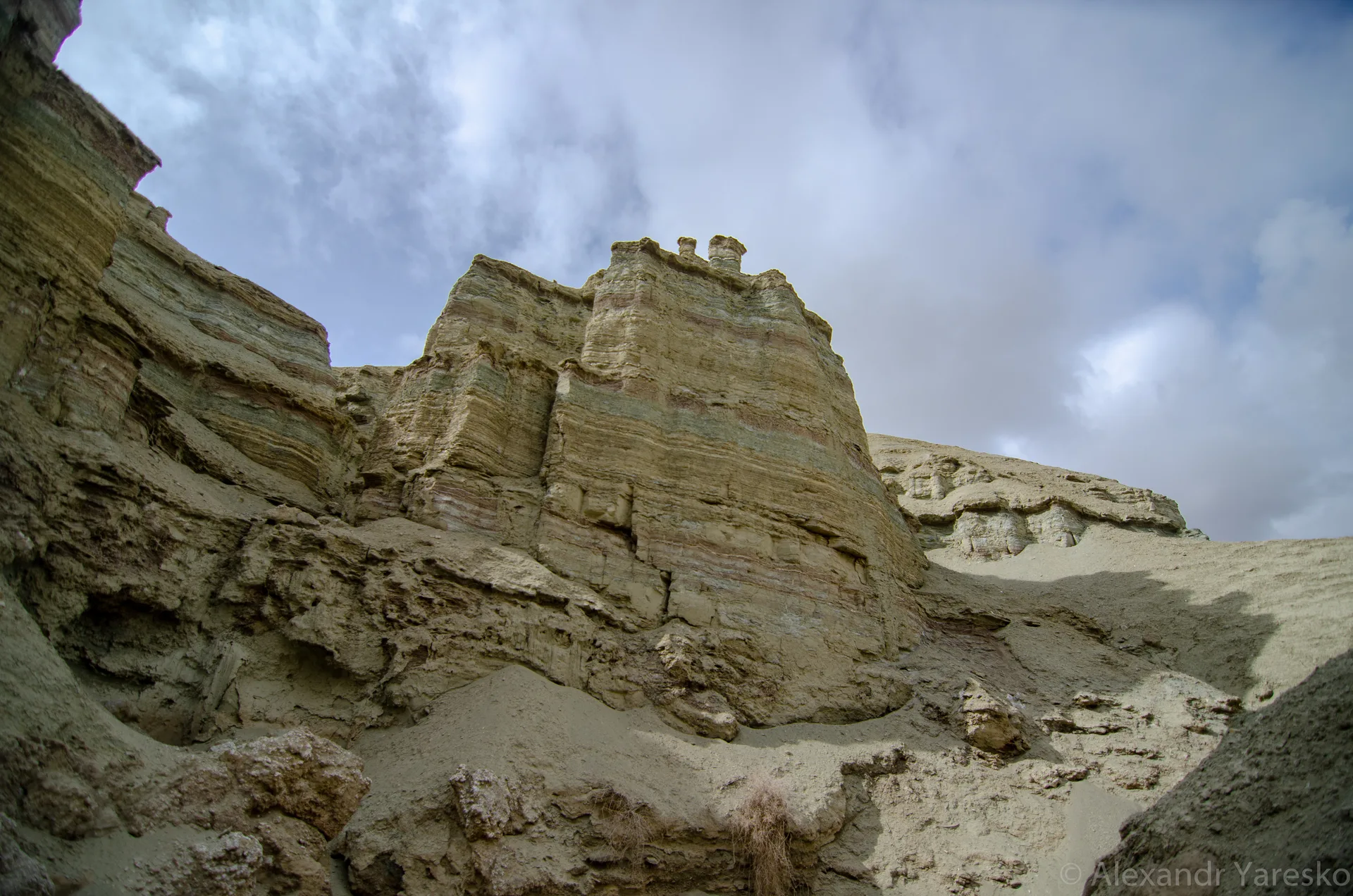
Stop 4
Aktau — First Viewpoint
- From previous:
- 72 km · 110 min drive
- Stay:
- ~1.5 h
The 72 km track from Basshi to the Aktau Mountains takes 90–120 minutes in dry conditions. The track crosses open sandy steppe, then rounds a ridge to reveal the Aktau escarpment abruptly: a 30-km wall of layered sediment in white, red-orange, ochre, and blue-grey that rises from the flat valley floor. The colours come from the mineral content of lake and river sediments deposited in what was once a humid subtropical basin: white chalk and cream from calcite, red and orange from iron oxides, yellow from limonite, and pale blue-grey from volcanic ash layers. The first viewpoint is at the western end of the massif, where the full extent of the banded formation is visible in one sweep. Fossil bones and shell fragments are occasionally visible in exposed cliff faces — do not remove them; they are protected under national park regulations.
Tip: April through June and August through October are the most comfortable months for walking the Aktau formations. July and August midday temperatures regularly exceed 40 °C and the white rock reflects heat intensely — carry a minimum of 3 L per person for any walk here. In spring, the clay drainage channels can hold standing water and the ground becomes very slippery.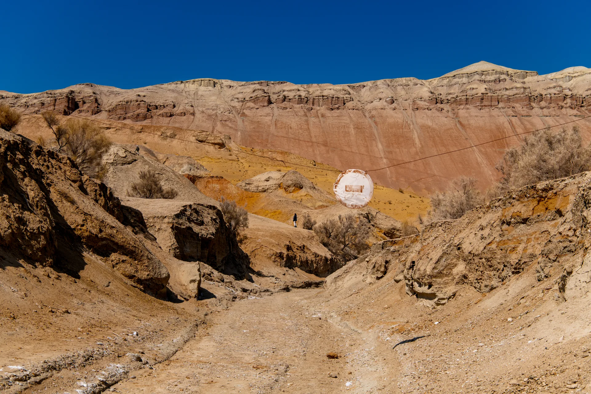
Stop 5
Aktau — Labyrinth Walk and Red Gorge
- From previous:
- 3 km · 10 min drive
- Stay:
- ~2.5 h
A 2–3 km walking loop enters the gully system known locally as the labyrinth — a maze of eroded clay channels that cut 5–15 m deep into the sediment. The Red Gorge section runs through an iron-oxide-rich stratum where the walls are a deep ochre-red on both sides and narrow to shoulder width in places. A second formation called 'the Paw' — a cluster of eroded pillars on the ridgeline that silhouettes into the shape of a large animal's foot from the south — is a 400 m side detour from the main track. The guide will typically identify both landmarks as part of the standard Aktau walk. The sediment underfoot is soft and powdery when dry; it adheres to shoes and clothing and can turn to thick mud after rain, so gaiters or tall rubber boots are useful in shoulder season.
Tip: The palaeontological layer most likely to contain visible fossils is the upper white chalk band near the head of the labyrinth. Bones and teeth are small and easily mistaken for rock fragments. The park guide can point out confirmed fossil exposures — ask specifically, as this is not included in every standard tour by default.
Stop 6
Aktau Panorama Ridge — Overnight at Shygan Camp
- From previous:
- 5 km · 15 min drive
- Stay:
- ~14 h
A short 4x4 drive brings you to the base of the Aktau ridge — the highest accessible point on the Aktau escarpment, where the stacked sedimentary layers are visible in cross-section from above. In late afternoon the low-angle light picks out the colour banding more sharply than at midday: the white chalk glows warm, the red bands deepen, and the shadowed gullies turn blue-grey. The Shygan ranger station (also noted as Mynbulak on some maps) operates a permit camping area at the foot of the mountains with basic toilet facilities and space for tents. Bring your own water — there is no water source at or near the camp. Evening temperatures drop considerably; the desert cools fast once the sun is gone. The camp is shared with the park ranger, who can provide orientation for the next morning's Katutau drive.
Tip: Camping at the Shygan station requires a camping permit issued at the Basshi headquarters — confirm this when registering your route on day one. The Matai Yurts camp run by the park can accommodate small groups with meals; contact the park office (+7 72840 45209) well in advance to book. If no camp accommodation is available, the fallback is returning to Basshi guesthouses (90 km back) and driving to Katutau from Basshi the following morning.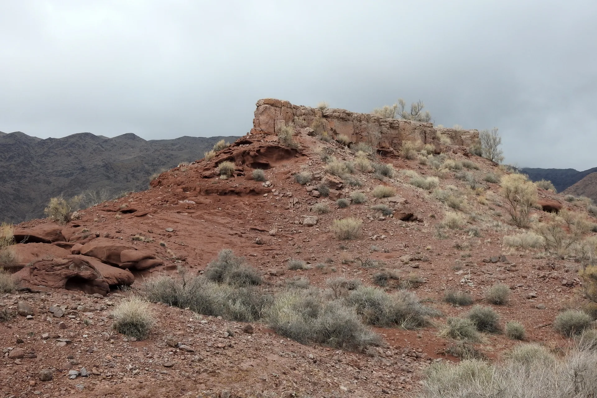
Stop 7
Katutau — Volcanic Basalt Ridge
- From previous:
- 25 km · 45 min drive
- Stay:
- ~3 h
Katutau ('Bitter Mountains' or 'Hard Mountains' in Kazakh) lies 25 km west-northwest of Aktau. The 25 km track from the Aktau camp takes 40–50 minutes. The landscape changes completely within a few kilometres: the pale chalk world gives way to dark red, purple, and violet-grey basalt formations — solidified lava from two large volcanoes that erupted roughly 240 million years ago into a shallow lake. The lava cooling in water produced hollow formations, arches, and pillar shapes unlike typical flat lava fields. The highest ridge tops out near 1,720 m. A 2–3 hour walk with the guide covers the main lava fields, a natural arch, and the Tiger Mountains sub-formation in the southeastern foothills — banded ochre, red, and white slopes where volcanic outcrops meet sedimentary rock from the same era. Kulans and gazelles are often seen on the steppe approach.
Tip: Start the Katutau walk by 09:00 to avoid walking on sun-heated basalt rock in the afternoon — the dark surface absorbs heat quickly and the surfaces become difficult to handle by midday in summer. Wear thick-soled shoes; volcanic rock is uneven and sharp-edged. The lava formations are fragile in places; walk on established paths where the guide leads.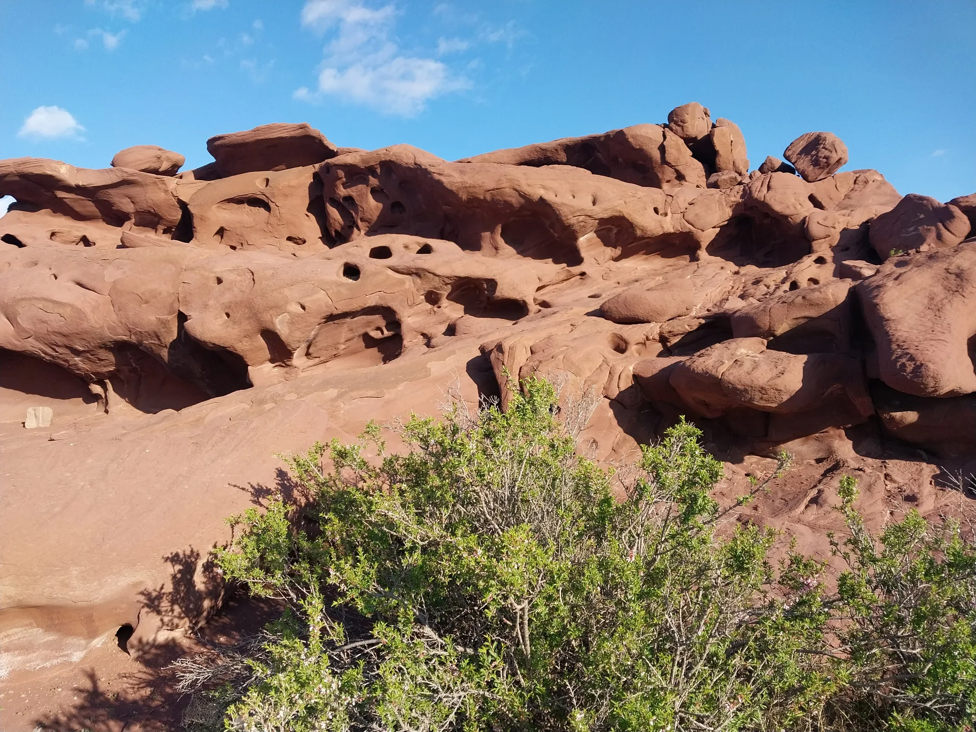
Stop 8
Return — Basshi Gate to Almaty
- From previous:
- 342 km · 370 min drive
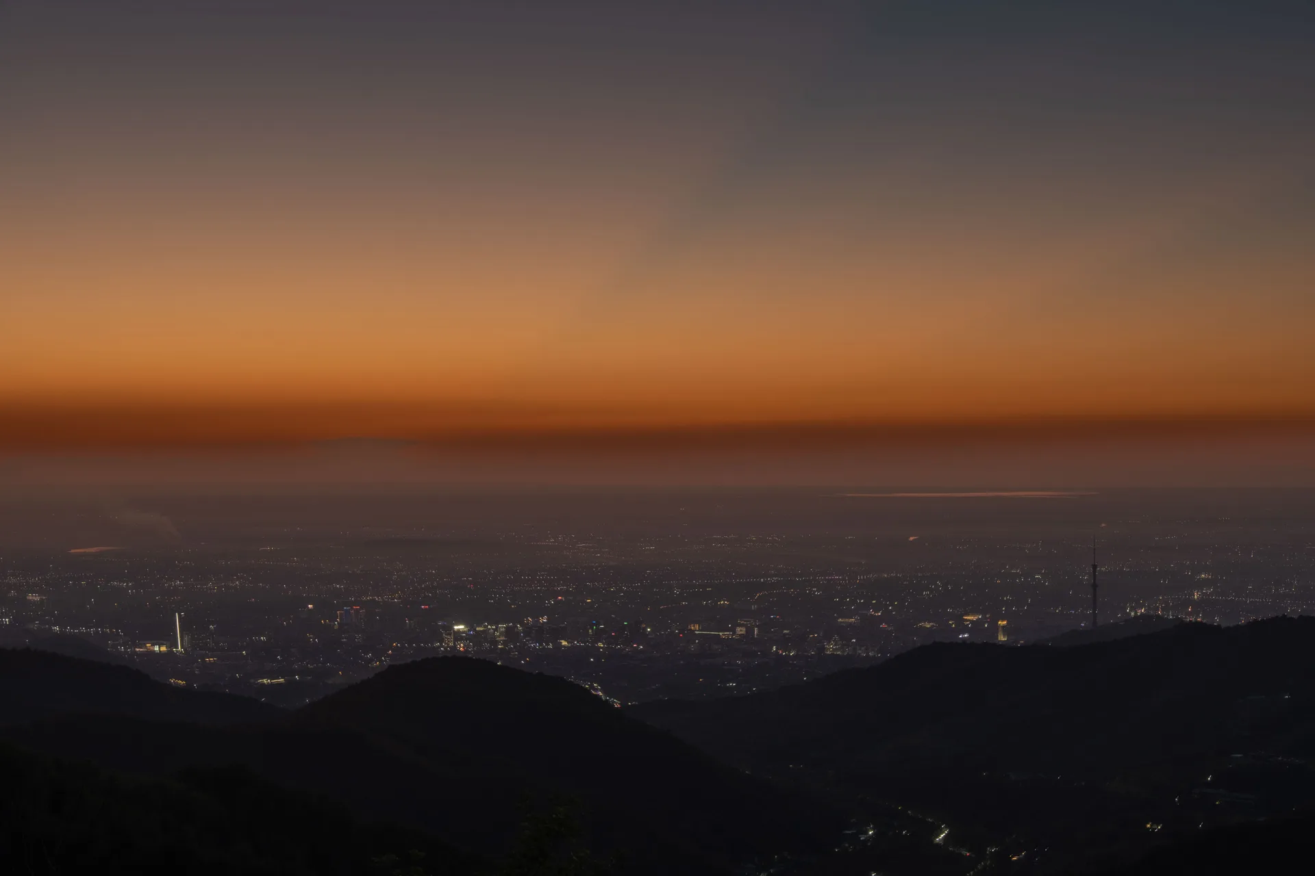
The return drive from Katutau to Basshi covers approximately 47 km and takes 60–80 minutes on the park track. Stop at the Basshi permit office to hand back any temporary permits and to verify the guide has checked you out — this is required procedure. From Basshi, the route retraces the Saryozek–Konaev–Almaty corridor on the A3 and A351. The 295 km drive takes approximately four to four and a half hours without stops; fuel up at Saryozek before the long stretch back. Almaty in the late afternoon on a weekday will have city traffic; arriving by 16:00 avoids the worst of it. The total round-trip distance for the two-day circuit, including park interior tracks, is approximately 640 km.
Tip: The park track from Katutau to Basshi can be slick after overnight dew in spring and autumn — allow extra time and drive conservatively in the early morning. If there was any rain overnight, check the track condition with the ranger before setting out; the clay sections near Aktau can become impassable for several hours after even light precipitation.
Night 1 of 1 · after Step 6: Aktau Panorama Ridge — Overnight at Shygan Camp
Shygan Ranger CampШыган
A basic ranger-run camping area at the foot of the Aktau escarpment inside Altyn-Emel National Park. It fits this route because it matches the real day split of the Aktau-Katutau circuit without a long evening return to Basshi. Expect a simple camp stop rather than a serviced lodge: bring your own warm layer, water, and overnight kit.
- Basic toilet
- Ranger orientation
- Tent space
Permit camping area with basic toilets; confirm availability through the park office before departure.
Also nearby
Zhanna Guest HouseGuesthouseMid-range· Meals on request
Zhanna Guest HouseЖанна
A small Basshi guesthouse a short walk from the Altyn-Emel park office on Mametova Street. It works well as the fallback overnight for Aktau routes because it keeps permit pickup, meals, and an early park departure in one compact village base. Expect a simple local stay rather than a resort-style property.
- Meals on request
- Permit-office access
- Village parking
Several rooms; contact ahead for current availability.
CaravansaraiYurt campMid-range· Parking

CaravansaraiКаравансарай
A mixed Basshi stay with yurts and rooms on the village edge, used as the more atmospheric fallback to a plain guesthouse. It suits Aktau routes because it still keeps travelers in the permit-and-supplies hub while offering a more camp-like desert-edge setting.
- Parking
- Pet friendly
- Picnic area
- Sauna
Mixed rooms and yurts; confirm current room type before arrival.
What to bring
- Water (minimum 5 L per person per day — no water sources at Aktau camp)
- Cash in KZT (permits, guide fees, accommodation)
- Offline GPS maps (2GIS or Maps.me downloaded before leaving Almaty)
- Full spare tyre plus tyre repair kit
- Jerry can (20 L extra fuel for park interior tracks)
- Sun hat and SPF 50+ sunscreen (white chalk reflects intense UV)
- Warm sleeping layer (desert temperatures drop sharply after dark)
- Tent or camping gear if not using ranger-station accommodation
- Packed meals for both days (no shops or cafes inside the park)
- First-aid kit
- Headlamp or torch
- Dust-proof bags for cameras and phones
- Waterproof jacket (clay track turns impassable in rain — if caught, shelter and wait)
Sources
Researched from English and Russian sources. Inaccuracies are mine.
- https://en.wikipedia.org/wiki/Aktau_Mountains
- https://en.wikipedia.org/wiki/Altyn-Emel_National_Park
- https://ru.wikipedia.org/wiki/%D0%90%D0%BB%D1%82%D1%8B%D0%BD-%D0%AD%D0%BC%D0%B5%D0%BB%D1%8C
- https://altynemel.kz/index.php/en/things-to-do/places-to-see/aktau-mountains
- https://altyn-emel.kz/en/tourism/unique-object/katutau-mountains.html
- https://wildticketasia.com/652-katutau-mountains-in-altyn-emel-park.html
- https://wondersandwaves.de/en/2025/10/21/1-day-in-altyn-emel-national-park-your-complete-self-drive-guide/
- https://altynemel.kz/index.php/en/things-to-do/hotels-and-campsites
Similar trips
2 days
Charyn's Canyons, Kaindy & the Kolsai Lakes
A two-day eastern weekend that pairs the full Charyn — the red sandstone Valley of Castles and the off-road clay folds of Moon Canyon — with the drowned spruce forest of Kaindy and the alpine water of the Kolsai Lakes. The 4x4 version of the classic loop.
Day trip
Big Almaty Lake
A turquoise alpine reservoir at 2,511 m in the Ile-Alatau National Park, roughly 28 km south of Almaty — the city's most accessible high-mountain destination and its primary drinking-water source.
Day trip
Butakovka Waterfall
A half-day hike into the Butakovka Gorge delivers two tiered waterfalls — 30 m and 20 m — tucked inside Ile-Alatau National Park, barely 20 km from Almaty's city center.