Before you go
- Vehicle
- Sedan is fine
- Permit
- Required — No permit is needed for general access to the reservoir shoreline or the lower Kurmety gorge. To approach the dam spillway area, a free pass (пропуск) is required from the Big Almaty Canal (БАК) administrative office in Almaty. Contact the canal authority in advance; the permit is typically issued the same day for a named list of visitors.
- Entrance fee
- No general entrance fee for the reservoir area. The lower Kurmety gorge falls within Kolsai Lakes National Park; rangers may collect a nominal conservation levy of around 500–1000 KZT per person at seasonal checkpoints.
- Peak altitude
- 1527 m
- Cell coverage
- Patchy
- Fuel
- Last reliable fuel before the reservoir is Chilik town (Shelek), approximately 170 km from Almaty on the A-351. Fill up there; there are no stations beyond that point until you loop back via Kegen.
- Road status
- The A-351 is fully paved to the Kokpek junction. The final 14–15 km to the reservoir is sealed asphalt with some rough patches near the dam. The Kegen valley road is paved but narrower. The lower Kurmety gorge approach is compacted gravel, passable to sedans when dry.
- Closed months
- Jan, Feb, Dec
About this trip
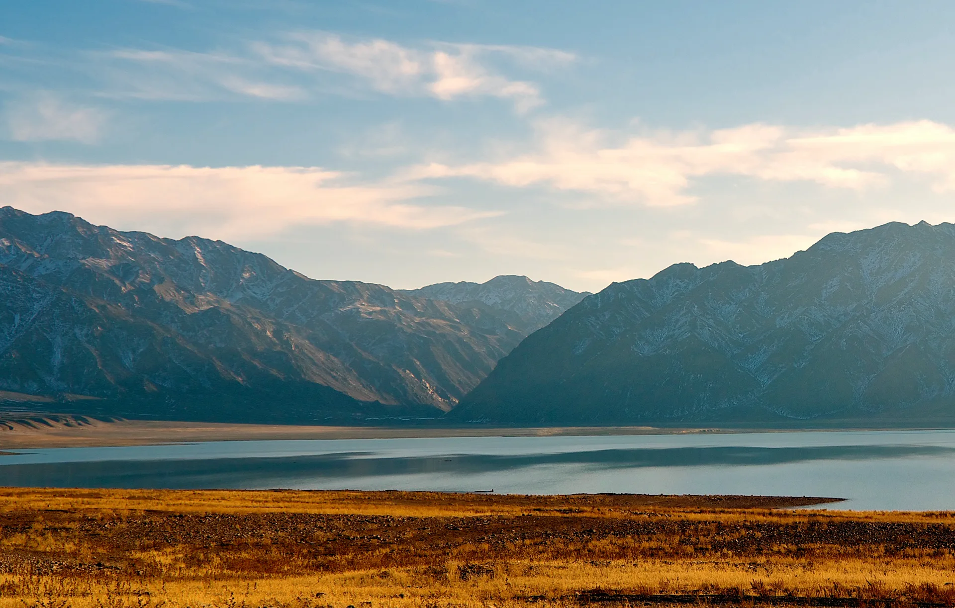
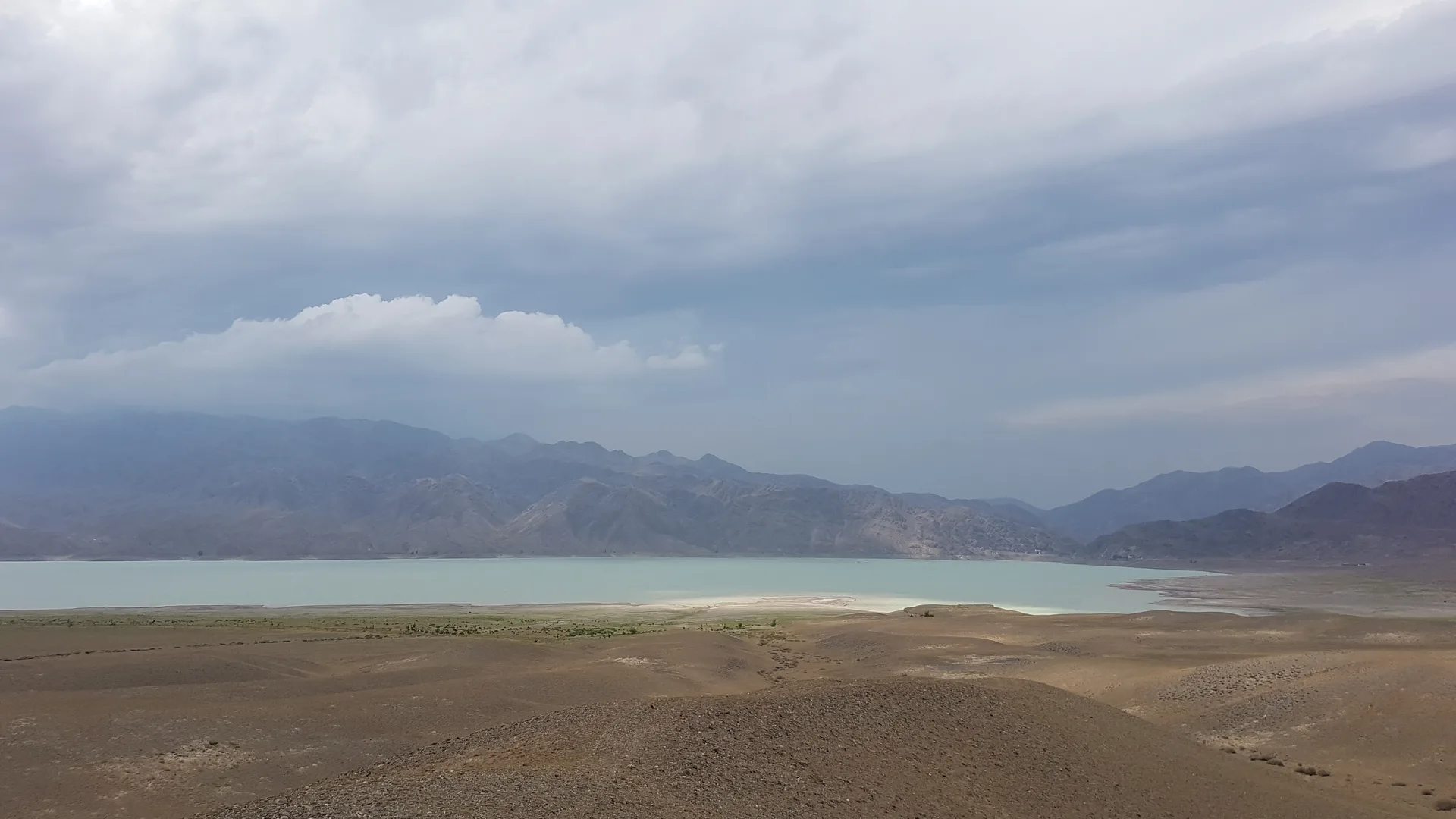
Bartogay Reservoir sits at 1,010 m in the Chilik valley, 194 km from Almaty by the Kuldjinsky Tract (A-351). Built in the early 1980s, the 60-metre rock-fill dam holds back a 13 km² lake whose colour shifts from jade to sky-blue depending on water level. The reservoir drains heavily from June through September to feed the Big Almaty Canal, so the waterline drops dramatically in midsummer — May and late September offer the highest and most photogenic fill. Burial mounds (kurgans) dot the surrounding slopes, reminders that this valley has served as a gathering place since antiquity.
The road from Almaty is sealed almost the entire way. After passing Chilik town, bear right (south) before Kokpek village and follow paved road for 14–15 km to the dam wall. A standard sedan handles the full route without trouble in dry conditions; the final kilometres skirt a loose gravel embankment, so cautious low-speed driving suffices. There are no services at the reservoir itself — fuel, food, and water must be arranged before Chilik town, roughly 170 km from Almaty.
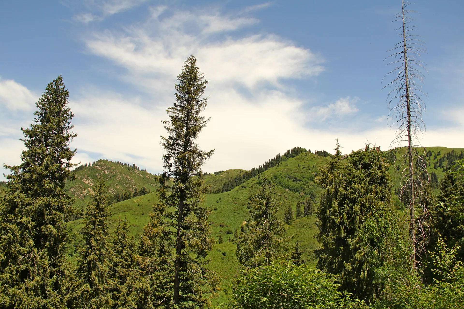
Kurmety gorge begins where the Kurmenty River cuts north from the Kungey Alatau ridge into Kolsay Lakes National Park. Dense Tien Shan spruce forests line the slopes, and the river runs clear enough to see the bottom. The gorge sits about 120 km southwest of Bartogay via the Kegen valley road, making it a natural return leg. The upper gorge requires a 4x4 to reach the high-alpine section, but the lower valley and treeline area are accessible on a graded gravel track by any vehicle.
Combined with Charyn Canyon — about 45 km north of the Bartogay turnoff — this circuit covers roughly 340 km of genuinely varied landscape in a single long day or a comfortable overnight. Border-zone permits are not required for the reservoir or the lower Kurmety gorge; the spillway area of the Bartogay dam requires a pass issued free of charge by the Big Almaty Canal administration office in Almaty.
Route
Skip map, jump to step listItinerary
Stop 1
Almaty — departure
Leave Almaty eastbound on the A-351 Kuldjinsky Tract (Кульджинский тракт). The highway runs through Ili district and crosses the flat steppe before the Chilik valley rises on the horizon. Morning departure before 07:00 keeps you clear of city traffic and puts you at the reservoir before midday heat in summer. Fuel up on the eastern outskirts of Almaty; the next reliable stop is Chilik town, 170 km away.
Stop 2
Bartogay Reservoir
- From previous:
- 194 km · 165 min drive
- Stay:
- ~3 h
The Bartogay dam appears after the road bends south from Kokpek village. The reservoir stretches 6 km north to south and 3 km across, with maximum depth of 25–30 m. Water colour ranges from pale turquoise in spring when snowmelt fills the basin to a deeper teal in autumn when irrigation releases have subsided. The shoreline is open steppe — there is no shade — so the Toraigyr area on the western bank, sheltered by a low ridge, is the best camp spot. Kurgans (ancient burial mounds) are visible on the surrounding terraces. Swimming is possible but officially discouraged; fishing for trout and carp is permitted in season.
Stop 3
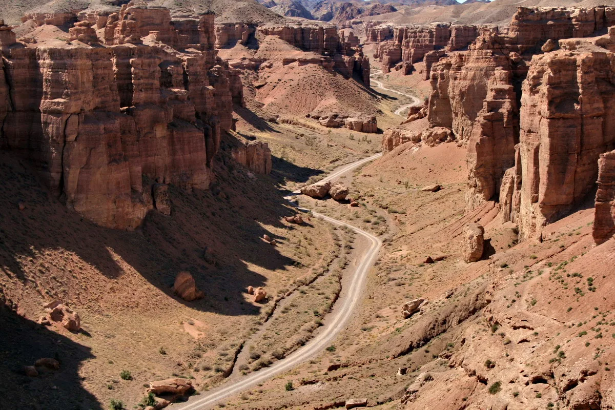
Charyn Canyon (optional loop)
- From previous:
- 70 km · 75 min drive
- Stay:
- ~2 h
Returning north on the Kokpek road and continuing 45 km east on the A-351 brings you to the Charyn Canyon junction. The Valley of Castles — the canyon's most-visited section — is a 2 km walk from the car park at the canyon rim, descending 150 m to the canyon floor where red-brown Cenozoic conglomerate walls close in to 20–30 m. The canyon offers a sharp contrast to the open reservoir valley and rounds out the day with minimal extra driving. Charyn National Park charges an entrance fee (around 1,000 KZT for foreign nationals) and has basic toilets at the car park.
Stop 4
Kurmety Gorge
- From previous:
- 100 km · 90 min drive
- Stay:
- ~2 h
Kurmety gorge cuts north from the Kungey Alatau range in the Kegen district, draining into the Kolsay Lakes National Park territory. The gorge entrance sits about 80 km southwest of Charyn via the Kegen valley road — a straightforward drive through open highland steppe at around 1,200–1,500 m elevation. At the treeline, Tien Shan spruce forests take over and the temperature drops several degrees. The Kurmenty River runs clear over rounded stone; the lower gorge is flat enough for an easy walk of 2–5 km depending on energy. Wildlife includes marmots on the slopes, deer deeper in, and raptors overhead. The upper gorge narrows dramatically above 2,200 m and demands a 4x4.
What to bring
- Water (3 L per person minimum — no potable sources at reservoir)
- Food and snacks for the day — no shops at the reservoir
- Sun hat and sunscreen
- Windproof layer (reservoir valley is exposed)
- Sturdy walking shoes or light hiking boots
- Fishing gear if permitted (trout and carp in the reservoir)
- Binoculars for birdwatching during migration season
- Camping tent and sleeping bag if planning overnight
- First-aid kit
- Offline maps or GPS track (cell coverage is patchy beyond Chilik)
Sources
Researched from English and Russian sources. Inaccuracies are mine.
- https://en.wikipedia.org/wiki/Bartogay_Lake
- https://central-asia.guide/kazakhstan/destinations-kz/bartogay-reservoir/
- https://wildticketasia.com/154-bartogay-reservoir-kazakhstan.html
- https://silkadv.com/en/content/bartogai-reservoir
- https://welcome.kz/en/info-cities/almaty-region/bartogay-reservoir
- https://commons.wikimedia.org/wiki/Category:Bartogay_Reservoir
- https://wildticketasia.com/778-kurmenty-gorge-in-kolsay-lakes-nationla-park.html
- https://silkadv.com/en/content/kurmenty-gorge-kolsai-kolderi-park
- https://ru.wikipedia.org/wiki/%D0%91%D0%B0%D1%80%D1%82%D0%BE%D0%B3%D0%B0%D0%B9%D1%81%D0%BA%D0%BE%D0%B5_%D0%B2%D0%BE%D0%B4%D0%BE%D1%85%D1%80%D0%B0%D0%BD%D0%B8%D0%BB%D0%B8%D1%89%D0%B5
- https://otkryvai.kz/vodohranilische-bartogai/
- https://caravanistan.com/kazakhstan/almaty-region/assy-plateau-bartogay-reservoir/
Similar trips
Day trip
Charyn Canyon
The Valley of Castles — 80 km of red sandstone gorges carved by the Charyn River — sits 200 km east of Almaty and rewards a long day behind the wheel with a landscape that looks borrowed from another planet.
Day trip
Issyk Lake
A turquoise alpine lake at 1,756 m in the Ile-Alatau foothills, 72 km from Almaty — a rewarding half-day drive through the Issyk Gorge, with forested shores, a reconstructed dam, and the nearby Saka 'Golden Man' burial mounds.
Day trip
Medeu & Shymbulak
The Ile-Alatau mountains rise straight from Almaty's southern edge; drive 17 km up the gorge and you reach Medeu's famous high-altitude ice rink, then a gondola carries you another 1,500 m to Talgar Pass at 3,200 m.