Before you go
- Vehicle
- High-clearance recommended
- Permit
- Not required
- Entrance fee
- No official entrance fee at Tamgaly-Tas. A caretaker may collect a small informal donation (500–1000 KZT). Beach resorts at Kapchagai charge per-day access fees (typically 500–2000 KZT per person) for use of facilities; public beach stretches are free.
- Peak altitude
- 650 m
- Cell coverage
- Patchy
- Fuel
- Fill up in Almaty or at the petrol stations in Konayev (formerly Kapchagay) before continuing north. No reliable fuel past Konayev on the road to Tamgaly-Tas.
- Road status
- A3 highway Almaty–Konayev is sealed and in good condition. Past the Ili dam bridge, the road to the Bakanas junction is paved. From the MChS (emergency services) polygon turnoff to Tamgaly-Tas is 4–5 km of graded dirt track; passable in dry conditions to high-clearance vehicles, muddy and slippery after rain.
About this trip
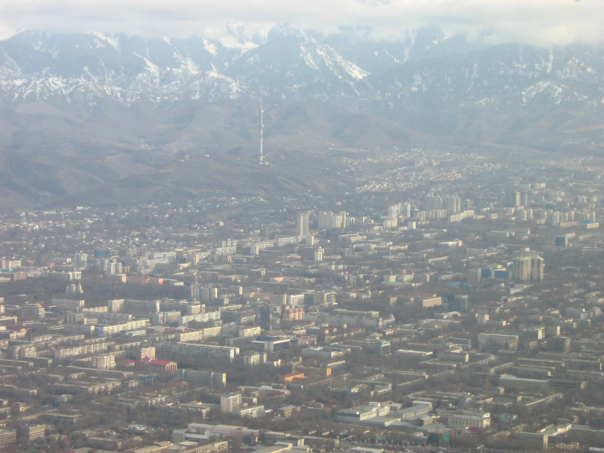
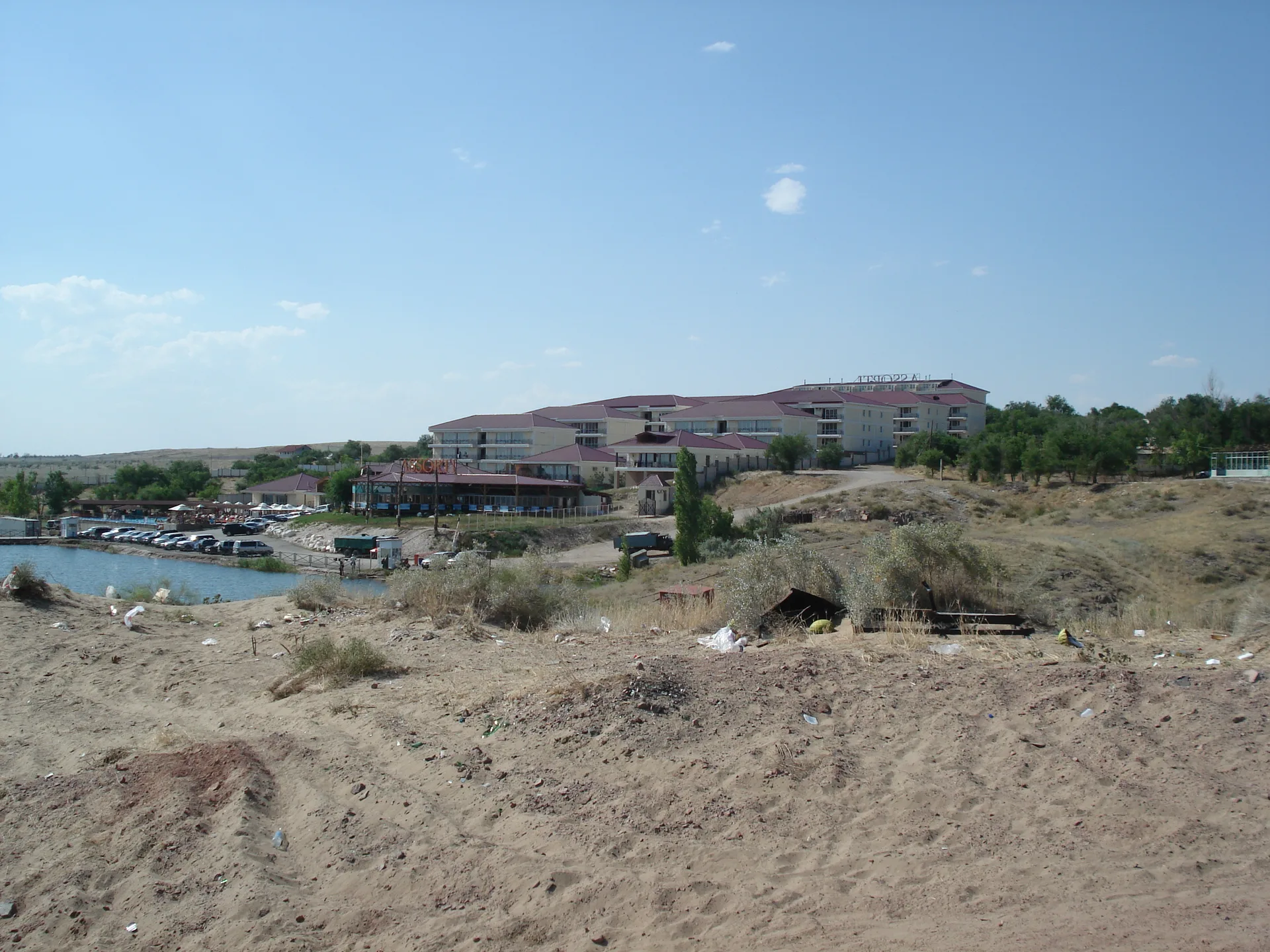
Kapchagai Reservoir stretches 140 km along the Ili River valley, formed after the Kapchagay dam was closed in 1969. The western shore near Konayev city hosts sand beaches, resort complexes, and warm, shallow water that heats up quickly by late May. For Almaty residents it is the default summer escape — close enough for a morning dash, big enough to feel like you have reached somewhere.
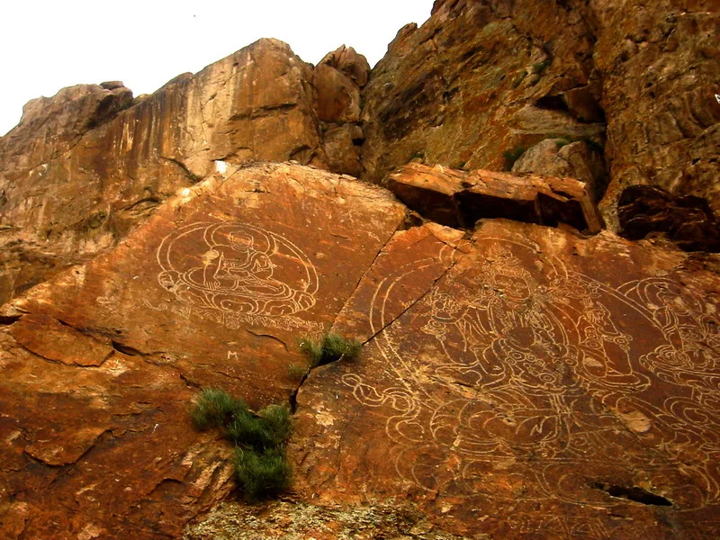
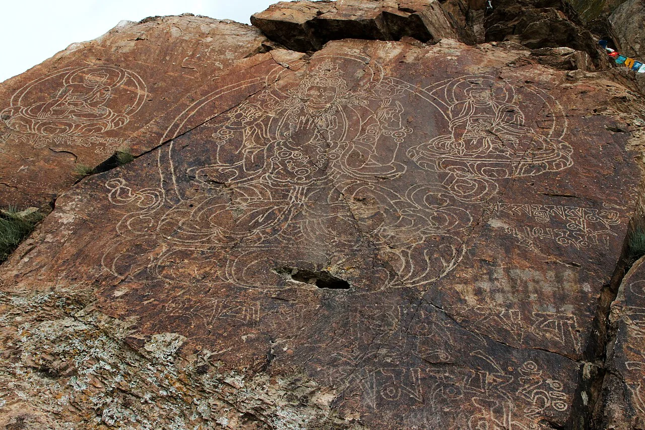
Tamgaly-Tas (Тамгалы-Тас, «painted rocks» in Kazakh) sits roughly 40 km north of the dam on the right bank of the Ili. Three sandstone outcrops carry about 1,000 carvings: Avalokiteshvara, Buddha Shakyamuni, and Amitabha rendered in Tibetan iconography alongside Oirat-Kalmyk script mantras, the oldest of them commissioned in 1677 by the Dzungar ruler Galdan-Boshugtu Khan. A handful of older Turkic runic lines from the 8th–9th century survive on a separate panel. The site is not fenced and entry is free; a caretaker sometimes collects a small informal fee.
The two stops sit on the same road axis and pair naturally: reservoir in the morning while it is cool, petroglyphs midday when shadows shorten and the carvings read more clearly. The A3 highway from Almaty is well paved to Konayev; the extension past the dam and across the Ili bridge to the petroglyph turnoff is sealed tarmac to the Bakanas junction, then 4–5 km of graded dirt to the cliffs. Sedans reach the beach without difficulty; the final dirt stretch to Tamgaly-Tas demands at least moderate ground clearance after any rain.
Route
Skip map, jump to step listItinerary
Stop 1
Almaty
Leave central Almaty heading north on Al-Farabi Avenue, then pick up the A3 (Almaty–Taldykorgan highway) toward Konayev. The city thins out within 20 minutes. Traffic is lightest before 08:00 on weekdays; weekend mornings can be slow through the northern suburbs. The road is dual carriageway for most of the run to Konayev, flat and easy to drive.
Stop 2
Kapchagai Reservoir
- From previous:
- 80 km · 70 min drive
- Stay:
- ~3 h
The reservoir appears on the left about 75 km from Almaty. Konayev city (until 2022 called Kapchagay) sits at the southwestern corner where the dam backs the Ili into a 140 km-long lake up to 22 km wide and 50 m deep. The western shore has the densest concentration of beach resorts — some pay-entry, some with public stretches. The water warms to comfortable swimming temperature by late May and stays warm through September. Sandy bottom, very gradual depth increase near shore: suitable for children.
Stop 3
Tamgaly-Tas Petroglyphs
- From previous:
- 45 km · 55 min drive
- Stay:
- ~2 h
From Konayev, cross the Ili dam bridge and continue north 19 km on the Bakanas road until a sign for «Полигон МЧС» (MChS training ground). Turn left onto a dirt track heading west toward the river for 4–5 km. Three low sandstone bluffs rise from the steppe at the water's edge; the carvings are spread across their faces at head height and above. The oldest Buddhist iconostasis — Avalokiteshvara with four hands seated on a lotus — dates to 1677, created at the order of Dzungar Khan Galdan. Later panels added images of Amitabha and Shakyamuni, Tibetan mantras, and Oirat calligraphy through 1771. An older panel at the northern end carries Turkic runic text from around the 8th–9th century. The site is open-air with no barriers; morning light from the east and early afternoon from the south both read the reliefs well.
What to bring
- Water (3 L per person minimum — no reliable water source at Tamgaly-Tas)
- Sun hat and sunscreen (steppe sun is intense May–September)
- Swimwear and towel for the reservoir beach
- Sturdy closed-toe shoes for walking over uneven cliff base
- Snacks and lunch — no cafes near Tamgaly-Tas
- Cash in KZT (small denominations for caretaker donation)
- Paper map or offline GPS — cell signal drops past the Ili bridge
- Insect repellent (mosquitoes active near the river in summer)
- Light jacket for the drive back in the evening
Sources
Researched from English and Russian sources. Inaccuracies are mine.
- https://en.wikipedia.org/wiki/Tamgaly-Tas_Petroglyphs_(Ili_Kapshagai)
- https://ru.wikipedia.org/wiki/%D0%A2%D0%B0%D0%BC%D0%B3%D0%B0%D0%BB%D1%8B-%D0%A2%D0%B0%D1%81
- https://en.wikipedia.org/wiki/Kapchagay_Reservoir
- https://central-asia.guide/kazakhstan/destinations-kz/tamgaly-tas/
- https://central-asia.guide/kazakhstan/destinations-kz/kapshagai-reservoir/
- https://almaty-travel.com/tamgaly-tas-buddhist-petroglyphs/
- https://www.kolsaitour.com/day-tour-kapchagay-tamgaly-tas
- https://welcome.kz/en/info-cities/almaty-region/tamgaly-tas
- https://shopomania.kz/travel/273-tamgaly-tas-petroglify-kak-doehat-karta-tury-legendy-istoriya.html
Similar trips
Day trip
Bartogay Reservoir & Kurmety Gorge
A 340 km loop east of Almaty along the A-351, tracing the Chilik River to a turquoise seasonal reservoir and continuing to the spruce-lined Kurmety gorge — an unhurried alternative to the Charyn crowds.
Day trip
Charyn Canyon
The Valley of Castles — 80 km of red sandstone gorges carved by the Charyn River — sits 200 km east of Almaty and rewards a long day behind the wheel with a landscape that looks borrowed from another planet.
Day trip
Issyk Lake
A turquoise alpine lake at 1,756 m in the Ile-Alatau foothills, 72 km from Almaty — a rewarding half-day drive through the Issyk Gorge, with forested shores, a reconstructed dam, and the nearby Saka 'Golden Man' burial mounds.